ISC Class 12 Sample Paper 2023 Geography
Finished viewing? Save it for later —
Download ISC Class 12 Sample Paper 2023 Geography (PDF · 7 pages)About ISC Class 12 Sample Paper 2023 Geography
ISC Class 12 Sample Paper 2023 Geography is available here for free download. Published by CISCE for Class 12, this sample paper can be viewed online or downloaded as a PDF (7 pages). Candidates preparing for Class 12 can use ISC Class 12 Sample Paper 2023 Geography to understand the exam pattern, the type of questions asked, and the overall difficulty level.
Frequently Asked Questions
How can I download ISC Class 12 Sample Paper 2023 Geography?
Open this page and click the Download button to save ISC Class 12 Sample Paper 2023 Geography as a PDF. It is completely free on AglaSem Docs.
Is ISC Class 12 Sample Paper 2023 Geography free to download?
Yes. ISC Class 12 Sample Paper 2023 Geography can be viewed online and downloaded as a PDF free of cost on AglaSem Docs.
How many pages does ISC Class 12 Sample Paper 2023 Geography have?
ISC Class 12 Sample Paper 2023 Geography contains 7 pages, which you can read online or download together as a single PDF.
Where can I find more Class 12 study material?
You can find more Class 12 question papers, sample papers, syllabus, and answer keys on AglaSem Docs.
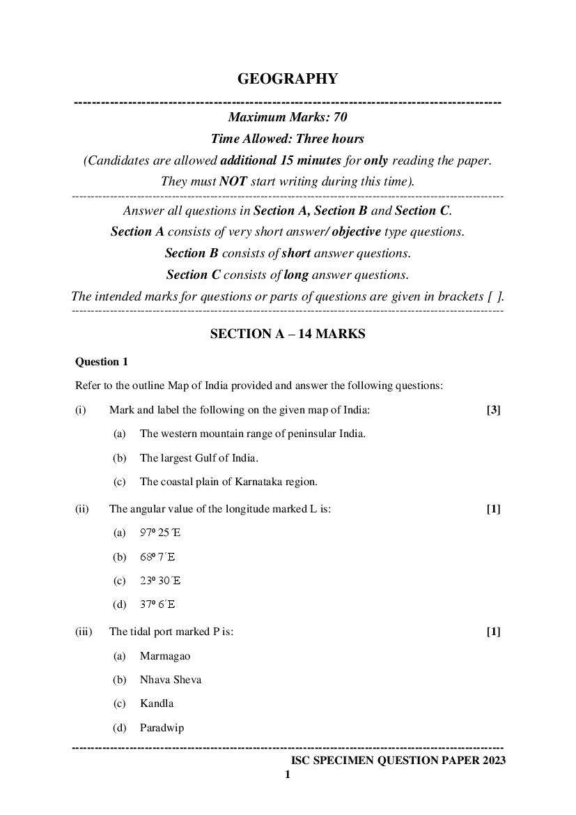
ISC Class 12 Sample Paper 2023 Geography – Text
Read the full text of this sample paper below — useful to quickly search, copy and reference the content online without downloading the PDF.
📄 View text version (7 pages)
Page 1
-----------------------------------------------------------------------------------------------
Maximum Marks: 70
Time Allowed: Three hours
(Candidates are allowed additional 15 minutes for only reading the paper.
They must NOT start writing during this time).
Answer all questions in Section A, Section B and Section C.
Section A consists of very short answer/ objective type questions.
Section B consists of short answer questions.
Section C consists of long answer questions.
The intended marks for questions or parts of questions are given in brackets [ ].
SECTION A – 14 MARKS
Question 1
Refer to the outline Map of India provided and answer the following questions:
(i) Mark and label the following on the given map of India: [3]
(a) The western mountain range of peninsular India.
(b) The largest Gulf of India.
(c) The coastal plain of Karnataka region.
(ii) The angular value of the longitude marked L is: [1]
(a) 97⁰ 25´E
(b) 68⁰ 7´E
(c) 23⁰ 30´E
(d) 37⁰ 6´E
(iii) The tidal port marked P is: [1]
(a) Marmagao
(b) Nhava Sheva
(c) Kandla
(d) Paradwip
1
Page 2
(a) Bhilai
(b) Bhadravati
(c) Vijayanagar
(d) Rourkela
(v) According to the Government of India Census of 2011, the state marked E has [1]
the highest:
(a) density of population.
(b) level of urbanisation.
(c) sex ratio.
(d) index of concentration of population.
(vi) Identify the following: [3]
(a) The east terminal of the ‘East-West Corridor’ marked T is __________.
(b) The oldest coalfield of India marked C is ______________.
(c) The left bank tributary of River Ganga marked R is ______________.
Question 2
(i) India shares her shortest land border with: [1]
(a) Nepal.
(b) Bhutan.
(c) Afghanistan.
(d) Myanmar.
(ii) The rivers Alaknanda and Bhagirathi are the headstreams of: [1]
(a) River Godavari.
(b) River Krishna.
(c) River Kaveri.
(d) River Ganga.
2
Page 3
(iv) State whether the statement given below is True or False: [1]
The Himalayas are known as Orthoclines.
SECTION B – 28 MARKS
Question 3 [4]
(i) (a) Briefly explain any two causes for rural to urban migration.
(b) Briefly discuss any two factors for low sex ratio in India.
OR
(ii) (a) Explain in brief two causes of migration. Give suitable examples from
India.
(b) Briefly discuss any two reasons for high dependency ratio in rural areas.
Question 4
A farmer owned a cultivable land in the plains. He left the land uncultivated for some
time.
(i) What kind of a land is being referred to here? [1]
(ii) Why did the farmer leave his land uncultivated for some time? [1]
(iii) Mention any two ways of increasing the agricultural production from this land. [2]
Question 5 [4]
A farmer in Punjab floods his fields to get a good crop. What problems can occur due
to over watering of farm fields?
Question 6 [4]
(i) (a) Mention any two advantages that the non-conventional energy resource
has over the conventional energy resource.
(b) State any two advantages of fishing industry in Japan.
OR
3
Page 4
(b) What are the four varieties of iron ore?
Question 7 [4]
Explain why radio is considered an important means of mass communication in India.
Question 8 [4]
Discuss any four strategies of the Second Green Revolution.
Question 9 [4]
Analyse the problems of urbanisation in India with relevant examples.
SECTION C – 28 MARKS
Question 10
Study the Rainfall and Temperature graphs for Station A and Station B given below
and answer the questions that follow:
STATION A STATION B
(i) Comment on the rainfall distribution pattern in both the Stations. Give a reason [3]
for the variation in the rainfall distribution.
4
Page 5
Stations.
Question 11
In the figure given below, B is the Deccan Plateau.
(i) Name the features marked A and C. What are the two significant differences [4]
between these features?
(ii) Do the features marked A and C play a significant role in Indian monsoon [3]
pattern? Give any three reasons for your answer.
Question 12
(i) (a) What is meant by multi level planning? State any three characteristics of [4]
a planning region.
(b) Mention any three factors that make Bengaluru the ‘Electronic capital of [3]
India.’
OR
(ii) (a) Which is the main beverage crop of India? Briefly explain the conditions [4]
suitable for its growth.
(b) What is meant by market gardening? Why is it gaining prominence in [3]
Indian agriculture in recent times?
5
Page 6
Read the passage given below and answer the questions that follow.
India is one of the leading producers of cotton textile goods. It is one of the largest
and important sectors in the economy in terms of output, foreign exchange earnings
and providing employment in India.
In India, most of the textile mills are in the cotton growing areas. The location of
cotton textile is mainly affected by raw material, proximity of market, moist weather.
(i) Why was there a need for the development of cotton textile industries in India? [2]
(ii) How do moist climate and coastal location help in the development of cotton [2]
textile industry in Mumbai?
(ii) State any three factors that influence the development of cotton textile industry [3]
in Ahmedabad.
6
Page 7
Document Details
| Board / Org | CISCE |
| Exam | Class 12 |
| Type | Sample Paper |
| Pages | 7 |
| Updated | 30 Apr 2026 |