APSC Assistant Geologist Direct Recruitment Syllabus
Finished viewing? Save it for later —
Download APSC Assistant Geologist Direct Recruitment Syllabus (PDF · 15 pages)About APSC Assistant Geologist Direct Recruitment Syllabus
APSC Assistant Geologist Direct Recruitment Syllabus is available here for free download. Published by PSC for Assam Public Service Commission, this syllabus can be viewed online or downloaded as a PDF (15 pages). Candidates preparing for Assam Public Service Commission can use APSC Assistant Geologist Direct Recruitment Syllabus to understand the exam pattern, the type of questions asked, and the overall difficulty level.
Frequently Asked Questions
How can I download APSC Assistant Geologist Direct Recruitment Syllabus?
Open this page and click the Download button to save APSC Assistant Geologist Direct Recruitment Syllabus as a PDF. It is completely free on AglaSem Docs.
Is APSC Assistant Geologist Direct Recruitment Syllabus free to download?
Yes. APSC Assistant Geologist Direct Recruitment Syllabus can be viewed online and downloaded as a PDF free of cost on AglaSem Docs.
How many pages does APSC Assistant Geologist Direct Recruitment Syllabus have?
APSC Assistant Geologist Direct Recruitment Syllabus contains 15 pages, which you can read online or download together as a single PDF.
Where can I find more Assam Public Service Commission study material?
You can find more Assam Public Service Commission question papers, sample papers, syllabus, and answer keys on AglaSem Docs.
APSC Assistant Geologist Direct Recruitment Syllabus – Text
Read the full text of this syllabus below — useful to quickly search, copy and reference the content online without downloading the PDF.
📄 View text version (15 pages)
Page 1
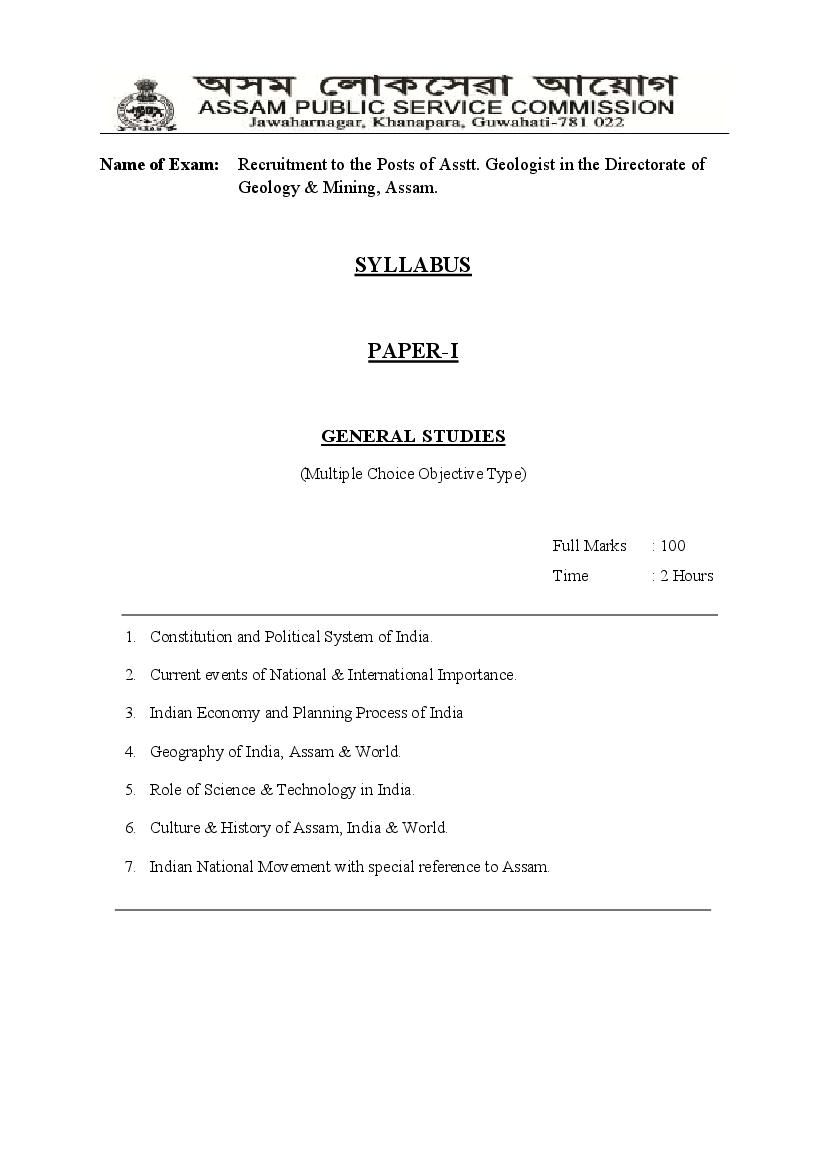
Geology & Mining, Assam.
SYLLABUS
PAPER-I
GENERAL STUDIES
(Multiple Choice Objective Type)
Full Marks : 100
Time : 2 Hours
1. Constitution and Political System of India.
2. Current events of National & International Importance.
3. Indian Economy and Planning Process of India
4. Geography of India, Assam & World.
5. Role of Science & Technology in India.
6. Culture & History of Assam, India & World.
7. Indian National Movement with special reference to Assam.
Page 2
Geology & Mining, Assam.
SYLLABUS
PAPER-II
GEOLOGY
(Multiple Choice Objective Type)
Full Marks : 100
Time : 2 Hours
GROUP-A
Structural Geology and Seismology
Structural Geology
Stress and Strain Definition of stress: Types of stress (hydrostatic, uniaxial, compressional,
tensional, triaxial, deviatoric, differential and effective stress). Sign convention of shear
stress; Mohr stress circle; Determination of direction of shearing stress.
Definition of strain: Types of strain; Principal axes of strain, measurement of strain, Flinn’s
diagram and Fry’s methods of strain measurement and other strain markers.
Ductile deformation : Morphological classifications of fold following Ramsay (1964) and
Fleuty (1964). Kinematics of folding. Buckle folds and shear folds. Determination of sense of
shear from fold geometry. Superposition of folds. Boudinage: origin and its relationship to
fold.
Brittle deformation: Faults, Classification of faults, mechanism of faulting. Normal
faulting: extensional, synthetic, antithetic, horst and graben, half graben, relay fault, duplex,
detachment fault, ramp and flat geometry. Fault nucleation and propagation; geometry of
fault propagation.
Page 3
Thrust: allochthonous, autochthonous, klippe, windows, overthrust, under thrust, nappe,
decollement, blind thrust, splay, ramp and flat geometry; thrust related folds; listric thrust,
duplex, schuppen structure, imbricate structure, thrust duplex, en echelon thrust; foreland,
hinterland; sinistral- dextral geometry - palm tree, tulip, negative flower and positive flower
structures.
Strike slip fault: tear fault, transcurrent fault, transfer fault and their characteristic features.
Mechanism of faulting with reference to stress and strain.
Foliation and lineation in deformed rocks : Morphological classification. Geometric
relationship of foliation and lineation with folds. Interference patterns of lineations. Relation
of foliations and lineations to strain directions.
Shear zone Ductile:brittle and brittle-ductile shear zone. Characteristic features of sheared
rocks. Strain variation within the shear zone. Mylonite. Determination of shear sense.
Rheology : Rheological equations and importance of temperature in rheology.
Geomagnetism. Thermal history of the Earth.
Graphical interpretation of structures :Symmetry of structures; Graphic representation of
spherical, stereographical plots, rose diagram and histogram. Introductory ideas on softwares
used in structural geology.
Seismology
Seismology: Introductory terminology and basic principles, crustal phases, travel time and
magnitude of earthquake. Earthquake as natural hazard- prediction and seismic hazard
management, seismic gap, Seismic waves, Snell’s law, travel time curve, velocity model, b-
value.
Focal depth, earthquake-fault relation in tectonic domain. M, Mb, Ms, Mw, MM scale.
Peaked ground acceleration (PGA) and peaked ground velocity (PGV), focal plane solution,
Benioff zone.
Palaeoseismology: concept of paleoseismology and its importance, active faults,
identification of seismogenic active faults, paleoseismological structures, identification of
paleoseismic deformational features and structures from syn-sedimentary and other
deformational structures, use of dating techniques for paleoseismic features and their
reliability, materials suitable for dating, interpretation of dates, use of historical and
archaeological data in paleoseismic data interpretation.
Page 4
GROUP-B
Mineralogy , Crystal Chemistry & Thermodynamics in Geology
Mineralogy
Chemical composition and compositional variation of minerals, solid solution, compositional
classification of minerals; detail classification and structural features of silicate minerals.
Principles of X-ray crystallography, mineral identification by X- ray diffractometry. Impact
of X-ray crystallography. Crystal structure: CCP and HCP packing. Defect in minerals: Point
Defects, Line defects and Planar defects.
Ionic crystal, ionic radii, coordination number, Pauling rule. Bonding in crystals: Ionic -,
covalent- and metallic bonding.
Transformation process in minerals: Exsolution, example of transition phase in mineral
exsolution. Structural transformation: Polymorphism. Classification, structural inversion,
solid solution behavior and exsolution in rock forming silicate minerals with the examples of
feldspar, olivine, pyroxene, amphibole, garnet and mica; their optical behaviour and
importance as rock forming minerals.
Thermodynamics
Forms of energy, transformation and conservation of energy, global energy budget. Geologic
process and energy flow; state properties; direction of changes in state.
Fundamental thermodynamic equation, First Law of Thermodynamics; work done in volume
expansion, Second and Third Law of Thermodynamics.
Chemical potential, Gibbs Free Energy function; Enthalpy, entropy and activity, Free Energy
change as a function of activity; variation of enthalpy, entropy and Gibbs Free Energy with
temperature and pressure, Clausius-Clapeyron equation.
Compositional dependence of Gibbs Free Energy and Gibbs-Duhem equation.
Mixing components, Raoults Law and Henrys Law, standard state and activity, ideal and non
ideal solution behaviour and equilibrium constant.
Page 5
GROUP-C
Geoinformatics , Geomorphology & Quaternary Geology
Geoinformatics
Spectral response curve. Sensors. Resolution properties of sensors. Resolution properties of
Indian remote sensing satellites and sensors. Elements of photo and image interpretation.
Remote sensing and geology.
Stereoscopy and vertical exaggeration. Basic elements of photogrammetric measurements of
aerial photographs / digital stereo image. Digital photogrammetry: Concept of digital
elevation model (DEM) and digital terrain model (DTM) and their uses. Advantages of
digital photogrammetry over traditional optical photogrammetry. Orthophoto.
Thermal remote sensing; Thermal properties of materials; Characteristics of thermal images;
thermal image processing and interpretation. Concept of LiDER remote sensing.
Microwave remote sensing; SLAR system; Spatial resolution of SLAR systems; Synthetic
Aperture Radar (SAR); microwave remote sensing satellites; microwave image
characteristics; Processing of microwave digital data; Geologic interpretation of radar image.
Image processing methods: Image restoration, image enhancement, False colour composite
(FCC). ratio images, multispectral classification - supervised and unsupervised, change
detection images, accuracy assessment. Concept of hyperspectral data and their importance.
Introduction to GIS and its components, vector and raster data, georeferencing, planning
needed to develop a GIS based project in earth science, analysis of spatial and attribute data
in GIS platform.
Geomorphology & Quaternary Geology
The Quaternary Period and its divisions, Neogene-Quaternary and Pleistocene-Holocene
boundary, the Anthropocene, Quaternary dating dating methods-cosmogenic radionuclides-
C14, Be10, Al26, luminescence chronology, dendrochronology (principles, applications and
limitations), low temperature thermochronology and exhumation/denudation history
Quaternary climate and tectonics- the ice age, Milankovitch theory, glacial-interglacial
cycles, LGM, Little Ice Age, Quaternary sea level changes, uplift-climate connection, climate
proxies and Quaternary paleoclimate, 87Sr/86Sr as proxy for silicate weathering, duricrusts-
calcrete, fericrete, alcrete and spleothems, application of stable isotopes in Quaternary
climate,
Quaternary geomorphology- the earth as a system, energy flow in the geomorphic system,
spatial and temporal scales of landscape analysis, role of structure, tectonics and climate in
landform development, neotectonics and active tectonics and landscape response
Page 6
Quaternary stratigraphy- oxygen isotope stratigraphy, magnetic stratigraphy –principles and
application in Quaternary sequences-Indian examples, pedostratigraphy, soil profile and
paleosol, Quaternary records from marine and continental settings, event stratigraphy
Quaternary sedimentary records from India- Himalayan foreland, Son-Narmada valley,
Gangetic plains, coastal plains, Brahmaputra plains and other parts of NE India
GROUP-D
Hydrogeology Climatology & Oceanography
Hydrogeology
Definition of hydrology and hydrogeology: Hydrologic cycle - precipitation and run-off
Analysis of hydrograph, base flow separation, factors governing shape of hydrograph.
Occurrence of ground water:O penings in rocks, types of openings. Porosity and void
ratio. Definition of aquifers, aquiclude, aquitard and aquifuge. Subsurface distribution of
water, vadose water and ground water. Specific yield and retention. Estimation of specific
yield. Aquifers and their classification. Ground water recharging.
Ground water movement: Darcy's law - its range of validity and limitation, Hydraulic
conductivity, permeability, effective stress, specific storage, transmissivity and storativity.
Physical and chemical characteristics of ground water. Chemical classification of ground
water. Quality criteria for drinking, irrigation, and industrial uses.
Occurrence of ground water in different rock types: igneous, metamorphic, sedimentary
and nonindurated sediments. Ground water provinces of India.
Ground water levels and fluctuations - secular, seasonal and diurnal variation. Factors
governing ground water level fluctuation. Fresh and salt water relationship in coastal area.
Ghyben-Herzberg principle. Prevention and control of sea water intrusion.
Basic principles of well hydraulics- drawdown and cone of depression. Steady state and
none steady state flow. Equation for pumping tests. Step drawdown test and aquifer
performance test. Analysis of pumping test data.
Surface and subsurface investigation of ground wate: Hydrogeological mapping.
Systematic and reappraisal survey by well inventory method. Geophysical methods of
exploration - gravity, magnetic, electrical and seismic methods. S.P., resistivity, gamma and
neutron gamma logging. Ground water exploration by test drilling.
Methods of construction of shallow wells: Methods of drilling, design criteria and
development of deep tube wells.
Page 7
Ground water assessment, development and management: Concept of ground water
reserve - static and dynamic reserve. Safe yield and overdraft. Factors governing safe yield.
Equation of hydrologic equilibrium. Ground water budgeting.
Climatology & Oceanography
Definition of climate, composition of atmosphere, vertical and horizontal distribution of
temperature, insolation, Clouds: their formation and classification. Precipitation: Causes,
forms, processes and types. Atmospheric pressure and air circulation, factors affecting wind
direction and speed, upper-level waves and jet streams, the Monsoons.
Weather disturbances: Properties of air masses, extratropical cyclone, fronts, anticyclones,
tropical weather, thunderstorms, tornadoes and waterspouts. Climates dominated by
equatorial and tropical air masses.
Classification of oceans and seas, general features of ocean floor, sea waves, tides, ocean
currents, giant deep ocean circulations, physical properties of sea water.
GROUP-E
Igneous Petrology Metamorphic Petrology
Igneous Petrology
Magma, their generation in the crust and mantle: Present day magmatism and global
tectonic processes. Magmatic process- concept and models (batch melting and Rayleigh
fractionation). Quantitative approach to partial melting, fractional crystallization and source
characterization.
Geochemical characteristics of igneous rocks: chemical analyses, major, trace and isotopic
composition of igneous rocks in the context of petrogenesis. Compatible and incompatible
elements. Geochemical criteria for the identification of palaeo-tectonic settings of igneous
rocks.
Phase equilibria study in igneous system: binary, ternary and quaternary silicate system
with reference to petrogenesis. Role of volatile H2O and CO2 in petrogenesis.
IUGS Classification schemes of Igneous rocks: Plume magmatism and hot spots. Concepts
of mantle metasomatism.
Petrology and petrogenesis of major igneous rock types: Ultramafic rocks (Komatite,
Kimberlite, Alkaline rocks, Ophiolites, Carbonatites, Flood basalts (Deccan Trap, Sylhet
Trap), Anorthosites, Granitoids and Layered igneous rocks.
Page 8
Metamorphic Petrology
Regional orogenic metamorphic textures: Tectonites, foliation, lineation; mechanism of
tectonic development; Analyses of poly-deformed and poly-metamorphic rocks; other
regional metamorphic textures; replacement textures and reaction rim and their role in
reconstructing P-T-t history of metamorphism.
Sources of plate tectonic metamorphic heat for crustal metamorphism, geothermal gradient,
crustal thickening processes and P-T-t path of metamorphism.
Mineral assemblages and their graphical representation: ACF, AKF and AFM and
compositional phase diagrams. Chemical equilibrium in metamorphism, solid-solid reaction,
continuous and discontinuous metamorphic reaction.
Cation exchange partitioning relationship among coexisting phases, application of
geothermometry and geobarometry, and petrogenetic grid
Regional metamorphism of pelitic and basic metamorphic assemblages: metamorphic
reaction involved during regional metamorphis
GROUP-F
Geochemistry and Isotope Geology & Engineering Geology
Geochemistry and Isotope Geology
Origin, abundance, classification and distribution of elements: Chemical differentiation
of earth. Crust and mantle as a geochemical system (composition of the crust, composition of
mantle,
interaction between crust and mantle), Ocean and atmosphere as a geochemical system
(composition of ocean, composition of atmosphere, evolution of sea water and air, the rise of
oxygen), Geochemical cycle.
Principles and application of analytical instruments in geochemistry and isotope
studies: Meteorites- classification, composition and origin. Type and composition of Martian
and Lunar meteorites.
Stability and abundance of radionuclides, decay mechanism, decay and growth rate of
radiogenic decay, decay series.
Radiogenic isotopes: Radiogenic isotopes in geochronology (Rb-Sr, Sm-Nd,K-Ar, U-Th-Pb
method of age dating). Extinct radionuclides in geochronological studies. Promordial 87Sr –
86Sr ratios. Isotopic evolution of Sr and Nd in the Earth.
Page 9
Stable isotopes: Stable isotopes of O, C and S. Control, application and fractionation of
stable isotopes. Oxygen isotope thermometry. Distribution of sulphur isotopes in nature.
Application of Statistics in Geology Binomial and Normal Distributions:Standardization
of normal distribution, Joint distribution.
Correlation and regression, variance and covariance, standard and probable error of
correlation coefficient.
Sampling distributions : Estimators, sampling distribution of mean, confidence limits,
Student tdistribution. Test of significance, setting up a hypothesis, null and alternative
hypothesis, z-test, t-test, F-test, Chi-square test.
Factor and principal component analysis: Gumbel and Log-Pearson distributions - their
applications in flood frequency analysis.
Engineering Geology
Soil: Engineering properties of soil, definition of unit weight, specific gravity, porosity and
void ratio, water content, degree of saturation, elementary knowledge of compressibility,
consolidation, compaction and shear strength. Importance of clay mineralogy, Atterberg units
and soil classification, soil and engineering structures.
Rocks: Strength of rocks, hardness, elasticity, porosity, specific gravity. Rock masses:
discontinuity in rock masses, weathering of rock masses, rock mass deformation.
Engineering classification of rocks, classification of rock masses in the field according to
R.Q.D. (rock quality designation), Bieniswaki and Q-system. Quarrying with special
reference to rock blasting. Rock as construction materials. Improvement of rock mass
properties - grouting, bolting and anchoring.
Dams and Reservoirs: Classification and parts of dams; geological and geophysical
investigation of dam sites, foundation and abutment problems, forces acting on them;
Seepage, bearing strength
and rebound problem; Treatment of weak zones – grouting, Investigation of reservoir area,
control of leakage and silting.
Geotechnical investigation for tunnel construction: General geotechnical consideration
for site locations, geology of the area, importance of structural discontinuities on tunnel and
bridge alignment, groundwater conditions, rock stress condition,Methods of tunnel
excavation.
Page 10
GROUP-G
Economic Geology
Genesis and Indian deposits, Exploration and mining
Economic Geology
Genesis: Morphology of ore bodies, textural and structural features of ores, chemical
composition of ire, classification of ore deposits, Metallogeny and its relation to crustal
evolution.
Genesis of ore deposits: Magmatic, Hydrothermal, Metasomatic, pegmatitic, submarine
exhalation and volcanogenic.
Sedimentary type ore deposits: chemical sedimentary and detrital sedimentary ore deposits:
stratabound and stratiform deposits; evaporates, metamorphic type ore deposits.
Organic matter in ore, fluid inclusion in ore; Geothermometry, Geobarometry and dating of
ore deposits. Metallogeny of Archaean greenstone belts and Proterozoic mobile belts
Structural and chemical control of ore deposits. Plate tectonic and global ore localization.
Ore mineralization through geological time.
Economic Geology – Indian deposits
Metallic mineral deposits of India, their distribution, mode of occurrence, mineralogy and
genesis: iron, manganese, chromium, copper, lead and zinc, gold, silver, aluminium, nickel
and molybdenum.
Non- metallic mineral deposits: Diamond, limestone and dolomite, magnesite, phosphates,
asbestoses, gemstone, refractory minerals. Clay mineral deposits of Northeast India. Critical
and essential minerals.
Radioactive minerals: uranium, thorium: their distribution, mode of occurrence, mineralogy
and genesis. Uranium mineralization in north eastern part of India. Rare Earth minerals.
Exploration and mining Methods of mineral prospecting and exploration. Classification
of mineral reserve, different methods of surface and subsurface mining for metallic and non-
metallic minerals; mining of coal; alluvial mining.
Page 11
GROUP-H
Sedimentlogy, and Surveying & Mapping
Sedimentology Texture of sedimentary rocks
Textural elements - size, roundness, sphericity, fabric, form and surface textures, their
measurement. Statistical treatment and interpretation of grain-size analysis data.
Structures of sedimentary rock - genesis and significance of sedimentary structures,paleo
current
analysis.
Sedimentary environments - classification of sedimentary environments, physical and
chemical parameters of depositional environments, lithofacies assemblages from fluvial,
deltaic, lacustrine, marine, glacial and arid environment.
Genetic classification of sedimentary rocks
Clastics (sandstone and shale), mineralogy of the clastic sediments Diagenesis and
lithification. Sedimentology of clay. Provenance determination using heavy minerals,
quartz, feldspars and rock fragments.
Origin, mineralogy, classification (Dunham and Folk) of limestone; Diagenesis and
neomorphism of carbonate rocks. Sedimentary basins: classification of sedimentary basins,
Sedimentation and tectonics (tectonic control of sedimentation, plate tectonics and sediment
accumulations).
Sedimentation as a geochemical process; Physico-chemical factors in sedimentation, Eh-pH
diagrams, Geochemistry of natural water, geochemical analysis of sediments and their
graphical plots to decipher their chemical maturity, weathering index of the source rocks,
determination of provenance and tectonic settings, classification of sediments.
Surveying and Mapping Maps
Types and basic elements, projection system, datum and datum transformation, digital
mapping techniques, GPS/GNSS and mapping. Surveying: Basic principles, types and
procedures of field survey. Closed loop and open traverse, principles of theodolite, dumpy
level and total station survey, RL transfer.
Geologic surveying: Definition and scope, study of outcrops, use of compass and
clinometers. Base maps: Locating field data on base map, geologic traverses, detail and
reconnaissance mapping; Geological field mapping in sedimentary and hard rock terrain.
Page 12
GROUP-I
Stratigraphy & Geodynamics
Principles of Stratigraphy
Stratigraphy and its relation with sedimentation. Components of stratigraphy, Geological
disposition of the Indian stratigraphic sequences; geological history of India. Geological time
scale. Stratigraphic units –International and Indian stratigraphic codes.
Principles and methods of correlation of stratigraphic units, stratigraphic relationships -
vertical and lateral. Concepts of sequence stratigraphy, magnetostratigraphy and seismo-
stratigraphy.
Sedimentary facies - facies concept, lateral and vertical facies variation, facies modeling,
palaeogeographic reconstruction.
Indian Stratigraphy
Precambrian formations of India : Dharwar Province, Eastern Ghats Province, Central Indian
Province, Singhbhum-Orissa Province and Aravalli-Bundelkhand Province. Archaean-
Proterozoic boundary.
Proterozoic formations of Indian Peninsula : Cuddapah Supergroup, Vindhyan Supergroup,
Kurnool Group.
Palaeozoic formations of India, Himalayan Palaeozoics, marine Palaeozoics in Peninsular
India, Precambrian-Cambrian boundary.
Mesozoic formations of India, Triassic of Spiti and Himalayan range; Jurrasic of Kutch
region, Cretaceous of Peninsular India. Deccan Traps and associated infra, inter and intra-
trappean beds.
Gondwana Sequence of India: Basin configuration, sedimentation and palaeoclimates,
Gondwana deposits of Peninsular India, marine intercalations.
Stratigraphy of North-East India
Precambrians and all igneous activities of Shillong Plateau and Arunachal Himalayas.
Gondwana and Paleozoic stratigraphy in the Northeastern region of India. Cretaceous
deposits of the Northeast India, Cretaceous-Tertiary boundary, Sylhet traps and other
Mesozoic intrusives of the Northeast India. Cenozoic stratigraphy of Assam-Arakan region.
Page 13
Geodynamics
Continents, Oceans and Mountains, Development of theories from geosynclines to plate
tectonics.
Sea-floor spreading, island arc, mid-oceanic ridge, emplacement of ophiolites. Earthquake
and seismic belts of the world. Measurements of plate dynamics.
Broad overview of tectonic settings of India. Evolution of the Himalayas and Himalayan
tectonics, Indo-Myanmar mobile belt.
Introduction and history of planetary geology: Universe; introduction to solar system: origin
and age of the solar system, formation of the Sun and the planets.
Cosmic dust. Asteroidal parent body. Morphology and classification of meteorites.
Primitive meteorites: Ordinary Chondrites and Carbonaceous Chondrites.
Differentiated meteorites: Achondrites, Lunar meteorites and Martian meteorites, iron and
stony –iron meteorites.
Planetary remote sensing: Planetary topography and surface study. Surface, asmospheric,
mineral and chemical composition study. Thermal remote sensing for planets. Gravity,
Gamma and X-ray spectroscopy.
GROUP-J
Palaeontology & Fuel Geology
Palaeontology
Micropalaeontology - definition, types of microfossils and their importance. Nannofossils
and their importance in geology; Trace fossils and their classification,
Foraminifers - their morphology and evolution, geological distribution and their applications
in palaeoecology, correlation, biostratigraphy and hydrocarbon exploration. Conodonts,
ostracods and radiolaria - morphology, stratigrapohic distribution and application.
Vertebrate palaeontology - Evolution of man, equidae and proboscidae in the context of
palaeoclimate and palaeoecology. Changing pattern of dentition during evolution of the
above vertibrates.
Palynology and its stratigraphic and palaeoclimatic significance. Study of pollens and spores,
diatoms, dianoflagellate. Palynological organic matters.
Detail account of Gondwana flora in the World and in the Indian context in the context of
palaeoclimate and palaeoecology.
Page 14
Fuel Geology
Coal
Origin of coal: Evolutionary development of flora; climatic, paleogographic and tectonic
requirements for origin of peat swamps; sedimentation of coal and coal bearing sequence,
geological features of coal seams; age and geographical distribution of coal; diagenesis of
peat and coalification, physical and chemical changes of coal associated with progressing
coalification; Causes of coalification.
Coal sampling and analysis: Coal sampling; coal analysis, chemical properties of coal,
proximate analysis and ultimate analysis; physical properties of coal; trace elements in coal;
coal classification.
Petrography of coal: Macroscropic description of coal; microscopic description of coal,
macerals- classification, properties, origin and application, microlithotypes.
Coal utilization and coal as alternative energy source: Combustion, gasification,
carbonization and coke; gas in coal, underground coal gasification, coal as liquid fuel, coal as
an oil prone source rock; coal and environment
Geology of Indian coal deposits: Geological and geographical distribution of Indian coal
deposits; geology of coal deposits of Northeast India.
Petroleum
Nature and origin of petroleum: Basic components of petroleum, Physical properties of oil,
Origin of petroleum, theories of organic and inorganic origin. Migration of hydrocarbon –
primary and secondary. Trapping mechanisms for oil and gas. Reservoir properties:
Porosity, permeability (absolute, effective and relative), Fluid saturation, relative
permeability and fluid saturation.
Reservoir rocks : Sandstone reservoir, carbonate reservoir, fractured reservoirs,
Petrophysical studies of reservoir rocks, Pressure condition in reservoirs – reservoir
pressures, normal and abnormal formation pressure.
Oil well drilling and drilling fluids : Parameters, usefulness types, vertical, deviated and
horizontal drilling, Duties of well site geologists; Well logging : Basic of well logging,
Different well logging – SP, GR, Resistivity log, neutron log, Density logs, sonic log,
conventional electric log. Resistivity and water saturation.
Exploration of hydrocarbon : Geological, geochemical and geophysical exploration.
Geophysical exploration of hydrocarbon – seismic survey, gravimetric survey, geological
interpretation of seismic data. Petroliferous basins of India. Oil and gas fields of Assam,
Arunachal Pradesh, Nagaland, Tripura, Mizoram, Cambay basins, Bombay Off-shore and
Krishna-Godaveri basins.
Page 15
GROUP-K
Fluvial System & Environmental Geology
Fluvial System
Fluvial processes: Evolution of drainage basin, drainage patterns and their significance,
hydraulic geometry, classification of fluvial systems, the processes of erosion, transportation
and deposition. Stream power, competence and capacity, base level control, structural and
active tectonic control on rivers.
Fluvial landforms: The form - process relationship, erosional and depositional landforms,
evolution of floodplains and their types, alluvial terraces, alluvial fan and delta, concept of
peneplain and fluvial cycle of erosion.
Fluvial depositional environments and sedimentation, depositional models, lithofacies and
lithofacies assemblages, genesis of facies, architectural element analysis in facies.
Fluvial landforms in NE India, records of Phanerozoic fluvial sequences, economic potential
of fluvial depositional systems System
Environmental Geology
Definition: Fundamental concepts and scope of environmental geology, pollution and
hazards due to mining activities, pollution due to radioactive mineral mining.
Landslides: Causal factors, impact of landslides on environment, landslide hazard zonation,
preventive measures, Soil erosion.
Flood :Definition, causes, flood in fluvial systems, flood management, structural and non-
structural methods of flood management, dams and flood, method of flood frequency
analysis, flood in Assam
Water pollution : Sources of pollution of surface and ground water, water pollution
parameters, types of water pollution, causal factors, case studies. Parameters of potable water
as per Indian and WHO’s standards.
###