AP PGECET 2015 Question Paper for Geo Engineering Geoinformatics
Finished viewing? Save it for later —
Download AP PGECET 2015 Question Paper for Geo Engineering Geoinformatics (PDF · 16 pages)About AP PGECET 2015 Question Paper for Geo Engineering Geoinformatics
AP PGECET 2015 Question Paper for Geo Engineering Geoinformatics is available here for free download. Published by APSCHE for Andhra Pradesh Post Graduate Engineering Common Entrance Test, this question paper can be viewed online or downloaded as a PDF (16 pages). Candidates preparing for Andhra Pradesh Post Graduate Engineering Common Entrance Test can use AP PGECET 2015 Question Paper for Geo Engineering Geoinformatics to understand the exam pattern, the type of questions asked, and the overall difficulty level.
Frequently Asked Questions
How can I download AP PGECET 2015 Question Paper for Geo Engineering Geoinformatics?
Open this page and click the Download button to save AP PGECET 2015 Question Paper for Geo Engineering Geoinformatics as a PDF. It is completely free on AglaSem Docs.
Is AP PGECET 2015 Question Paper for Geo Engineering Geoinformatics free to download?
Yes. AP PGECET 2015 Question Paper for Geo Engineering Geoinformatics can be viewed online and downloaded as a PDF free of cost on AglaSem Docs.
How many pages does AP PGECET 2015 Question Paper for Geo Engineering Geoinformatics have?
AP PGECET 2015 Question Paper for Geo Engineering Geoinformatics contains 16 pages, which you can read online or download together as a single PDF.
Where can I find more Andhra Pradesh Post Graduate Engineering Common Entrance Test study material?
You can find more Andhra Pradesh Post Graduate Engineering Common Entrance Test question papers, sample papers, syllabus, and answer keys on AglaSem Docs.
AP PGECET 2015 Question Paper for Geo Engineering Geoinformatics – Text
Read the full text of this question paper below — useful to quickly search, copy and reference the content online without downloading the PDF.
📄 View text version (16 pages)
Page 1
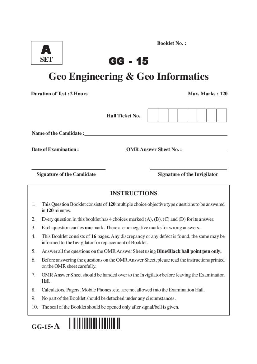
A
SET GG - 15
Geo Engineering & Geo Informatics
Duration of Test : 2 Hours Max. Marks : 120
Hall Ticket No.
Name of the Candidate :
Date of Examination : OMR Answer Sheet No. :
Signature of the Candidate Signature of the Invigilator
INSTRUCTIONS
1. This Question Booklet consists of 120 multiple choice objective type questions to be answered
in 120 minutes.
2. Every question in this booklet has 4 choices marked (A), (B), (C) and (D) for its answer.
3. Each question carries one mark. There are no negative marks for wrong answers.
4. This Booklet consists of 16 pages. Any discrepancy or any defect is found, the same may be
informed to the Invigilator for replacement of Booklet.
5. Answer all the questions on the OMR Answer Sheet using Blue/Black ball point pen only.
6. Before answering the questions on the OMR Answer Sheet, please read the instructions printed
on the OMR sheet carefully.
7. OMR Answer Sheet should be handed over to the Invigilator before leaving the Examination
Hall.
8. Calculators, Pagers, Mobile Phones, etc., are not allowed into the Examination Hall.
9. No part of the Booklet should be detached under any circumstances.
10. The seal of the Booklet should be opened only after signal/bell is given.
GG-15-A
Page 2
1. The solution of the equations x + 3 y + 2 z = 0 , x + 4 y + 3z = 0 and x + 5 y + 4 z = 0
(A) x = y = 1, z = −1 (B) x = z = 1, y = −1
(C) y = z = 1, x = −1 (D) none
2. The eigen values of an orthogonal matrix are
(A) 0 (B) 1
(C) either -1 or +1 (D) neither 0 nor 1
∂( x, y)
3. If x = r cos θ and y = r sinθ then =
∂( r , θ )
(A) 0 (B) r (C) 1 (D) none
4. If φ is any scalar function then ∇φ is
(A) solenoidal (B) irrotational (C) zero (D) a scalar
x2 y2 ∂u ∂u
5. If u ( x, y ) = 2 2
then x + y is equal to
x +y ∂x ∂y
1 1
u u
(A) 2u (B) 4u (C) 2 (D) 4
6. The real and imaginary parts of a complex analytic function are called
(A) even functions (B) odd functions
(C) none of these (D) harmonics
7. A complex function f ( z ) = u( x, y) + iv( x, y) is analytic then
∂u ∂v ∂u
(A) =− (B) =0
∂y ∂x ∂x
∂u ∂v ∂u
= =0
(C) ∂y ∂x (D) ∂y
8. If the mean and variance of a binomial distributed random variable are 4 and 3
respectively then the probability distribution is
(A) Cx8 (1/ 4) x (3 / 4)8− x (B) Cx8 (1/ 3) x (2 / 3)8− x
16 − x
(C) C16 x
x (1/ 4) (3 / 4) (D) None
Set - A 2 GG
Page 3
distribution with 2 accidents on an average, the probability that on a given day there will
be atleast one accident is
e−2 2 e−2 2
(A) (B) 1+ (C) 1 − e−2 (D) None
1! 1!
1 – 1z2
10. The variance of a standard normal distribution e 2 is
2π
1
(A) 1 (B) 0 (C) 0.5 (D)
2π
11. The shape of the earth is
(A) Sphere (B) Ellipse (C) Spheroid (D) Circular
12. The densest central part of the earth which is composed of the inner and outer cores is
known as
(A) Hydrosphere (B) Asthemosphere
(C) Lithosphere (D) Barysphere
13. The diameter at equator of the earth is
(A) 12713 km (B) 12756 km (C) 6357 km (D) 6371 km
14. Mass Density of the whole earth is
(A) 1.03 g/cm3 (B) 2.8 g/cm3 (C) 10.72 g/cm3 (D) 5.52 g/cm3
15. Isostasy refers to
(A) Gravitational equilibrium (B) Continental drift
(C) Plate tectonics (D) Volcanic activity
16. Which of the following explains the hypothesis of sea floor spreading ?
(A) Earth quakes (B) Thermal convection
(C) Tsunami (D) Gravitation
17. The movement of the continents relative to one another is termed
(A) Plate tectonics (B) Diastrophism
(C) Continental drift (D) Seafloor spreading
18. The estimate of reasonably reliable age of the earth is based on
(A) Gradual development of earth features
(B) Normal processes of sedimentation
(C) Evolutionary sequence indicated by fossils
(D) Radiometric datings
Set - A 3 GG
Page 4
(A) Continental Glacier (B) Composite glacier
(C) Calving (D) Cirque
20. The causes for cyclonic storm wind circulation to be counter clockwise in the Northern
hemisphere and clockwise in the Southern hemisphere is due to
(A) Deflation (B) Bore (C) Gravitation (D) Coriolis effect
21. Name the location where the highest seamount is found
(A) Esperance, Australia (B) West coast of India
(C) Tonga trench, New Zealand (D) Near Andaman island
22. Vast plains form deep layer of sediment lying 3500 m below sea level
(A) Submarine canyon (B) Abyssal plain
(C) Guyot (D) Trench
23. The study of regular pattern of faces and angles between the faces and of the internal
structure of the mineral to which it is related, is called
(A) Crystallography (B) Twinning
(C) Tenacity (D) Palaeontology
24. The _______ is the colour of the powdered mineral which is most readily seen by
scraping the mineral across a plate of unglazed hard porcelain.
(A) Streak (B) Tenacity (C) Cleavage (D) lustre
25. The following is a symbolic structure for the clay minerals and its representing structure
of
(A) Kaolin (B) Serpentine (C) Illite (D) Montmorillonite
26. The relative hardness (H) of quartz as per the arbitrary scale of ten standard minerals,
arranged in Mohs’ scale of hardness is
(A) 1 (B) 4 (C) 7 (D) 10
27. The term reniform used to describe crystal habit means
(A) kidney shaped (B) broad, flat crystal
(C) bunch of grapes (D) long crystals—like fibres
Set - A 4 GG
Page 5
(A) native metallic elements such as pure copper, gold and silver.
(B) metallic ores such as sulphides and oxides
(C) silicates and carbonates
(D) sulphates and halides
29. The dominant agent in dynamic metamorphism is
(A) increased stress
(B) increased temperature
(C) increased temperature or pressure
(D) both, increased temperature and pressure
30. Grain size of gneiss is
(A) fine to medium grained (B) fine grained
(C) medium to coarse grained (D) medium grained
31. Sum of specific yield and specific retention is equal to
(A) Permeability (B) Hydraulic gradient
(C) Porosity (D) Hydraulic conductivity
32. Rocks that are formed by the accumulation and compaction of fragments from pre-
existing rocks which have been disintegrated by erosion are called
(A) Igneous rocks (B) Metamorphic rocks
(C) Extrusive rocks (D) Sedimentary rocks
33. What are spectral bands useful for rock type mapping ?
(A) Visible and short wave infrared bands
(B) Thermal infrared data
(C) Radar data
(D) Near infrared data
34. The type of rock which can be readily identified in Arial photography
(A) Sedimentary rock (B) Igneous rock
(C) Metamorphic rock (D) Lime stone
35. Which of the following is more strong and impervious ?
(A) Granite (B) Mica schist’s
(C) Lime stones (D) Shale
36. The angle between two plane mirrors of an optical square is
(A) 30° (B) 60° (C) 45° (D) 90°
Set - A 5 GG
Page 6
(A) a dense forest (B) a hillock (C) a river (D) a tall building
38. An instrument used for measuring the angle of a slope is
(A) Planimeter (B) Clinometer
(C) Tacheometer (D) Omnimeter
39. The instrument used to reproduce plans to a different scale is called
(A) Planimeter (B) Clinometer (C) Ghat tracer (D) Pantograph
40. The method which is most commonly used in triangulation survey
(A) Repetition (B) Reiteration
(C) Both A and B (D) None
41. The contours which are parallel and equidistant of an area, then that area should be
(A) Flat (B) Steep slope (C) Gentle slope (D) Uniform slope.
42. The most rapid method of orientation by the three-point method of plane tabling is the
(A) Tracing paper method (B) Graphical method
(C) Trial and error method (D) Both A and B
43. Geodetic surveying is different from plane surveying because of
(A) The curvature of the earth
(B) The large difference of elevations between various points
(C) Coverage is large
(D) Undulations of the topography
44. If the R.L. of a B.M. is 100.00 m, the back sight is 1.215 m and the foresight is 1.870 m,
the R.L. of the forward station is
(A) 99.345 m (B) 100.345 m (C) 100.655 m (D) 101.870 m
45. The process of revolving the telescope through 360° about its transverse horizontal axis
is known as
(A) Setting (B) Focusing (C) Transiting (D) Centering
46. Systematic errors in survey works is known as
(A) Natural errors (B) Personal errors
(C) Compensating errors (D) Cumulative errors
Set - A 6 GG
Page 7
(A) Graphical scale (B) Engineer’s scale
(C) Representative fraction (D) Numerical scale
48. Which among the following is large scale map ?
(A) Cadastral map (B) Atlas
(C) Wall map (D) Globe
49. SOI Toposheets are of _____ map projection.
(A) Conic (B) Polyconic (C) UTM (D) Cylindrical
50. Spatial relationships between features is called
(A) Topology (B) Topography
(C) Photo-geology (D) DEM
51. Triangulated Irregular Network is
(A) Land use / land cover classification
(B) Consists of elevation data with x, y coordinates
(C) Vector model of elevation
(D) Steroscopic view of an image
52. The process of filling each cell of a new grid with the value of the corresponding cell or
cells in an original grid is termed as
(A) Resampling (B) Affine
(C) Rubber sheeting (D) Stretching
53. Relational database is
(A) A database that is organized at different levels and uses the one-to-many
association between levels.
(B) A database that contains all data in a large table.
(C) A database that consists of a collection of tables and uses keys to connect the
tables.
(D) A database that is based on the built-in-connections across tables.
54. Conformal Projection is
(A) One type of map projection that uses a cylinder as the projection surface.
(B) One type of map projection that uses a polyconic as the projection surface.
(C) One type of map projection that preserves local shapes.
(D) One type of map projection that retains certain accurate directions. It uses a plane
as the projection surface.
Set - A 7 GG
Page 8
(A) the value of a contour
(B) difference of value between consecutive contours
(C) horizontal shortest distance between consecutive contours
(D) slope of the contour line
56. Flow direction grid is
(A) the directional measure of slope
(B) the vertical distance between contour lines
(C) a graphic method which simulates how the land surface looks with the interaction
between sunlight and landform features.
(D) that shows the direction that water will flow out of each cell of a DEM.
57. A map projection preserves the following
(A) Area (B) Shape
(C) Direction (D) One of the above
58. The instrument for plotting planimetry is
(A) Digital photogrammetry (B) Theodolite
(C) Stereometer (D) Altimeter
59. Buffering in GIS analysis refers to
(A) An overlay method that preserves only those features that fall within the area
extent common to the input and overlay maps.
(B) A GIS operation, in which each point of a point map is assigned attribute data of
the polygon within which it falls.
(C) A GIS operation in which areas that are within a specified distance of selected map
features are separated from areas that are beyond.
(D) A polygon –on-polygon overlay method that preserves all features from the input
and overlay maps extent defined by the input map
60. If ‘f ’ is the focal length of an Aerial camera lens and ‘H’ is the flying height above the
mean terrain then f/H is equal to
(A) Tilt (B) Relief
(C) Vertical exaggeration (D) Scale
61. _______ measures (in geometric transformation) the deviation between the actual
location and the estimated location of the tie (control) points.
(A) Mean (B) Mode
(C) Root Mean Square (RMS) (D) Chi square
Set - A 8 GG
Page 9
(A) Overshoot arcs
(B) Undershoot arcs
(C) Very small polygons found along the shared boundary of the two input maps in
map overlay, often resulted from digitizing
(D) A polygon –on-polygon overlay method that preserves all features from the input
and overlay maps
63. Hill shade or Shaded relief or shading is
(A) The directional measure of slope
(B) The vertical distance between contour lines
(C) A graphic method which simulates how the land surface looks with the interaction
between sunlight and landform features.
(D) A grid that shows the direction water will flow out of each cell of a DEM.
64. The raster data analysis operation that involves a focus cell and a set of its surrounding
cells
(A) Band ratioing (B) NDVI
(C) Neighbourhood operation (D) Classification
65. Geo-referencing is
(A) The process of filling each cell of a new grid with the value of the corresponding
cell or cells in an original grid
(B) The process of using a set of control points to convert images from image
coordinates to real–world coordinates
(C) Selecting Bench Mark
(D) Referring to astronomical survey
66. Flat file is defined as
(A) A database that is organized at different levels and uses the one-to-many
association between levels
(B) A database that contains all data in a large table
(C) A database that consists of a collection of tables and uses keys to connect the
tables
(D) A database that is based on the built-in-connections across tables
67. The Scattering process which explains about blue sky, red sunset etc. is known as
(A) Rayleigh (B) Mie (C) Non-selective (D) Selective
Set - A 9 GG
Page 10
(A) only visible part
(B) visible part and infrared regions of EM spectrum
(C) only infrared regions of EM spectrum
(D) Ultraviolet region
69. The average spectrum reflectance values of an object observed for distinct wavelength
bands will indicate
(A) Mean spectral reflectance (B) Spectral characteristics
(C) Spectral signature (D) Spectroradiation
70. Thermal IR imagery is usually obtained in the wavelength regions of
(A) less than 0.7 micrometre (B) 3 to 5.5 and 8 to 14 micrometre
(C) 3 to 35 micrometre (D) above 35 micrometre
71. At Nadir point, geometrical distortion is
(A) zero (B) highest
(C) average (D) varies with focal length of camera lens
72. For a stereoscopic coverage, Aerial photography is normally flown with
(A) 25% forward slope and 60% side lap
(B) 30% overlap
(C) 60% forward overlap and 25% side lap
(D) No overlap is required
73. Aspect is defined as
(A) The directional measure of slope
(B) The vertical distance between contour lines
(C) A graphic method which simulates how the land surface looks with the interaction
between sunlight and landform features.
(D) A grid that shows the direction water will flow out of each cell of a DEM.
74. Map overlay is
(A) A distance tolerance used to force points and lines to be snapped together if they
fall within the specified distance
(B) A GIS operation that combines the geometry and attributes of two digital maps to
create the output
(C) A GIS operation in which areas that are within a specified distance of selected map
features are separated from areas that are beyond
(D) An overlay method that preserves only features that fall within the area extent
defined by the input map
Set - A 10 GG
Page 11
(A) Linear response and non linear time variance
(B) Linear response and time variance
(C) Non-linear response and time variance
(D) Linear response and linear time variance
76. Specific capacity of a confined well under equilibrium conditions and within the working
limits of drawdown
(A) Is constant at all drawdowns
(B) Decrease with the increasing drawdown
(C) Increases with drawdown
(D) Increases with decreasing drawdown
77. For unconfined aquifers, the storage coefficient
(A) Is essentially same as the specific yield
(B) Is essentially same as the specific retention
(C) Is essentially same as the porosity
(D) Doesn’t exist
78. A 6 hour storm had 6 cm of rainfall and 3 cm of runoff. If the infiltration index (φ)
remains at the same value, a rainfall excess 12 cm in a 15 hour storm produces a runoff
in this catchment of
(A) 3 cm (B) 4.5 cm (C) 6 cm (D) 7.5 cm
79. The rain gauge station density as per BIS recommendation for plains is approximately
equal to one station per _______ sq.km.
(A) 130 (B) 260 (C) 390 (D) 520
80. The recording type rain-gauge gives
(A) Mass curve of rainfall (B) Rainfall per second
(C) Total rainfall of 24 hours period (D) Hourly rainfall
81. The hyetograph is related to
(A) Runoff curve
(B) Hourly rainfall of a storm
(C) Line joining points of equal rainfall
(D) Hydrograph
82. Time taken for the runoff to be equal to rainfall in urban catchments is known as
(A) Basin time lag (B) Rainfall duration
(C) Equilibrium time (D) Peak flood time
Set - A 11 GG
Page 12
(A) Unit Hydrograph (B) Runoff-Coefficient Method
(C) Rational formula (D) Infiltration index method
84. If K is permeability coefficient and d is depth of aquifer, the transmissibility coefficient
is equal to
(A) d/K (B) K/d (C) K+d (D) K*d
85. The amount of water in soil mass not useful to plant’s growth is
(A) Available moisture (B) Readily available moisture
(C) Hygroscopic water (D) Capillary moisture
86. The capillary fringe is
(A) Above the channel bed (B) Below HFL
(C) Below water table (D) Above water table
87. The permeability coefficient of an aquifer can be determined by
(A) Pumping test (B) Soil test
(C) Topographical surveying (D) All the above
88. In Duipt’s theory, the assumption made that the aquifer is
(A) Unconfined (B) Confined (C) Isotropic (D) Anisotropic
89. The cone of depression is related to
(A) Reservoir (B) River intake (C) Aquifer (D) Hydrograph
90. The drawdown is increasing towards
(A) Nearest observation well (B) Testing well
(C) Farthest observation well (D) Spring
91. The solid part of the earth’s crust is known as
(A) Atmosphere (B) Hydrosphere (C) Lithosphere (D) Biosphere
92. Blue Planet is the name given to the earth due to the presence of
(A) Ice (B) Ocean
(C) Water vapour (D) Ice, water and water vapour
Set - A 12 GG
Page 13
(A) Hydrosphere (B) Biosphere (C) Atmosphere (D) Lithosphere
94. Which of the following is not an abiotic component of earth’s environment ?
(A) Soil (B) Calcium (C) Humus (D) Microbes
95. Which of the following depends on autotrophs for both energy and raw materials to make
complex organic molecules ?
(A) Fungi and Bacteria (B) Bacteria and Protozoa
(C) Only Bacteria (D) Fungi, Bacteria and Protozoa
96. Which of the following are consumers ?
(A) Herbivores (B) Carnivores
(C) Decomposers (D) All the above
97. Now-a-days, to monitor and control the environment pollution, an increasing threat to be
considered is
(A) Ozone layer depletion (B) Global warming
(C) Air pollution (D) Water pollution
98. World environment day is observed on
(A) 1st December (B) 5th June (C) 17th July (D) 22nd September
99. The biotic components of environment are
(A) Autotrophs (B) Heterotrophs
(C) Autotrophs and Heterotrophs (D) Petrophs
100. The optimum moisture content for clay will be
(A) 14-20% (B) 12-16% (C) 8-12% (D) 6-10%
101. The void ratio of a soil sample is 0.5, then porosity of the sample is
(A) 0.5 (B) 1.0 (C) 0.33 (D) 0.25
102. The swelling nature of black cotton soil is primarily due to the presence of
(A) Kaolinite (B) Illite
(C) Montmorillonite (D) Vermiculite
Set - A 13 GG
Page 14
liquid limit test of the soil sample, its water content varied from 5% to 25%. When the
number of blows increased from 10 to 100, the toughness index of the soil is
(A) 1.0 (B) 0.75 (C) 0.50 (D) 2.0
104. The useful moisture of a soil is equal to its
(A) Field capacity
(B) Saturation capacity
(C) Moisture content at permanent wilting point
(D) Difference between field capacity and permanent wilting point within the root zone
of plants
105. Texture of a soil is largely reflected by the particle
(A) Size (B) Shape
(C) Size and Shape (D) Size, Shape and Gradation
106. The Critical void ratio is the void ratio at which volume change is
(A) Constant (B) Zero (C) Maximum (D) Minimum
107. The optimum moisture content is the water content at which the dry density is
(A) Zero (B) Minimum (C) Constant (D) Maximum
108. During liquefaction, soil will have
(A) Gain of shear strength (B) Loss of shear strength
(C) Erosion (D) Sedimentation
109. Soils that are formed by disintegration of rocks in place under various actions are known
as
(A) Residual soils (B) Alluvial soils
(C) Aeolian soils (D) Colluvial soils
110. According to Darcy’s law, as porosity (n) of soil sample increases, the seepage velocity
(Vs)
(A) increases (B) constant
(C) decreases (D) independent of porosity
111. The function that defines the entry point and exit point of a C program is
(A) printf (B) scanf (C) main( ) (D) float c
Set - A 14 GG
Page 15
(A) Errors (B) Loops (C) Data types (D) Library functions
113. A collection of similar elements stored in adjacent locations are called
(A) Functions (B) Structures (C) Arrays (D) Pointers
114. The structure elements are accessed using _______ operator.
(A) (.) Dot operator (B) (? :) Conditional operator
(C) (!) OR operator (D) (&) AND operator
115. Which of the following is a decision control structure ?
(A) scanf (B) else (C) char (D) switch-case
116. Which of the following is not a type of storage class in C ?
(A) stack (B) register (C) extern (D) auto
117. A pointer is generally notated as
(A) a[ ] (B) *a (C) &a (D) %a
118. int, char and float are
(A) Library functions (B) Loops
(C) Operators (D) Data types
119. Which of the following is not a library function ?
(A) clrscr( ) (B) add(a,b) (C) getch( ) (D) scanf( )
120. Fuzzy tolerance
(A) Distance tolerance used to force points and lines to be snapped together if they fall
within the specified distance.
(B) A GIS operation that combines the geometry and attributes of two digital maps to
create the output.
(C) Very small polygons found along the shared boundary of the two input maps in
map overlay, often resulted from digitizing.
(D) An overlay method that preserves only features that fall within the area extent
defined by the input map.
_____________
Set - A 15 GG
Page 16
Set - A 16 GG
Document Details
| Board / Org | APSCHE |
| Exam | Andhra Pradesh Post Graduate Engineering Common Entrance Test |
| Type | Question Paper |
| Pages | 16 |
| Updated | 22 Jul 2026 |