PSEB 11th Class Syllabus 2027 Geography
Finished viewing? Save it for later —
Download PSEB 11th Class Syllabus 2027 Geography (PDF · 2 pages)About PSEB 11th Class Syllabus 2027 Geography
PSEB 11th Class Syllabus 2027 Geography is available here for free download. Published by Punjab Board for Class 11, this syllabus can be viewed online or downloaded as a PDF (2 pages). Candidates preparing for Class 11 can use PSEB 11th Class Syllabus 2027 Geography to understand the exam pattern, the type of questions asked, and the overall difficulty level.
Frequently Asked Questions
How can I download PSEB 11th Class Syllabus 2027 Geography?
Open this page and click the Download button to save PSEB 11th Class Syllabus 2027 Geography as a PDF. It is completely free on AglaSem Docs.
Is PSEB 11th Class Syllabus 2027 Geography free to download?
Yes. PSEB 11th Class Syllabus 2027 Geography can be viewed online and downloaded as a PDF free of cost on AglaSem Docs.
How many pages does PSEB 11th Class Syllabus 2027 Geography have?
PSEB 11th Class Syllabus 2027 Geography contains 2 pages, which you can read online or download together as a single PDF.
Where can I find more Class 11 study material?
You can find more Class 11 question papers, sample papers, syllabus, and answer keys on AglaSem Docs.
PSEB 11th Class Syllabus 2027 Geography – Text
Read the full text of this syllabus below — useful to quickly search, copy and reference the content online without downloading the PDF.
📄 View text version (3 pages)
Page 1
PSEB 11th Class
Syllabus 2027
Geography
EXAM YEAR TYPE SUBJECT
Punjab Class 11 2027 Syllabus Geography
Notes · Sample Papers · Previous Year Papers · Mock Tests
Page 2
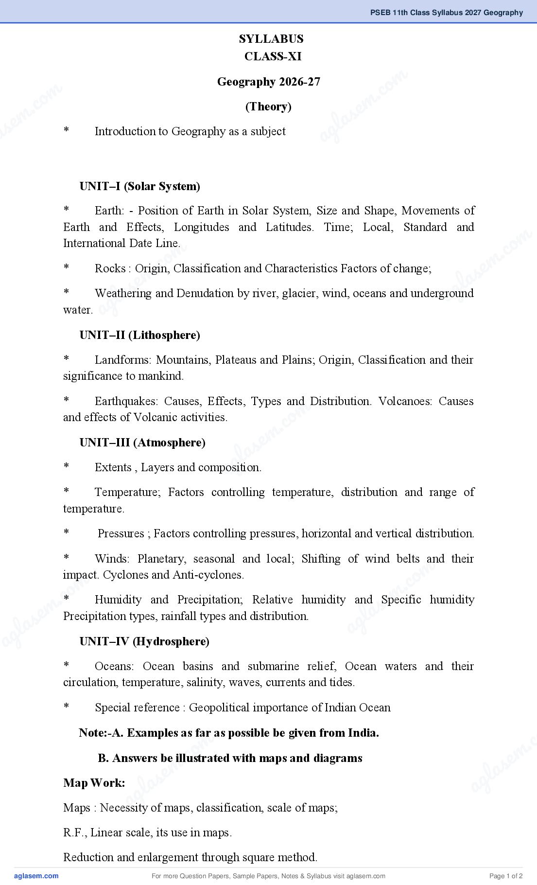
CLASS-XI
Geography 2026-27 m
m .co
m .co (Theory)
s e m
as e * Introduction to Geography as a subject g la
a
UNIT–I (Solar System)
* Earth: - Position of Earth in Solar System, Size and Shape, Movements of
Earth and Effects, Longitudes and Latitudes. Time; Local, Standard and
m
International Date Line.
om . co
* . c
Rocks : Origin, Classification and Characteristics Factors of change; e m
m
e and Denudation by river, glacier, wind, oceans and underground
l as
* as
Weathering
l ag
water. ag
UNIT–II (Lithosphere)
* Landforms: Mountains, Plateaus and Plains; Origin, Classification and their
significance to mankind.
* Earthquakes: Causes, Effects, Types and Distribution. Volcanoes: Causes
m
.co
and effects of Volcanic activities.
e m
UNIT–III (Atmosphere)
l as
* ag
Extents , Layers and composition.
* Temperature; Factors controlling temperature, distribution and range of
temperature.
* Pressures ; Factors controlling pressures, horizontal and vertical distribution.
* Winds: Planetary, seasonal and local; Shifting of wind belts and their
m
.co
impact. Cyclones and Anti-cyclones.
m
m .co
* Humidity and Precipitation; Relative humidity and Specific humidity
s e m
s e Precipitation types, rainfall types and distribution.
g la
g la a
a UNIT–IV (Hydrosphere)
* Oceans: Ocean basins and submarine relief, Ocean waters and their
circulation, temperature, salinity, waves, currents and tides.
* Special reference : Geopolitical importance of Indian Ocean
Note:-A. Examples as far as possible be given from India.
m . c
c. o with maps and diagrams
B. Answers be illustrated
s e m
e m l a
Map Work:
las ag
g
a of maps, classification, scale of maps;
Maps : Necessity
R.F., Linear scale, its use in maps.
Reduction and enlargement through square method.
For more Question Papers, Sample Papers, Notes & Syllabus visit Page 1 of 2
Page 3
in the field, methods of showing direction on the map.
Atlas map symbols: Identifications and Recognition of Symbols of conventional
signs used in atlas, Topographic sheet and weather maps.
Methods of showing relief on maps: Contours, Interpolation of Contours
identification of simple relief features from contours on a map. Drawing of cross-
section,
Observation and recording of various weather elements with the help of following
instruments: a) Six’s minimum and maximum thermometer. b) Aneroid Barometer
c) Wind Vane d) Wet and Dry bulb thermometer e) Rain gauge
f) Drawing of isotherms, isobars and isohyets.
For more Question Papers, Sample Papers, Notes & Syllabus visit Page 2 of 2