KUET 2025 Question Paper Geography
Finished viewing? Save it for later —
Download KUET 2025 Question Paper Geography (PDF · 17 pages)About KUET 2025 Question Paper Geography
KUET 2025 Question Paper Geography is available here for free download. Published by University of Kashmir for KUET, this question paper can be viewed online or downloaded as a PDF (17 pages). Candidates preparing for KUET can use KUET 2025 Question Paper Geography to understand the exam pattern, the type of questions asked, and the overall difficulty level.
Frequently Asked Questions
How can I download KUET 2025 Question Paper Geography?
Open this page and click the Download button to save KUET 2025 Question Paper Geography as a PDF. It is completely free on AglaSem Docs.
Is KUET 2025 Question Paper Geography free to download?
Yes. KUET 2025 Question Paper Geography can be viewed online and downloaded as a PDF free of cost on AglaSem Docs.
How many pages does KUET 2025 Question Paper Geography have?
KUET 2025 Question Paper Geography contains 17 pages, which you can read online or download together as a single PDF.
Where can I find more KUET study material?
You can find more KUET question papers, sample papers, syllabus, and answer keys on AglaSem Docs.
KUET 2025 Question Paper Geography – Text
Read the full text of this question paper below — useful to quickly search, copy and reference the content online without downloading the PDF.
📄 View text version (18 pages)
Page 1
KUET 2025 Question
Paper Geography
EXAM YEAR TYPE
KUET 2025 Question Paper
Notes · Sample Papers · Previous Year Papers · Mock Tests
Page 2
m .co
c. o
e m
em l a s
s a g
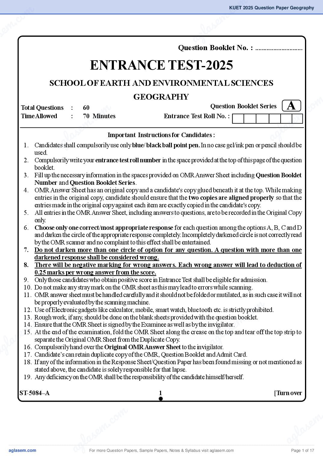
Question Booklet No. : .............................
ENTRANCE TEST-2025
SCHOOL OF EARTH AND ENVIRONMENTAL SCIENCES
A .com
GEOGRAPHY
m
co
Total Questions : 60 Question Booklet Series
. e m
as
Time Allowed : 70 Minutes Entrance Test Roll No. :
e m l
a s g
l compulsorily use only blue/ black ball point pen. In no case gel/ink pen or pencila should be
g
Important Instructions for Candidates :
used.
a
1. Candidates shall
2. Compulsorily write your entrance test roll number in the space provided at the top of this page of the question
booklet.
3. Fill up the necessary information in the spaces provided on OMR Answer Sheet including Question Booklet
Number and Question Booklet Series.
4. OMR Answer Sheet has an original copy and a candidate's copy glued beneath it at the top. While making
entries in the original copy, candidate should ensure that the two copies are aligned properly so that the
m
co
entries made in the original copy against each item are exactly copied in the candidate's copy.
.
5. All entries in the OMR Answer Sheet, including answers to questions, are to be recorded in the Original Copy
em
only.
a s
6. Choose only one correct/most appropriate response for each question among the options A, B, C and D
l
g
and darken the circle of the appropriate response completely. Incompletely darkened circle is not correctly read
a
by the OMR scanner and no complaint to this effect shall be entertained.
7. Do not darken more than one circle of option for any question. A question with more than one
darkened response shall be considered wrong.
8. There will be negative marking for wrong answers. Each wrong answer will lead to deduction of
0.25 marks per wrong answer from the score.
9. Only those candidates who obtain positive score in Entrance Test shall be eligible for admission.
10. Do not make any stray mark on the OMR sheet as this may lead to errors while scanning.
11. OMR answer sheet must be handled carefully and it should not be folded or mutilated, as in such case it will not
m
co
be properly evaluated by the scanning machine.
m .
12. Use of Electronic gadgets like calculator, mobile, smart watch, blue tooth etc. is strictly prohibited.
c. o se
m
13. Rough work, if any, should be done on the blank sheets provided with the question booklet.
em la
14. Ensure that the OMR Sheet is signed by the Examinee as well as by the invigilator.
las g
15. At the end of the examination, fold the OMR Sheet along the crease on the top and tear off the top strip to
g
separate the Original OMR Sheet from the Duplicate Copy.
a
a 16. Compulsorily hand over the Original OMR Answer Sheet to the invigilator.
17. Candidate’s can retain duplicate copy of the OMR, Question Booklet and Admit Card.
18. If any of the information in the Response Sheet/Question Paper has been found missing or not mentioned as
stated above, the candidate is solely responsible for that lapse.
19. Any deficiency on the OMR shall be the responsibility of the candidate himself/herself.
ST-5084–A 1 [Turn over
m .
.co s e m
e m l a
l a s a g
ag For more Question Papers, Sample Papers, Notes & Syllabus visit Page 1 of 17
Page 3
ground covered by the scanner is called: Pacific Ocean?
(A) Synoptic View 1. Asia
(B) Nadir Point 2. North America
(C) Swath 3. South America
(D) Path 4. Africa
2. What is meant by transhumance with respect to 5. Australia
migration? Select the correct code from the options given below:
(A) Permanent migration (A) Only 1, 3 & 5
(B) Seasonal migration (B) Only 1, 2 & 3
(C) Daily migration (C) Only 1, 2, 3 & 5
(D) Long term migration (D) 1, 2, 3, 4 & 5
3. Which of the following is not a characteristic feature 7. Which one of the following weather condition is
of temperate cyclone? indicated by a sudden fall in the barometer reading?
(A) Fogginess and Poor visibility (A) Stormy
(B) Unsettled weather (B) Cloudy and dry
(C) Movement from west to east (C) Calm
(D) Torrential rainfall (D) Hot and sunny
4. In which among the following countries does the ship 8. The report entitled “Our Common Future” was
building industry is the most advance? submitted in1987 by :
(A) Japan (A) Brundtland Commission
(B) China (B) Food and Agricultural Organisation
(C) Germany (C) World Meteorological Organisation
(D) Canada (D) Intergovernmental Panel on Climate Change
5. Which among the following salts has the highest (IPCC)
percentage in ocean water? 9. Tropical black soils have been formed by:
(A) Magnesium chloride (A) Deposits by river
(B) Sodium chloride (B) Volcanic activity
(C) Calcium sulphate (C) Decay and decomposition of vegetation
(D) Calcium carbonate (D) Chemical activity
ST-5084–A 2
For more Question Papers, Sample Papers, Notes & Syllabus visit Page 2 of 17
Page 4
m .co
c. o
e m
em l a s
s 10. A horn is associated with: ag
16. Match the List I with List II:
(A) Erosional work of a river List I List II
(B) Depositional work of a river
1. Isohels a. Rainfall
(C) Depositional work of a glacier
2. Isonephs b. Sunshine
(D) Erosional work of a glacier
3. Isohyet c. Snow depth
m
11. Which of the following is not the result of Glacio-
m c. o
fluvial deposits? 4. Isonif d. Cloudiness
(A) Esker
.co 1 2 3 4
s e m
e m la
(C) Moraine as g
(B) Kame (A) b a c d
l a
(D) Hornag
(B) a c d b
(C) b d a c
12. Vector and raster data models are used in:
(D) a d c b
(A) Global Positioning System
17. What causes wind to deflect toward left in the
(B) Remote Sensing
Southern hemisphere?
(C) Geographical Information System
(A) Temperature
m Magnetic field
(D) All the above
13. Who defined Geography as human ecology?
. o
c (C) Rotation of the Earth
(B)
s em
(A) Schaefer
(B) Hartshorne
g l a (D) Pressure
(C) Richtofen a 18. The Radical school of geography was established by:
(D) Barrows
(A) B.J. Alberry
14. Which among the following has the highest albedo?
(B) R. Peet
(A) Forests
(C) G.Taylor
(B) Deserts
(C) Fresh snow (D) E. Sample
m
co
19. In which of the following regions would you expect
m .
(D) Land surface
c. o se
m
15. Which one is the following is a conventional the maximum effect of insolation as an agent of
em (A) Polyconic la
projection? weathering?
s
la (B) Sinusoidal a g
g
(A) Sahara region
a (C) Bonnes
(B) Tundra region
(C) Mediterranean region
(D) None
(D) Equatorial region
ST-5084–A 3 [Turn over
m .
.co s e m
e m l a
l a s a g
ag For more Question Papers, Sample Papers, Notes & Syllabus visit Page 3 of 17
Page 5
(A) Amidst the mountain ranges (A) Kant
(B) Near the sea coast (B) Peet
(C) On a cliff (C) Kuhn
(D) Hagget
(D) On the edge of a plain
26. Who among the following pleaded that history be
21. Carl Sauer is best identified for his classic work related
treated geographically and geography be treated
to:
historically?
(A) Cultural landscape
(A) Homer
(B) Economic landscape (B) Thales
(C) Social landscape (C) Heatacus
(D) Physical landscape (D) Herodotus
22. Which of the following is not a graphic representation ? 27. Thornthwaite’s modified climatic classification is based
(A) Pie Chart on the concept of:
(A) Effective temperature
(B) Frequency Table
(B) Precipitation Index
(C) Bar Chart
(C) Potential Evapotranspiration
(D) Histogram
(D) Potential Precipitation
23. In the subcontinent of India the region frequently
28. In Koppen’s classification of climate the symbol Aw
affected by tropical cyclone is:
refers to:
(A) Gujarat Coast
(A) Tropical Savanna Climate
(B) Coromandel Coast (B) Monsoon Climate
(C) Konkan Coast (C) Tropical rainforest Climate
(D) Malabar Coast (D) Steppe
24. Which one of the following techniques is not suitable 29. Which of the following earthquake waves are more
for showing Urban population on the map? destructive at epicentre?
(A) Circles (A) S waves
(B) Divided Circles (B) P waves
(C) Spheres (C) R waves
(D) L waves
(D) Hachures
ST-5084–A 4
For more Question Papers, Sample Papers, Notes & Syllabus visit Page 4 of 17
Page 6
m .co
c. o
e m
em l a s
s a g
30. Which one of the following is formed due to tectonic 35. According to Christaller’s Central Place Theory
forces? k = 4 stands for :
(A) Hanging valley (A) Administrative principle
(B) U-shaped valley (B) Market principle
(C) Blind valley (C) Transport principle
m
m c. o
(D) Rift valley
co
(D) Trade principle
. e m
m s
31. Chemical weathering is more effective than 36. Which one of the following is not correctly matched ?
a s e
mechanical weathering in :
g la
l a
(A) Concentric theory- Sinclair
ag
(A) Semi-arid region
(B) Sector theory- Human Hoyt
(B) Arid region
(C) Central Place Theory- Christaller
(C) Coastal region
(D) Multiple Nuclei Theory- Harris and Ullman
(D) Cool temperate region
37. For his model of industrial location, Weber marks use
32. Which one of the following is not a sedimentary rock?
of :
m
(A) Coal
co
(A) Isogons
.
em
(B) Shale
(B) Isophens
(C) State
l a s
g
(C) Isodapanes
(D) Sandstone
a (D) Isohyet
33. Which of the following is a warm ocean current?
38. Which of the following is a footloose industry ?
(A) Canary
(A) Electronics
(B) Gulf Stream
(B) Leather
(C) Labrador
(C) Paper
m
co
(D) Kuril
m .
(D) Cement
c. o se
m
34. Which one of the following is missing in classifying a
em
39. With increase in time and distance, accessibility :
la
settlement as a town in the census of India?
las (A) Reduces
a g
g
(A) Population size
a (B) Population density
(B) Increases
(C) Remains the same
(C) Dominance of male worker participation
(D) Function (D) First reduces then increases
ST-5084–A 5 [Turn over
m .
.co s e m
e m l a
l a s a g
ag For more Question Papers, Sample Papers, Notes & Syllabus visit Page 5 of 17
Page 7
primary activity? cryosphere?
(A) Coal mining (A) Antarctica
(B) Teaching (B) Artic
(C) Australia
(C) Handicrafts
(D) South America
(D) Car manufacturing
46. __________ is the frozen water part of the Earth
41. Growth Pole theory was originally developed by :
water system.
(A) Glasson
(A) Lithosphere
(B) Perroux (B) Troposphere
(C) Thirwal (C) Mesosphere
(D) Hirschman (D) Cryosphere
42. Which one of the following is an example of a 47. Which of the following is a gas released when
Nodal Region ? permafrost thaws?
(A) Damodar Valley Region (A) Oxygen
(B) Upper Ganga Yamuna Doab Region (B) Methane
(C) Western Ghats Region (C) Hydrogen
(D) Nitrogen
(D) National Capital Region
48. Rainfall with an intensity of 6 mm/hr is classified as :
43. The city region is an example of :
(A) Trace rain
(A) Formal region
(B) Moderate rain
(B) Functional region
(C) Heavy rain
(C) Compact region
(D) Light rain
(D) Adhoc region
49. When rainfall intensity is greater than infiltration
44. Which of the following is not part of the capacity indicated by the infiltration curve, the excess
Cryosphere? water contributes to :
(A) Glaciers (A) Ground water charge
(B) Rivers (B) Evapotranspiration
(C) Iceberg (C) Surface run off
(D) Evaporation
(D) Permafrost
ST-5084–A 6
For more Question Papers, Sample Papers, Notes & Syllabus visit Page 6 of 17
Page 8
m .co
c. o
e m
em l a s
s 50. A land is known as waterlogged : a g
56. Which element is most useful for identifying tall building
(A) When the permanent wilting point is reached in an aerial photograph?
(B) When gravity drainage has ceased
(A) Size
(C) Capillary fringe reaches the root zone of
plants (B) Shadow
(D) None of the above (C) Shape
m
c. o
51. Pick up the correct statement from the following.
m
(D) Pattern
.co m
(A) Hydrograph is a plot of discharge and time
m
57. Which is not a method of hypothesis testing?
s e
e la
(B) In hydrograph, time is plotted on x axis
l a s
(C) The maximum flow in the river due to rainfall (A) Chi-square test
a g
ag
is called peak flow (B) Student test
(D) All the above
(C) Circular test
52. Which one of the following is not a part of spatial
information technique? (D) Parametric test
(A) GIS 58. Which type of sampling technique is used to draw a
(B) GPS sample from a heterogeneous universe?
(C) SPSS
m
(A) Systematic
c. o(B) Stratified
(D) Remote Sensing
em (C) Random
53. Which of the following is a GIS analysis technique?
(A) Image displaying
l a s
(B) Contrast Sketching
(C) Map Overlaying a g (D) Area
59. Mean, Median and Mode are:
(D) Map designing
54. Which one of the following characteristics separate (A) Measures of Deviation
GIS from other systems? (B) Ways of Sampling
(A) Map making and generalised output
(C) Measure of Central Tendency
(B) Linking spatial and attribute data
m
co
(D) Measure of Dispersion
m .
(C) Map designing and layout
c. o se
m
(D) All the above 60. Which of the following statistical technique is used to
em la
55. Out of the following which one is not the example of analyse the interdependence of variables ?
s
la (A) IIRS
polar orbiting satellites? (A) Location Quotient
a g
ag (B) Standard Score
(B) LANDSAT
(C) Coefficient of Variability
(C) SPOT
(D) Factor Analysis
(D) INSAT
ST-5084–A 7
m .
.co s e m
e m l a
l a s a g
ag For more Question Papers, Sample Papers, Notes & Syllabus visit Page 7 of 17
Page 9
ST-5084–A 8 73
For more Question Papers, Sample Papers, Notes & Syllabus visit Page 8 of 17
Page 10
em l a
as
ag
m
co
m m.co
m . s e
s e la
la ag
ag
m
. co
s em
g l a
a
m
m c. o
c. o s e m
s em l a
gla ag
a
m .
.co e m
se
m
For more Question Papers, Sample Papers, Notes & Syllabus visit
las
Page 9 of 17
Page 11
Page 12
em l a
as
ag
m
co
m m.co
m . s e
s e la
la ag
ag
m
. co
s em
g l a
a
m
m c. o
c. o s e m
s em l a
gla ag
a
m .
.co e m
se
m
For more Question Papers, Sample Papers, Notes & Syllabus visit las
Page 11 of 17
Page 13
Page 14
s em la
ag
m
co
m m .co
m . s e
se l a
l a ag
ag
m
. co
s em
g l a
a
m
m c. o
c. o s e m
s em l a
gla ag
a
m
.co s e m
m la
se
For more Question Papers, Sample Papers, Notes & Syllabus visit Page 13 of 17
Page 15
Page 16
s em l a
ag
m
co
m m .co
m . s e
s e la
la ag
ag
m
. co
s em
g l a
a
m
m c. o
c. o s e m
s em l a
gla ag
a
m .
.co e m
se
m
For more Question Papers, Sample Papers, Notes & Syllabus visit las
Page 15 of 17
Page 17
Page 18
em la
as
ag
m
co
m m.co
m . s e
se l a
l a ag
ag
m
. co
s em
g l a
a
m
m c. o
c. o s e m
s em l a
gla ag
a
m .
.co e m
se
m
For more Question Papers, Sample Papers, Notes & Syllabus visit las
Page 17 of 17
Document Details
| Board / Org | University of Kashmir |
| Exam | KUET |
| Type | Question Paper |
| Pages | 17 |
| Updated | 29 Oct 2026 |