PUMDET 2023 Question Paper Geography
Finished viewing? Save it for later —
Download PUMDET 2023 Question Paper Geography (PDF · 12 pages)About PUMDET 2023 Question Paper Geography
PUMDET 2023 Question Paper Geography is available here for free download. Published by WBJEEB for PUMDET, this question paper can be viewed online or downloaded as a PDF (12 pages). Candidates preparing for PUMDET can use PUMDET 2023 Question Paper Geography to understand the exam pattern, the type of questions asked, and the overall difficulty level.
Frequently Asked Questions
How can I download PUMDET 2023 Question Paper Geography?
Open this page and click the Download button to save PUMDET 2023 Question Paper Geography as a PDF. It is completely free on AglaSem Docs.
Is PUMDET 2023 Question Paper Geography free to download?
Yes. PUMDET 2023 Question Paper Geography can be viewed online and downloaded as a PDF free of cost on AglaSem Docs.
How many pages does PUMDET 2023 Question Paper Geography have?
PUMDET 2023 Question Paper Geography contains 12 pages, which you can read online or download together as a single PDF.
Where can I find more PUMDET study material?
You can find more PUMDET question papers, sample papers, syllabus, and answer keys on AglaSem Docs.
PUMDET 2023 Question Paper Geography – Text
Read the full text of this question paper below — useful to quickly search, copy and reference the content online without downloading the PDF.
📄 View text version (12 pages)
Page 1
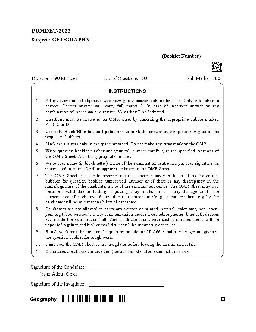
(Booklet Number)
Duration : 90 Minutes No. of Questions : 50 Full Marks : 100
INSTRUCTIONS
1. All questions are of objective type having four answer options for each. Only one option is
correct. Correct answer will carry full marks 2. In case of incorrect answer or any
combination of more than one answer, ½ mark will be deducted.
2. Questions must be answered on OMR sheet by darkening the appropriate bubble marked
A, B, C or D.
3. Use only Black/Blue ink ball point pen to mark the answer by complete filling up of the
respective bubbles.
4. Mark the answers only in the space provided. Do not make any stray mark on the OMR.
5. Write question booklet number and your roll number carefully in the specified locations of
the OMR Sheet. Also fill appropriate bubbles.
6. Write your name (in block letter), name of the examination centre and put your signature (as
is appeared in Admit Card) in appropriate boxes in the OMR Sheet.
7. The OMR Sheet is liable to become invalid if there is any mistake in filling the correct
bubbles for question booklet number/roll number or if there is any discrepancy in the
name/signature of the candidate, name of the examination centre. The OMR Sheet may also
become invalid due to folding or putting stray marks on it or any damage to it. The
consequence of such invalidation due to incorrect marking or careless handling by the
candidate will be sole responsibility of candidate.
8. Candidates are not allowed to carry any written or printed material, calculator, pen, docu-
pen, log table, wristwatch, any communication device like mobile phones, bluetooth devices
etc. inside the examination hall. Any candidate found with such prohibited items will be
reported against and his/her candidature will be summarily cancelled.
9. Rough work must be done on the question booklet itself. Additional blank pages are given in
the question booklet for rough work.
10. Hand over the OMR Sheet to the invigilator before leaving the Examination Hall.
11. Candidates are allowed to take the Question Booklet after examination is over.
Signature of the Candidate : ______________________________
(as in Admit Card)
Signature of the Invigilator : ______________________________
Geography
Page 2
Geography 2
Page 3
(A) Distribution of continents and oceans
(B) Shape, size and orientation of continents and oceans
(C) Both (A) and (B)
(D) Neither (A) nor (B)
2. Continental drift is the result of :
(A) Gravitational differential force and buoyancy
(B) Tidal force of the Sun and the Moon
(C) Both (A) and (B)
(D) Neither (A) nor (B)
3. The Milankovitch cycle is related to :
(A) The shape of the Earth’s orbit, known as eccentricity.
(B) The angle the Earth’s axis is tilted with respect to the Earth’s orbital plane, known
as obliquity.
(C) The direction the Earth’s axis of rotation is pointed, known as precession.
(D) All of the above
4. Viviparous characteristics of vegetation are found in :
(A) Halophyte (B) Mesophyte
(C) Mangrove (D) Xerophyte
5. The main cause of rising sea level is :
(A) The added water from melting of ice sheets and glaciers.
(B) Thermal expansion of sea water
(C) Both (A) and (B)
(D) Neither (A) nor (B)
Geography 3
Page 4
(A) Always higher than apparent dip
(B) Sometimes lower, but often higher than apparent dip
(C) May be higher or equal to apparent dip
(D) Always equal to apparent dip
7. Which of the following is an antecedent river ?
(A) Sutlej (B) Indus
(C) Brahmaputra (D) All of the above
8. The course of Narmada and Tapi are nearly straight and parallel because
(A) the rivers are west flowing.
(B) the rivers are rain fed.
(C) the rivers flow through two parallel normal faults.
(D) the rivers are guided by two mountains.
9. GTS benchmarks are maintained by
(A) NRSA (B) ISRO
(C) DRDO (D) Survey of India
10. The terms blurriness and sharpness of a digital image are associated with :
(A) Spatial resolution (B) Radiometric resolution
(C) Temporal resolution (D) Spectral resolution
11. National Population Policy (NPP) – 2000 of India contains :
(A) Antinatal components (B) Pronatal components
(C) Both (A) and (B) (D) Neither (A) nor (B)
Geography 4
Page 5
and urban population ?
(A) Dots and spheres map (B) Choropleth map
(C) Chorochromatic map (D) Choroschematic map
13. DVC is an example of :
(A) Functional region (B) Natural region
(C) Economic region (D) Planning region
14. Which of the following is not the name of a Mahajanapada ?
(A) Kosala (B) Anga
(C) Magadh (D) Banga
15. The total number of goals to be achieved by 2030 under Sustainable Development Goals
(SDG) is :
(A) 15 (B) 17
(C) 22 (D) 27
16. In spite of having great potential of hydropower, India has not been able to harness it
extensively because :
(A) High initial cost
(B) Fragile environment in the hydropower rich regions
(C) Distance of places of large scale demand
(D) All of the above
17. Rainfall activities experienced in the North-western plain region of India during the
winter season is associated with :
(A) Tropical cyclones (B) Cloud bursts
(C) Mid-latitude cyclones (D) Western disturbances
Geography 5
Page 6
(A) Door to enter Nepal from the East
(B) Door to enter Assam from the West
(C) Door to enter Bhutan from the South
(D) Door to enter Bangladesh from the North
19. “Antipode” is a journal which can be related to :
(A) Radical Geography (B) Welfare Geography
(C) Feminist Geography (D) Humanistic Geography
20. Who was the propounder of the idea “all geography should be taught historically, and all
history should be taught geographically” ?
(A) Herodotus (B) Alexander Von Humboldt
(C) Eratosthenes (D) Thales
21. Which one is more appropriate for depicting consistency of rainfall ?
(A) Mean (B) Standard Deviation
(C) Range (D) Co-efficient of Variation
22. Christaller’s K-7 Principle is related to :
(A) Marketing Principle (B) Administrative Principle
(C) Transportation Principle (D) Migration
23. Easier and cheaper way to distinguish Hematite and Magnetite ores can be done by
observing their :
(A) Microscopic examination (B) Acid reaction
(C) Hardness (D) Streak colour
Geography 6
Page 7
Assertion (A) : Land is a natural resource of utmost importance.
Reason (R) : Land can be used for various purposes.
Options :
(A) Both (A) and (R) are true and (R) is the correct explanation of (A).
(B) Both (A) and (R) are true, but (R) is not the correct explanation of (A).
(C) (A) is true, but (R) is false.
(D) (A) is false, but (R) is true.
25. Arrange the correct sequences :
Column I Column II
(a) Social Geography 1. Rural planning
(b) Political Geography 2. Marketing Geography
(c) Economic Geography 3. Military Geography
(d) Settlement Geography 4. Gender Geography
Select the correct answer from the codes given below :
Codes :
(a) (b) (c) (d)
(A) 3 4 1 2
(B) 4 3 2 1
(C) 2 3 4 1
(D) 3 2 1 4
26. Oldham-Gutenberg Discontinuity is the transitional zone between :
(A) Lower Mantle and Outer Core (B) Crust and Upper Mantle
(C) Outer Core and Inner Core (D) Sial and Sima
27. Which is the correct order of ocean sizes in decreasing order ?
(A) Pacific Ocean, Indian Ocean, Atlantic Ocean, Arctic Ocean
(B) Arctic Ocean, Pacific Ocean, Indian Ocean, Atlantic Ocean
(C) Pacific Ocean, Atlantic Ocean, Indian Ocean, Arctic Ocean
(D) Atlantic Ocean, Indian Ocean, Arctic Ocean, Pacific Ocean
Geography 7
Page 8
(A) Heave and Throw (B) Tear and Heave
(C) Throw and Heave (D) Heave and Tear
29. Which one of the following is not an approach in human geography ?
(A) Areal differentiation (B) Spatial organization
(C) Quantitative revolution (D) Exploratory description
30. Resources which are surveyed and their quantity have been determined for utilization are
known as :
(A) Potential resources (B) Developed resources
(C) Stock (D) Reserves
31. The extinction of species is a :
(A) Fast continuous process
(B) Slow continuous process
(C) Irregular process
(D) Slow continuous process with intervals
32. Z - Score is a :
(A) Standard Score (B) Proxy Score
(C) Dummy Score (D) Non-parametric Score
33. Siltstone belongs to :
(A) Rudaceous sediments (B) Arenaceous sediments
(C) Argillaceous sediments (D) Calcareous sediments
34. The most important characteristics of Guyots are :
(A) Of metamorphic origin
(B) Formed by deposition of sedimentary rocks
(C) Always in tilted position
(D) Truncated and have flat tops
Geography 8
Page 9
(A) Windward side of the mountain (B) Leeward side of the mountain
(C) Crest of the mountain (D) Base of the mountain
36. Which of these is not a frontier state in the Indo-Nepal border ?
(A) Uttarakhand (B) Bihar
(C) Sikkim (D) Himachal Pradesh
37. Which of the following was not included in Census of India enumeration (2011) ?
(A) Demographic characteristics (B) Social-cultural characteristics
(C) Economic characteristics (D) Status of health of the population
38. Which of the following anthropogenic activity accounts for more than 2/3 rd of global
water consumption ?
(A) Agriculture (B) Hydropower generation
(C) Industry (D) Domestic and municipal usage
39. Which one of the following racial groups is identified by external features like wavy hair,
brown to white skin colour and medium to high stature ?
(A) Caucasoid (B) Negroid
(C) Mongoloid (D) Negrito
40. If in a population natality is balanced by mortality, then there will be :
(A) Over population (B) Zero population growth
(C) Increase in population growth (D) Decrease in population growth
41. Besides the other criteria, what is the minimum population size required for classifying a
settlement as “Urban” as per census of India definition ?
(A) 4500 persons (B) 5000 persons
(C) 6000 persons (D) 4000 persons
Geography 9
Page 10
India ?
(A) 100 cm isohyet (B) 35 ℃ isotherm
(C) 200 frost free days (D) 150 sunny days
43. The correct sequence of the eastward flowing rivers of the peninsular India from north to
south is :
(A) Subarnarekha, Mahanadi, Godavari, Krishna, Penner, Cauvery and Vaigai
(B) Subarnarekha, Mahanadi, Krishna, Godavari, Cauvery and Vaigai
(C) Mahanadi, Subarnarekha, Godavari, Krishna, Cauvery, Penner and Vaigai
(D) Mahanadi, Subarnarekha, Krishna, Godavari, Cauvery, Vaigai and Penner
44. Who proposed the concept of ‘Neo-determinism’ ?
(A) Griffith Taylor (B) Paul Vidal de La Blache
(C) Ellsworth Huntington (D) Carl Ritter
45. Match the following :
List I (Theory) List II (Proponent)
(a) Migration Theory 1. Edwin Cannan
(b) Optimum Population Theory 2. S. Stouffer
(c) Demographic Transition Theory 3. E. G. Ravenstein
(d) Intervening Opportunities Theory 4. W. Thompson
Codes :
(a) (b) (c) (d)
(A) 3 1 4 2
(B) 3 1 2 4
(C) 3 4 2 1
(D) 4 1 3 2
Geography 10
Page 11
(A) Pygmies (B) Red Indians
(C) Bakarwals (D) Masai
47. According to the rank-size rule, if the largest city in the Country “X” has 1,00,000
inhabitants, approximately how many people will live in Country X’s 4 th largest city ?
(A) 10,000 (B) 75,000
(C) 25,000 (D) 50,000
48. Who is the father of the White Revolution ?
(A) Norman Borlaug (B) Indira Gandhi
(C) Verghese Kurien (D) Hiralal Chaudhri
49. In the Concentric Zone Theory, the 5 zones from the core to the periphery are :
(i) Commuter’s Zone
(ii) Residential Zone
(iii) Transition Zone
(iv) CBD
(v) Zone of working men’s home
Select the correct answer from the given codes :
Codes :
(A) iv, iii, v, i, ii (B) iv, i, v, ii, iii
(C) iv, iii, v, ii, i (D) iv, ii, iii, v, i
50. The Garo, Khasi and Jaintia are major tribes of :
(A) Manipur (B) Meghalaya
(C) Assam (D) Odisha
_______________
Geography 11
Page 12
Geography 12
Document Details
| Board / Org | WBJEEB |
| Exam | PUMDET |
| Type | Question Paper |
| Pages | 12 |
| Updated | 22 Jul 2026 |