ICSE Class 10 Sample Paper 2026 Geography
Finished viewing? Save it for later —
Download ICSE Class 10 Sample Paper 2026 Geography (PDF · 22 pages)About ICSE Class 10 Sample Paper 2026 Geography
ICSE Class 10 Sample Paper 2026 Geography is available here for free download. Published by CISCE for Class 10, this sample paper can be viewed online or downloaded as a PDF (22 pages). Candidates preparing for Class 10 can use ICSE Class 10 Sample Paper 2026 Geography to understand the exam pattern, the type of questions asked, and the overall difficulty level.
Frequently Asked Questions
How can I download ICSE Class 10 Sample Paper 2026 Geography?
Open this page and click the Download button to save ICSE Class 10 Sample Paper 2026 Geography as a PDF. It is completely free on AglaSem Docs.
Is ICSE Class 10 Sample Paper 2026 Geography free to download?
Yes. ICSE Class 10 Sample Paper 2026 Geography can be viewed online and downloaded as a PDF free of cost on AglaSem Docs.
How many pages does ICSE Class 10 Sample Paper 2026 Geography have?
ICSE Class 10 Sample Paper 2026 Geography contains 22 pages, which you can read online or download together as a single PDF.
Where can I find more Class 10 study material?
You can find more Class 10 question papers, sample papers, syllabus, and answer keys on AglaSem Docs.
ICSE Class 10 Sample Paper 2026 Geography – Text
Read the full text of this sample paper below — useful to quickly search, copy and reference the content online without downloading the PDF.
📄 View text version (21 pages)
Page 1
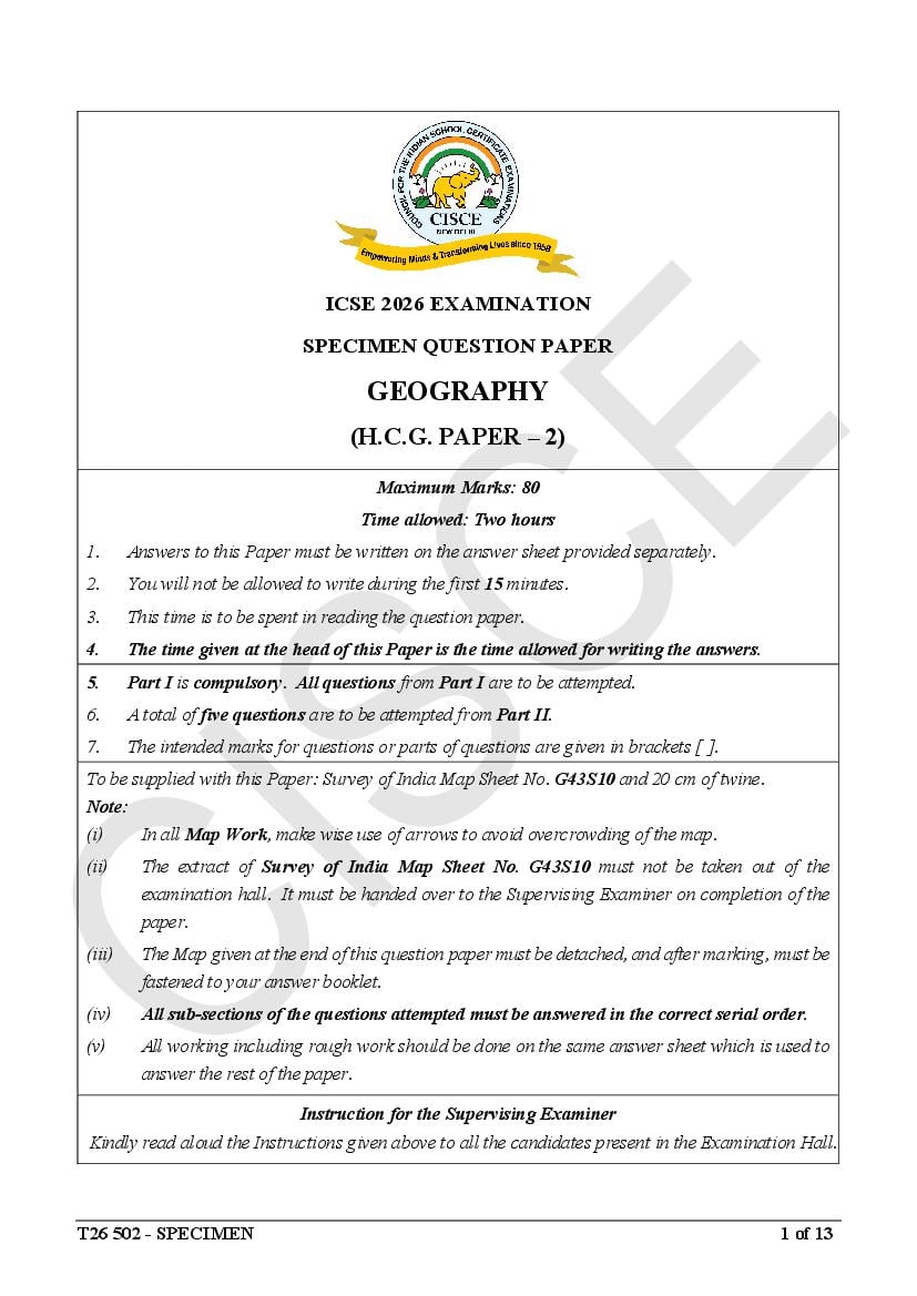
SPECIMEN QUESTION PAPER
GEOGRAPHY
(H.C.G. PAPER – 2)
Maximum Marks: 80
Time allowed: Two hours
1. Answers to this Paper must be written on the answer sheet provided separately.
2. You will not be allowed to write during the first 15 minutes.
3. This time is to be spent in reading the question paper.
4. The time given at the head of this Paper is the time allowed for writing the answers.
5. Part I is compulsory. All questions from Part I are to be attempted.
6. A total of five questions are to be attempted from Part II.
7. The intended marks for questions or parts of questions are given in brackets [ ].
To be supplied with this Paper: Survey of India Map Sheet No. G43S10 and 20 cm of twine.
Note:
(i) In all Map Work, make wise use of arrows to avoid overcrowding of the map.
(ii) The extract of Survey of India Map Sheet No. G43S10 must not be taken out of the
examination hall. It must be handed over to the Supervising Examiner on completion of the
paper.
(iii) The Map given at the end of this question paper must be detached, and after marking, must be
fastened to your answer booklet.
(iv) All sub-sections of the questions attempted must be answered in the correct serial order.
(v) All working including rough work should be done on the same answer sheet which is used to
answer the rest of the paper.
Instruction for the Supervising Examiner
Kindly read aloud the Instructions given above to all the candidates present in the Examination Hall.
T26 502 - SPECIMEN 1 of 13
Page 2
The Specimen Question Paper in the subject provides a realistic
format of the Board Examination Question Paper and should be used
as a practice tool. The questions for the Board Examination can be set
from any part of the syllabus. However, the format of the Board
Examination Question Paper will remain the same as that of the
Specimen Question Paper.
Page 3
(Attempt all questions from this Part.)
Question 1
Study the extract of the Survey of India Map Sheet No. G43S10 and answer the
following questions:
(i) (a) Identify the conventional symbol found at the six figure reference [2]
of 666364. [Application &
(b) Identify the drainage pattern in the Grid Square 6334. Understanding]
(ii) (a) Calculate the shortest distance in km. from Malgaon to [2]
Mohabbatgarh.
(b) In which direction will Sneha be driving if she is going from [Application]
Mohabbatgarh to Sanwara along the metalled road?
(iii) (a) Write whether the conventional symbol marked as a blue dot in the [2]
Pamera settlement is man-made or natural.
(b) A resident of Malgaon settlement (Grid Square 6131) has to report [Analysis]
a crime at the nearest police station. Which settlement will he be
visiting?
(iv) (a) How do the local people benefit from the causeways seen in this [2]
region? [Application &
(b) Explain why Fire lines are significant from the point of view of Recall]
environment.
(v) (a) Rajiv is travelling from Gulabganj for a visit to the Reserved Forest [2]
near Tarepara Nadi (Grid square 6728). Which two means of
transport he would come across during his journey?
(b) Differentiate between the types of huts in Grid Square 6935 and the
ones found in Grid Square7033.
[Understanding]
T26 502 – SPECIMEN 2 of 13
Page 4
[Recall]
On the outline map of India provided:
(i) Shade and label an area of black soil in Gujarat. [1]
(ii) Mark using a dot and name a major river port of India. [1]
(iii) Shade and label the Deccan plateau of India. [1]
(iv) Mark and label the Palk Strait. [1]
(v) Mark with arrows and name the wind which brings rainfall to the Konkan [1]
coast.
(vi) Shade and label a sparsely populated area in western India. [1]
(vii) Mark and label the hills that are popularly called Blue Mountain. [1]
(viii) Mark and name the river known as the ‘Sorrow of Bengal’. [1]
(ix) Mark and label the Indian Standard Meridian. [1]
(x) Mark and label the Coromandel coast. [1]
Question 3
Choose the correct answers to the questions from the given options. [10]
(Do not copy the question, write the correct answers only.)
(i) The Himalayas have a significant impact on the climate of India as they:
(a) block the N.E. monsoon winds.
(b) cause rainfall in the Gangetic plains.
(c) create a rain shadow area in the Deccan plateau.
(d) cause cyclonic disturbance in the Bay of Bengal. [Application]
(ii) Ex-situ soil found in India is __________.
(a) Alluvial soil
(b) Black soil
(c) Laterite soil
(d) Red soil [Recall]
T26 502 – SPECIMEN 3 of 13
Page 5
Teak: Tropical Deciduous Forest
(a) Mahogany: Furniture
(b) Stilted roots: Mangrove Vegetation
(c) Ebony: Tropical Rainforest
(d) Spines: Tropical Desert Vegetation. [Recall]
(iv) Which of the following may be used for the recharging of underground
water?
(a) Planting of shelter belt
(b) Plugging of gullies and ravines
(c) Percolation pit
[Understanding]
(d) Tube-well irrigation
(v) Arrange the following in descending order according to their carbon
content:
(a) Anthracite, Bituminous, Peat, Lignite
(b) Bituminous, Lignite, Anthracite, Peat
(c) Anthracite, Bituminous, Lignite, Peat
[Understanding]
(d) Anthracite, Lignite, Peat, Bituminous
(vi) Assertion (A): Agriculture in India is heavily dependent on monsoon
rains.
Reason (R): Most Indian farmers practice rainfed agriculture and lack
access to irrigation facilities.
(a) (A) is true but (R) is false.
(b) (A) is false but (R) is true.
(c) Both (A) and (R) are true and (R) is the correct explanation of (A).
(d) Both (A) and (R) are true but (R) is not the correct explanation of
[Analysis]
(A).
T26 502 – SPECIMEN 4 of 13
Page 6
(a) Sugarcane
(b) Jute
(c) Rice
(d) Cotton [Recall]
(viii) Which steel plant amongst the following does NOT belong to public
sector?
(a) Bhilai
(b) Tata Steel
(c) Vishakhapatnam
(d) Rourkela [Recall]
(ix) If you need to transport perishable goods over a short distance, which
mode of transport will you use and why?
(a) Air transport because it is the fastest.
(b) Road transport as it is economical.
(c) Rail transport as it is ecofriendly.
(d) Water transport as it can handle large amount of goods. [Application]
(x) Which of the following methods of disposal is best applicable for the
waste depicted in the picture below:
(a) Burning waste in an open area
(b) Recycling waste
(c) Dumping
(d) Composting [Application]
T26 502 – SPECIMEN 5 of 13
Page 7
(Attempt any five questions from this Part.)
Question 4
(i) “The climate in different parts of India is largely impacted by the relief [2]
features”. [Analysis &
Explain the above statement with the help of two suitable examples. Application]
(ii) What is the source of winter rainfall in each of the following areas? [2]
(a) Punjab
(b) Tamil Nadu [Recall]
(iii) Give a reason for each of the following: [3]
(a) Kerala gets rainfall from the summer monsoons much before Uttar
Pradesh.
(b) Vishakhapatnam records a low annual range of temperature.
(c) Winds are mostly offshore during the cold season. [Analysis]
(iv) Study the climatic data of station X and answer the following questions: [3]
Month Jan Feb Mar Apr May Jun July Aug Sep Oct Nov Dec
Temp (oC) 25.0 25.5 26.3 27.1 30.0 36.2 36.0 35.9 30.3 28.4 27.0 24.6
Rainfall
24.5 23.1 15.0 2.4 0.1 11.0 9.3 7.2 4.0 9.4 14.5 20.4
(cm)
(a) Calculate the average temperature of station X for the summer season
[Application]
only.
[Understanding]
(b) Which is the driest month?
[Analysis]
(c) Name the wind that brings maximum rainfall to this station.
T26 502 – SPECIMEN 6 of 13
Page 8
(i) Nathu, a farmer in Bihar, does not get good yields as the soil he tills is [2]
coarse and has fair proportion of kankars. Motilal on the other hand has
his field closer to the river and gets better yields.
(a) Identify the two types of soil being discussed in the above passage.
[Recall &
(b) Give a possible reason why Motilal benefits from having his field Application]
along the river banks.
(ii) With reference to soil erosion in India, answer the following questions. [2]
(a) How does population pressure affect soil erosion?
(b) Mention any two innovative agricultural techniques that can help to
prevent soil erosion. [Application]
(iii) With reference to Red Soil, answer the following: [3]
(a) How is it formed? [Understanding]
(b) Why is it good for Dry Farming? [Application]
(c) Name any two areas where it is found. [Recall]
(iv) Give a reason for the following statements: [3]
(a) Black Soil has self-ploughing property.
(b) Laterite Soil is not suitable for cultivation.
(c) Alluvial soil has varying texture. [Analysis]
Question 6
(i) Mahesh went for an excursion with his friend and came across a marshy [2]
area with trees that had stilt like roots.
(a) Which natural vegetation belt did he come across? [Application]
(b) Name an area in India where this kind of vegetation is found. [Recall]
(ii) (a) How does Social Forestry help to conserve forests? [2]
[Evaluate]
(b) Why are long and deep roots a typical characteristic of desert [Evaluate]
vegetation?
T26 502 – SPECIMEN 7 of 13
Page 9
[Analysis]
(iv) (a) Name a forest conservation method that involves the local [3]
community. [Recall]
(b) Which primitive system of agriculture had led to large scale [Recall]
destruction of forest in the past?
(c) Name the process which involves planting two saplings for each tree
[Recall]
that is felled.
Question 7
(i) The need for irrigation in India is to a large extent, influenced by the [2]
rainfall pattern of the country. Explain. [Analysis]
(ii) Why is canal irrigation a more suitable method of irrigation in the [2]
northern plains of India? [Analysis]
(iii) (a) Name a state in India where tube wells are commonly used. [3]
[Analysis]
(b) Give two geographical conditions that favour tube well irrigation in
this state.
(iv) Study the picture given below and answer the questions that follow: [3]
[Understanding
& Recall]
(a) Name the water conservation method shown in the picture.
(b) Mention any two similar water harvesting practices followed in
India.
T26 502 – SPECIMEN 8 of 13
Page 10
(i) There is ample potential of setting up biogas plants in India. The National [2]
Bioenergy Programme has been recommended by the concerned
Ministry, for implementation in two phases. The spread of biogas
technology is a boon for Indian farmers with its direct and guaranteed
benefits. (https://biogas.mnre.gov.in)
(a) Why do you think generation of biogas can be achieved in every
household of rural India?
(b) Mention two ways in which generation of this form of energy proves [Analysis and
to be a boon for Indian farmers. Evaluate]
(ii) With reference to the picture given below, answer the following: [2]
[Recall &
(a) On which river is it based?
Application]
(b) Name an Indian state benefitted by the project.
(iii) (a) Why is copper an important household mineral? [3]
(b) Name two Indian states where copper is found.
(c) How is distribution of mineral deposits responsible for the [Application &
concentration of industries in the Chhota Nagpur Plateau? Recall]
T26 502 – SPECIMEN 9 of 13
Page 11
(a) Identify the type of energy being harnessed in the above picture.
[Understanding,
(b) Mention why this form of energy is preferred over fossil fuels.
Evaluate &
(c) Why does India stand at an advantage in the production of this type
Application]
of energy.
Question 9
(i) Mention any two agricultural reforms done by the government for the [2]
betterment of the agricultural sector. [Understanding]
(ii) (a) State one point of difference between Rabi and Kharif cropping [2]
seasons. [Analysis &
(b) Name the state that is the leading producer of groundnut in India. Recall]
(iii) With reference to cultivation of coffee, answer the following: [3]
(a) Name a state that leads in the production of coffee in India. [Understanding]
(b) Give two geographical conditions present in this state that make it [Recall]
the leading producer.
(c) Other than coffee, name a crop that can also be raised in plantations. [Evaluate]
(iv) Rohan, a farmer, hired some labourers to help him with ‘GINNING’. [3]
(a) Name the crop grown by Rohan. [Application]
(b) Mention any two climatic conditions suitable for this crop. [Recall]
Question 10
(i) Mention any two points of difference between Small scale and Large [2]
scale industry. [Analysis]
(ii) Explain any two ways in which cotton textile industry is important for the [2]
Indian economy. [Understanding]
T26 502 – SPECIMEN 10 of 13
Page 12
(a) State a reason for the growing popularity of this industry in recent
times. [Application]
(b) Why is it located close to oil refineries? [Evaluate]
(c) Name any two petrochemical products. [Recall]
(iv) Give one reason to explain each of the following: [3]
(a) Sugar production is gradually gaining importance in peninsular
India.
(b) Indian silk products are becoming less popular in the international
market.
(c) The importance of the iron and steel industry will never decline.
[Analysis]
Question 11
(i) Mention any two disadvantages of using waterways. [2]
[Understanding]
(ii) Explain why the Golden Quadrilateral has contributed towards [2]
improvement of the Indian economy? [Understanding]
(iii) (a) “Roadways have an edge over railways in India.” Give reasons to [3]
support your answer.
(b) Air transport is fast but not suitable for all regions and purposes in
India. Give arguments in favour of the statement. [Understanding
(c) Which is the Inland Waterway that connects Prayagraj to Haldia? & Recall]
(iv) Give a reason for each of the following: [3]
(a) At present times, airports are being established even in smaller
towns of India.
(b) Railways are well developed in the northern states of India.
(c) Helicopter services are crucial during emergencies. [Analysis]
T26 502 – SPECIMEN 11 of 13
Page 13
(i) What is the impact of waste generation on the following? [2]
(a) Surface water
(b) Landscape [Understanding]
(ii) Study the picture given below and answer the questions that follow: [2]
[Analysis]
(a) Name the method of waste disposal seen in the picture.
(b) Why is this method considered a harmful method of waste disposal?
(iii) Fire broke out at the Kochi city waste treatment plant. Thick clouds of [3]
toxic smoke engulfed the city. The waste at the plant also contained
plastic and biomedical wastes, both of which on combustion are
extremely harmful for the general health of people.
— Economic Times, 10.03.2023
(a) Which method of waste management would have helped in
reducing health hazards in the above case? [Analysis]
(b) Mention any one measure you can adopt in schools to reduce waste. [Application]
(c) State one way in which domestic waste can be made useful. [Understanding]
(iv) (a) What is composting? [3]
(b) Enumerate two advantages of composting as a method of waste [Recall &
disposal. Application]
T26 502 – SPECIMEN 12 of 13
Page 14
Index No.……………………………………………. UID……………………………..
(This map, if used, must be fastened with all other answers)
Map of India for Question 2.
ONLY FOR THE EXAMINER
(i) (ii) (iii) (iv) (v) (vi) (vii) (viii) (ix) (x) Total
T26 502 - SPECIMEN 13 of 13
Page 16
DRAFT MARKING SCHEME – GEOGRAPHY (H.C.G. PAPER 2)
Question 1 [10]
(i) (a) Post office
(b) Dendritic
(ii) (a) 3 km - 3.5 km (any answer within this range)
(b) North-east
(iii) (a) Man-made
(b) Pamera
(iv) (a) Causeways are raised roads that help people to cross minor seasonal streams
when they have water during monsoons.
(b) Fire lines prevent forest fires from spreading and help in protection of forest
reserves.
(v) (a) Metalled road and unmetalled road
(b) ● Grid Square 7033: Temporary
● Grid Square 6935: Permanent
Question 2
[10]
T26 502 – SPECIMEN 1 of 7
Page 17
(i) (b) Causes rainfall in the Gangetic plains
(ii) (a) Alluvial soil
(iii) (c) Ebony: Tropical Rainforest
(iv) (c) Percolation pit
(v) (c) Anthracite, Bituminous, Lignite, Peat
(vi) (c) Both (A) and (R) are true and (R) is the correct explanation of (A).
(vii) (b) Jute
(viii) (b) Tata steel
(ix) (b) Road transport as it is economical.
(x) (b) Recycling waste.
Question 4 [10]
(i) The Arabian Sea branch of the S.W. Monsoons strikes the western side of the
Western Ghats which receives very heavy rainfall being on the windward side
whereas the Deccan Plateau being on the leeward side receives lesser amount of
rainfall. / The Arabian sea branch of the S.W. Monsoon because of the North -
South alignment of the Aravallis runs parallel to it. As a result it doesn’t intercept
and Thar on the western side is a desert./ The moisture laden Bay of Bengal branch
of the S.W. Monsoon winds is trapped in the funnel shaped depression of the Garo
Khasi Jaintia hills. As a result Mawsymnram on the windward side receives the
heaviest rainfall in the world of about 1200 cm while Shillong on the leeward side
receives only around 400cm of rainfall.
(Any two)
(ii) (a) Western disturbances originating in the Mediterranean region/Temperate
cyclones
(b) North-east winter monsoon wind/retreating monsoon.
(iii) (a) Kerala lies in the southwest of the country where the southwest monsoon
wind strikes first. The wind then advances to the north and reaches Uttar
Pradesh.
(b) Visakhapatnam has a coastal location and experiences the moderating
influence of the sea.
(c) Land loses heat fast and high pressure develops over it during the cold season.
The surrounding seas remain warm and have low pressure during this time.
Thus winds blow from land to sea and are offshore.
(iv) (a) 27.8 degrees Celsius
(b) May
(c) N E Monsoon
T26 502 – SPECIMEN 2 of 7
Page 18
(i) (a) Bhangar and Khadar respectively.
(b) The khadar soil gets replenished every year and is hence more fertile.
(ii) (a) Deforestation / mining / urbanization / industrialization / over grazing.
(b) Crop rotation / contour ploughing / strip cropping / shelter belts
(iii) (a) Erosion and weathering of crystalline metamorphic and igneous rocks.
(b) Porous / cannot hold moisture
(c) Parts of Odisha / Madhya Pradesh / Chhattisgarh / Jharkhand / Tamil Nadu /
Karnataka/ Meghalaya/ Manipur/ Nagaland/ Mizoram
(iv) (a) Black soil hardens and cracks when dry which helps in aeration of the soil
naturally.
(b) Due to leaching, the essential minerals percolate down the soil profile making
the top soil infertile.
(c) The numerous rivers here bring large amounts of sediments and deposit them
to form fertile alluvial plains. In the upper course, the sediments deposited
are coarse and porous. They become progressively finer and compact in the
lower course and in river deltas.
Question 6 [10]
(i) (a) Tidal / Littoral
(b) Delta of R. Ganga in Sundarbans / deltas of R. Godavari / Krishna / Kaveri
(ii) (a) Involves local communities to manage and protect forests / By providing
fuelwood, fodder, timber and other minor forest products to the rural
population it reduces pressure on natural forests. / Educates and raises
awareness amongst local communities about forest conservation / Promotes
forest based local cottage industries with forest based raw materials, thus
increasing employment opportunities and lessen dependence on forests.
(b) To draw water from deep underground as rainfall is scanty here.
(iii) Provides us with oxygen & purifies air / Absorbs carbon dioxide and reduces rate
of global warming / Allows percolation of water and recharges ground water /
Flood control / Habitat for numerous species of plants & animals / roots hold the
soil particles & checks soil erosion / transpiration induces rainfall
(Any three points)
(iv) (a) Social forestry
(b) Jhum cultivation / shifting agriculture / slash & burn method of farming
(c) Reforestation / Afforestation
T26 502 – SPECIMEN 3 of 7
Page 19
(i) Rainfall is erratic / rainfall is unevenly distributed / rainfall is seasonal / some crops
like rice and sugarcane need more water.
(Any two reasons)
(ii) Because the northern plains have a level topography making it easier to build
canals. There is a presence of many perennial rivers in northern part of India which
make canal irrigation possible and useful.
(iii) (a) Punjab / Haryana / Uttar Pradesh / Bihar / West Bengal
(b) High groundwater table / steady supply of electricity / soft soil / fertile,
productive land that can make this expensive method viable
(Any two)
(iv) (a) Rainwater harvesting
(b) Rooftop rain water harvesting / percolation pit / bore well / dug well /
johad / tankas / percolation tank / recharge pit / Zing
(Any two)
Question 8 [10]
(i) (a) Every rural household generates organic kitchen waste and animal waste
which can be converted into useful biogas.
(b) Generation of biogas produces bio-fertilizer as by-product
It reduces the volume of waste.
It brings about improved hygiene in rural areas.
It is cheap as no raw materials need to be purchased.
(Any two)
(ii) (a) R. Mahanadi
(b) Odisha
(iii) (a) Being malleable, ductile and rust proof it is used to make utensils./ being a
good conductor of electricity, copper wires are commonly used.
(b) Madhya Pradesh, Rajasthan
(c) Coal and iron ore, both of which are bulky and also useful for making steel,
are found in close vicinity
(Any two)
T26 502 – SPECIMEN 4 of 7
Page 20
(b) Clean source of energy
Inexhaustible
Reduces pressure on fossil fuel
Cheaper in the long run (Any one)
(c) India has a tropical location and receives more or less strong rays of the sun
for a large part of the year.
Question 9 [10]
(i) Green Revolution / Use of HYV seeds / development of irrigation facilities / Rural
banks and cooperatives have been set up so that easier for farmers to get loans /
Credit facilities / Mass communication to raise awareness / distribution of
fertilizers & pesticides at subsidized rates
(Any two)
(ii) (a) Rabi: Winter crop / sown in October or November / Harvested in
February or March
Kharif : Summer crop / Sown in May or June / Harvested in September or
October
(b) Gujarat
(iii) (a) Karnataka
(b) Temperature-15-28 degrees Celsius, rainfall-150-250 cm, shade is needed as
it is sensitive to direct sunlight, loamy soil and a sloping land
(c) Tea
(iv) (a) Cotton
(b) Temperature: 20º to 32º C
Rainfall : 50 to 120 cm
At least 200 frost free days
(Any two)
Question 10 [10]
(i) Small scale industries: Less capital investment/ employs less labour / goods
produced are lesser in quantity
Large scale industries: Huge capital investment/ large number of workers/ needs
large area/ production on a large scale.
(Any two)
T26 502 – SPECIMEN 5 of 7
Page 21
decentralization of industries / meets high domestic demand of a tropical country
(Any two)
(iii) (a) Cheaper / Durable / Can be manufactured in a short span of time / Attractive
(Any One)
(b) Facilitates easy availability of raw materials / reduces transportation costs
(c) Plastics / Synthetic fibre / Synthetic rubber / PVC pipes. / detergents
(Any two)
(iv) (a) Sugar plantations are well planned and scientifically managed/modern
machineries/use of irrigation facilities/ fertilizers/ managed in the
cooperative sector/ large farm size/longer crushing season/ mills located near
the sugarcane plantations.
(Any One)
(b) High price of Indian silk
(c) Basic industry whose products including machineries are necessary for all
other industries such as railways, roadways, construction purposes,
automobiles, ships, infrastructure etc.
Question 11 [10]
(i) It is a slow means of transport / Can be affected by weather disturbances /
Waterways may not be operational throughout the year / they are operational only
where there are seas, oceans and rivers.
(Any Two)
(ii) It has reduced the time and distance between the cities and ports thereby facilitating
fast movement of people and goods/ Better movement of goods to facilitate truck
movement/ Better job opportunities/ Export of goods via the ports / small towns on
the way have developed into urban centers.
(Any two)
(iii) (a) Roads are cheaper and easier to build.
Suitable for short and medium distances.
Connect rural areas with urban centers.
Flexible and provide door-to-door service.
Complement other modes of transport.
(b) Expensive; limited to urban centers. Not suitable for transporting bulk goods.
(c) National Waterway No. 1
(iv) (a) To encourage air travel for Indians as it saves time / For the growth of smaller
towns and cities / increase job opportunities. (Any one)
T26 502 – SPECIMEN 6 of 7
Page 22
(Any one)
(c) Can easily reach remote areas fast/Provides swift medical aid / Helps in the
search and rescue operations / Can airdrop potable water and food packets in
emergencies. (Any one)
Question 12 [10]
(i) (a) Pollution / Death of aquatic animals / eutrophication (Any one)
(b) Spoilage of landscape/ Pollution. (Any one)
(ii) (a) Dumping
(b) Leads to soil pollution/ underground water pollution / spread of diseases /
gives off bad odour / attracts pests and rodents.
(Any two)
(iii) (a) Segregation of plastic and bio-medical wastes.
(b) Reusing/composting/sending waste for recycling/creating awareness
amongst students of all ages/ banning the use of plastics / using biodegradable
products/ promote carpool/ pass down textbooks to junior classes / use old
copies as rough book / any other pertinent point.
(Any one)
(c) Converting old clothes into useful items like doormats, covers, decorative
items etc. / Kitchen waste can be made into compost / Reusing glass bottles,
unused pages of books / any other pertinent point
(Any one)
(iv) (a) Composting is a biological process in which microorganisms convert organic
waste into humus which is a good fertiliser for plants.
(b) The waste is converted into valuable fertilizers / Waste is considerably
reduced / Improves soil texture and fertility / Aids plant growth / Enhances
the water holding capacity of the soil.
(Any two)
T26 502 – SPECIMEN 7 of 7
Document Details
| Board / Org | CISCE |
| Exam | Class 10 |
| Type | Sample Paper |
| Pages | 22 |
| Updated | 24 Sep 2026 |