CBSE Class 12 Question Paper 2022 Geospatial Technology
Finished viewing? Save it for later —
Download CBSE Class 12 Question Paper 2022 Geospatial Technology (PDF · 7 pages)About CBSE Class 12 Question Paper 2022 Geospatial Technology
CBSE Class 12 Question Paper 2022 Geospatial Technology is available here for free download. Published by CBSE for Class 12, this question paper can be viewed online or downloaded as a PDF (7 pages). Candidates preparing for Class 12 can use CBSE Class 12 Question Paper 2022 Geospatial Technology to understand the exam pattern, the type of questions asked, and the overall difficulty level.
Frequently Asked Questions
How can I download CBSE Class 12 Question Paper 2022 Geospatial Technology?
Open this page and click the Download button to save CBSE Class 12 Question Paper 2022 Geospatial Technology as a PDF. It is completely free on AglaSem Docs.
Is CBSE Class 12 Question Paper 2022 Geospatial Technology free to download?
Yes. CBSE Class 12 Question Paper 2022 Geospatial Technology can be viewed online and downloaded as a PDF free of cost on AglaSem Docs.
How many pages does CBSE Class 12 Question Paper 2022 Geospatial Technology have?
CBSE Class 12 Question Paper 2022 Geospatial Technology contains 7 pages, which you can read online or download together as a single PDF.
Where can I find more Class 12 study material?
You can find more Class 12 question papers, sample papers, syllabus, and answer keys on AglaSem Docs.
CBSE Class 12 Question Paper 2022 Geospatial Technology – Text
Read the full text of this question paper below — useful to quickly search, copy and reference the content online without downloading the PDF.
📄 View text version (7 pages)
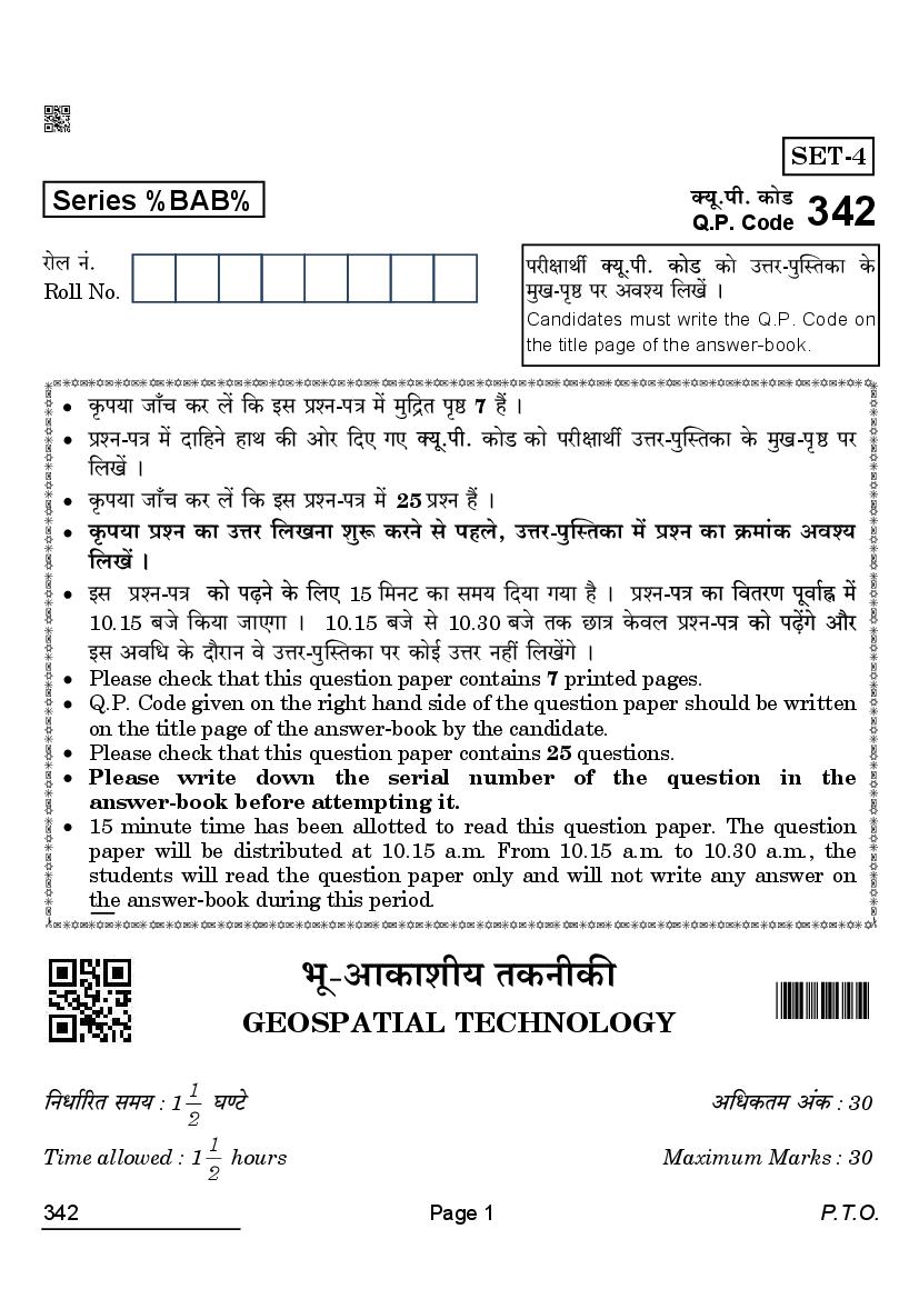
Page 1
Series %BAB% H$moS>
Q.P. Code 342
amob Z§. narjmWu H$mo CÎma-nwpñVH$m Ho$
Roll No. _wI-n¥ð >na Adí` {bIo§ &
Candidates must write the Q.P. Code on
the title page of the answer-book.
H¥$n`m Om±M H$a b| {H$ Bg àíZ-nÌ _o§ _w{ÐV n¥ð> 7 h¢ &
àíZ-nÌ _| Xm{hZo hmW H$s Amoa {XE JE H$moS H$mo narjmWu CÎma-nwpñVH$m Ho$ _wI-n¥>ð> na
{bI| &
H¥$n`m Om±M H$a b| {H$ Bg àíZ-nÌ _| >25 àíZ h¢ &
H¥$n`m àíZ H$m CÎma {bIZm ewê$ H$aZo go nhbo, CÎma-nwpñVH$m _| àíZ H$m H«$_m§H$ Adí`
{bI| &
Bg àíZ-nÌ 15 {_ZQ >H$m g_` {X`m J`m h¡ & àíZ-
10.15 ~Oo {H$`m OmEJm & 10.15 ~Oo go 10.30 ~Oo VH$ N>mÌ Ho$db àíZ-
Bg Ad{Y Ho$ Xm¡amZ do CÎma-nwpñVH$m na H$moB© CÎma Zht {bI|Jo &
Please check that this question paper contains 7 printed pages.
Q.P. Code given on the right hand side of the question paper should be written
on the title page of the answer-book by the candidate.
Please check that this question paper contains 25 questions.
Please write down the serial number of the question in the
answer-book before attempting it.
15 minute time has been allotted to read this question paper. The question
paper will be distributed at 10.15 a.m. From 10.15 a.m. to 10.30 a.m., the
students will read the question paper only and will not write any answer on
the answer-book during this period.
^y-AmH$mer` VH$ZrH$s
GEOSPATIAL TECHNOLOGY
1
:1 : 30
2
1
Time allowed : 1 hours Maximum Marks : 30
2
342 Page 1 P.T.O.
Page 2
(i)
(ii)
(iii) 5 6
1 4
5 6
(iv) 17 16
7 13
14 18
19 22
(v) 8 3
23 25
(vi)
(vii) /
IÊS H$
(amoµOJma H$m¡eb) (3+2=5 A§H$)
4 3 3 1=3
1. EH$ ñQ>mQ>©- ? 1
1
2. g§JR>ZmË_H$ H$m¡eb H$s {H$Ýht + 1 =1
3. h[aV H$m°ba H$m`©H$Vm© Ho$ ê$n _| {H$go OmZm OmVm h¡ ? 1
4. Obdm`w n[adV©Z na amîQ´>r` H$m`© `moOZm (EZ.E.nr.gr.gr.) Ho$ {H$Ýht Xmo {_eZm|
1
H$s{OE & + 1 =1
2 1 1 2=2
5. {H$Ýht Xmo VarH$m| H$mo ñnîQ> H$s{OE, {OZHo$ Ûmam _hÎdmH$m§jr CÚ_r ZE ì`mdgm{`H$ Adgam|
H$mo nhMmZ gH$Vo h¢ & 1+1=2
6. ? Bg joÌ Ho$ {H$Ýht Xmo h[aV H$m`m] 1+1=2
342 Page 2
Page 3
(i) Please read the instructions carefully.
(ii) This question paper is divided into three sections, viz. Section A,
Section B and Section C.
(iii) Section A is of 5 marks and has 6 questions on Employability Skills.
(a) Questions number 1 to 4 are one mark questions. Attempt any
three questions.
(b) Questions number 5 and 6 are two marks questions. Attempt any
one question.
(iv) Section B is of 17 marks and has 16 questions on Subject Specific Skills.
(a) Questions number 7 to 13 are one mark questions. Attempt any
five questions.
(b) Questions number 14 to 18 are two marks questions. Attempt any
three questions.
(c) Questions number 19 to 22 are three marks questions. Attempt any
two questions.
(v) Section C is of 8 marks and has 3 Competency-Based Questions.
Questions number 23 to 25 are four marks questions. Attempt any two
questions.
(vi) Do as per the instructions given in the respective sections.
(vii) Marks allotted are mentioned against each section/question.
SECTION A
(Employability Skills) (3+2=5 marks)
Answer any 3 questions out of the given 4 questions. 3 1=3
1. What is a start-up ? 1
1
2. Mention any two competencies of organisational skill. + 1 =1
3. Who is known as a Green Collar Worker ? 1
4. Mention any two missions of National Action Plan on Climate Change
1
(NAPCC). + 1 =1
Answer any 1 question out of the given 2 questions. 1 2=2
5. Explain any two ways by which aspiring entrepreneurs can identify new
business opportunities. 1+1=2
6. What is eco-tourism ? Mention any two green jobs in this field. 1+1=2
342 Page 3 P.T.O.
Page 4
({df` {d{eï> H$m¡eb) (5+6+6=17 A§H$)
7 5 5 1=5
7. n¥Ïdr H$s gVh H$mo g~go ghr VarHo$ go Xem©Zo gdm©{YH$ gQ>rH$ h¢ ? 1
1
8. àñVa `wJ _| Zm¡g§MmbZ Ho$ {bE H$m¡Z-go gmYZ Cn`moJ {H$E OmVo Wo ? + 1 =1
9. A{^J«mhr H$s pñW{V H$s JUZm H$aZo Ho$ {bE Or.nr.Eg. Ho$ {H$g AmYma^yV {gÕm§V H$m
Cn`moJ hmoVm h¡ ? 1
10. ~hþ-Ñí`m^mgr N>{d`m| Ho$ VrZ _yb a§Jm| Ho$ Zm_ {b{IE & 1
11. B©.Eg.Ama.AmB©. Ûmam {dH${gV {H$E JE {Ì-Am`m_r gm°âQ>do`a H$m Zm_ {b{IE & 1
12. H$mogr AmnXm _mZ{MÌ ~ZmZo _| {H$g VH$ZrH$ H$m Cn`moJ {H$`m J`m ? 1
13. S>moS>mhmbm Obg§^a {H$g amÁ` _| pñWV h¡ ? 1
5 3 3 2=6
14. S>ãë`y.Or.Eg. 84 ? ñnï> H$s{OE & 2
15. Or.nr.Eg. _| pñWVr` gQ>rH$Vm _| Ìw{Q> n¡Xm H$aZo dmbo {H$Ýht Xmo H$maH$m| H$s ì`m»`m
H$s{OE & 1+1=2
16. Or.nr.Eg. _| EH$ dmhZ Q´>¡qH$J V§Ì Ho$ A{Zdm`© AmJV ? 1+1=2
17. gwXÿa g§doXZ VH$ZrH$s ? BgHo$ {H$gr EH$ Cn`moJ H$m
1+1=2
18. {dd¥V Or.AmB©.Eg. 1+1=2
4 2 2 3=6
19. ? BgHo$ {H$Ýht Xmo àH$m`m] H$mo ñnï> H$s{OE & 1+2=3
20. H$m¡Z-gm d¡pídH$ pñW{VH$aU V§Ì ~hþV-gr àmH¥${VH$ Ed§ _mZd-O{ZV Ìw{Q>`m| Ho$ {ZañVrH$aU
Ho$ gmW H$m`© H$aVm h¡ ? ewÕ pñW{V H$s g_W©H$mar à{H«$`m H$mo ñnï> H$s{OE & 1+2=3
21. A{V- ? ñnï> H$s{OE & 1 3=3
22. ? ^y-AmH$mer` VH$ZrH$s à^mdr Obg§^a à~§YZ _| {H$g Vah go ghm`H$
hmo gH$Vr h¡ ? 1+2=3
342 Page 4
Page 5
(Subject Specific Skills) (5+6+6=17 marks)
Answer any 5 questions out of the given 7 questions. 5 1=5
7. Why are Globes the most accurate way to represent the Earth surface ? 1
1
8. What means were used for navigation during the Stone Age ? + 1 =1
9. Name the fundamental prin
position. 1
10. Name the three basic colours of Multispectral Images. 1
11. Name the 3D software developed by ESRI. 1
12. Which technique was used in Kosi hazard mapping ? 1
13. In which State is Doddahalla watershed located ? 1
Answer any 3 questions out of the given 5 questions. 3 2=6
14. Why is WGS 84 used worldwide ? Explain. 2
15. Explain any two factors causing errors in positional accuracy in GPS. 1+1=2
16. What are the essential inputs in a vehicle tracking system with GPS ? 1+1=2
17. What is the most recent trend in remote sensing technology ? Mention
one of its uses. 1+1=2
18. Mention the two fundamental requirements of open GIS. 1+1=2
Answer any 2 questions out of the given 4 questions. 2 3=6
19. What is Digital Cartography ? Explain any two functions of it. 1+2=3
20. Which Global Positioning System works by cancelling out most of the
natural and man-made errors ? Explain the process of enabling precise
location. 1+2=3
21. What is Hyperspectral remote sensing ? Explain. 1 3=3
22. What is a Watershed ? How can Geospatial technology help in efficient
watershed management ? 1+2=3
342 Page 5 P.T.O.
Page 6
(`mo½`Vm-AmYm[aV àíZ) (2 4=8 A§H$)
3 2
23. OrdZ Ho$ {d{^Þ joÌm| _| g§H$ënZmAm| H$s Ñí` ê$naoIm ~ZmZo, g_PZo Am¡a ~ohVa {ZU©`
boZo _| Or.AmB©.Eg. _hÎdnyU© ^y{_H$m {Z^mVm h¡ & Bg H$WZ H$mo Ý`m`g§JV R>hamBE & 1 4=4
24. H$m¡Z-gm Or.AmB©.Eg. EH$ joÌ A{YH$mar H$mo joÌ _| ^m¡Jmo{bH$ gyMZmAm| H$mo EH$Ì H$aZo,
aIZo Am¡a AÚVZ H$aZo _| gj_ ~ZmVm h¡ ? Bg Or.AmB©.Eg. Ho$ bm^m| H$s ì`m»`m
H$s{OE & 1+3=4
25. AmOH$b Am§V[aH$ gwajm {H$gr ^r Xoe Ho$ {bE EH$ Ádb§V g_ñ`m h¡ & Bg g_ñ`m H$mo
gwbPmZo Ho$ {bE nw{bg {d^mJ {H$g Vah {O`mo_¡ H$m Cn`moJ H$a ahm h¡ ? ñnï>
H$s{OE & 1 4=4
342 Page 6
Page 7
(Competency-Based Questions) (2 4=8 marks)
Answer any 2 questions out of the given 3 questions.
23. s a visual framework for conceptualizing, understanding and
taking better decisions in va 1 4=4
24. Which GIS enables a field officer to capture, store and update geographic
information on field ? Explain the advantages of this GIS. 1+3=4
25. Internal security of a country has become a burning issue nowadays. How
is the Police department using Geomatics to deal with this problem ?
Explain. 1 4=4
342 Page 7 P.T.O.
Document Details
| Board / Org | CBSE |
| Exam | Class 12 |
| Type | Question Paper |
| Pages | 7 |
| Updated | 30 Apr 2026 |