CBSE Class 12 Marking Scheme 2021 for Geography
Finished viewing? Save it for later —
Download CBSE Class 12 Marking Scheme 2021 for Geography (PDF · 26 pages)About CBSE Class 12 Marking Scheme 2021 for Geography
CBSE Class 12 Marking Scheme 2021 for Geography is available here for free download. Published by CBSE for Class 12, this sample paper can be viewed online or downloaded as a PDF (26 pages). Candidates preparing for Class 12 can use CBSE Class 12 Marking Scheme 2021 for Geography to understand the exam pattern, the type of questions asked, and the overall difficulty level.
Frequently Asked Questions
How can I download CBSE Class 12 Marking Scheme 2021 for Geography?
Open this page and click the Download button to save CBSE Class 12 Marking Scheme 2021 for Geography as a PDF. It is completely free on AglaSem Docs.
Is CBSE Class 12 Marking Scheme 2021 for Geography free to download?
Yes. CBSE Class 12 Marking Scheme 2021 for Geography can be viewed online and downloaded as a PDF free of cost on AglaSem Docs.
How many pages does CBSE Class 12 Marking Scheme 2021 for Geography have?
CBSE Class 12 Marking Scheme 2021 for Geography contains 26 pages, which you can read online or download together as a single PDF.
Where can I find more Class 12 study material?
You can find more Class 12 question papers, sample papers, syllabus, and answer keys on AglaSem Docs.
CBSE Class 12 Marking Scheme 2021 for Geography – Text
Read the full text of this sample paper below — useful to quickly search, copy and reference the content online without downloading the PDF.
📄 View text version (26 pages)
Page 1
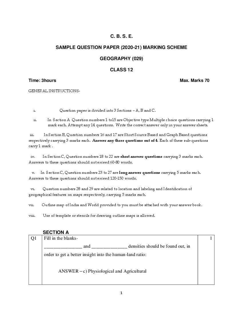
SAMPLE QUESTION PAPER (2020-21) MARKING SCHEME
GEOGRAPHY (029)
CLASS 12
Time: 3hours Max. Marks 70
GENERAL INSTRUCTIONS-
i. Question paper is divided into 3 Sections – A, B and C.
ii. In Section A Question numbers 1 to15 are Objective type Multiple choice questions carrying 1
mark each. Attempt any 14 questions. Write the correct answer only in your answer sheets.
iii. In Section B, Question numbers 16 and 17 are Short Source Based and Graph Based questions
respectively carrying 3 marks each. Answer any three questions out of 4. Each of these sub-questions
carry 1 mark .
iv. In Section C, Question numbers 18 to 22 are short answer questions carrying 3 marks each.
Answers to these questions should not exceed 60-80 words.
v. In Section C, Question numbers 23 to 27 are long answer questions carrying 5 marks each.
Answers to these questions should not exceed 120-150 words.
vi. Question numbers 28 and 29 are related to location and labeling and Identification of
geographical features on maps respectively, carrying 5 marks each.
vii. Outline map of India and World provided to you must be attached with your answer book.
viii. Use of template or stencils for drawing outline maps is allowed.
SECTION A
Q1 Fill in the blanks- 1
________________ and _______________ densities should be found out, in
order to get a better insight into the human-land ratio:
ANSWER – c) Physiological and Agricultural
1
Page 2
development
1. Spatial organization
2. Regional approach
3. Areal differentiation
4. Humanistic approach
ANSWER – (c) 2. , 3. , 1. , 4.
Q3 Panna, Para, Palli, Nagla and Dhani are examples of Which of the following 1
settlements?
a) Clustered Settlements
b) Semi-Clustered Settlements
c) Dispersed Settlements
d) Hamleted Settlements
ANSWER – d) Hamleted Settlements
Q4 1
Examine which of the following problems are generally confronted by the
villages of South Asia.
a) Lack of facilities due to high density
b) Political instability
c) Occurrence of floods and droughts
d) Fear of wild animals
ANSWER – c) Occurrence of floods and droughts
Q5 1
1
Page 3
enabling the rural population to conserve water for drinking, irrigation,
fisheries and afforestation?
a) Arvary Pani Sansad
b) Haryali 1
c) Neeru-Meeru
d) Narmada bachao
ANSWER - b) Haryali
Q6 1
Population of India according to their economic status is divided into:
a) Main workers, Marginal workers, Non workers
b) Marginal workers, Household industrial workers, Non workers
c) Non workers, agricultural labourers, Marginal workers
d) Cultivators, Main workers, Marginal workers
ANSWER – a) Main workers, Marginal workers, Non workers
Q7 The concept of Human Development was developed by 1
_____________________
Answer- Dr. Mahbub ul Haq
Q8 1
Which of the following best describes development?
a) An increase in size
b) A constant in size
c) A positive change in quality
d) A simple change in quality
Answer- c) A positive change in quality
1
Page 4
Which one of the following is not a plantation crop?
a) Coffee
b) Sugarcane
c) Rubber
d) Wheat
Answer- d) Wheat 1
Q10 1
Arrange the correct sequence of column II against the states in column I
COLUMN I (RELATED FIELD) COLUMN II (MINERALS)
I. Chikkamagaluru 1. Iron Ore
II. Singhbhum 2. Bauxite
III. Durg 3. Manganese
IV. Koraput 4. Copper
(a) Answer – (a) III – 1, IV – 2, I – 3, II – 4
Q11 Which of the following programme has been launched by Union Government 1
for the cleaning of river Ganga ?
a) Ganga Action Plan
b) Namami Gange
c) Ganga Namami Action Plan
d) Ganga Cleaning Mission 1
Ans. b) Namami Gange
1
Page 5
Outsourcing (KPO) ?
a) E- Learning
b) Intellectual property
c) Collection of information
d) Legal profession
Ans. c) Collection of information
Q13 1
Relate the most important factor responsible for high density of population
found in Katanga, Zambia Plateau located in Africa:
a) Availability of Copper in abundance
b) Availability of Forests resources
c) Close Social ties
d) Scenic Natural beauty
Answer – a) Availability of Copper in abundance
Q14 1
If a country is having large proportion of young population, it would mean-
a) High Birth rate and the population is youthful
b) Large working population
1
Page 6
d) Heavy pressure on government to arrange basic facilities.
ANSWER – a) High Birth rate and the population is youthful
Q15 3
Age and skill selective migration from rural areas have not adverse effect on
which of the following demographic attributes ?
a) Downfall recorded in working population
b) The whole burden of agricultural work has to be borne by the old
population in rural areas
c) Old people and women are left behind in the place of origin
d) Balance in age and sex composition
Answer – d) Balance in age and sex composition
1
1
Page 7
Q16
SOURCE BASED QUESTION 1x3=3
Read the Case Study given below and answer the questions that follow:
❈❛✁ ✥ ✂✉✄ ☎ ✆ ❆ ✝ ♦❧✁ ✟♦✄ ✁❧ ✂♦ ✝✁✂ ♦✞✁ ✂✠✁ ✡ ❝♦❧ ♦❣☎ ❛☛✄ ✥ ❛☞✁ ❣✉❛ ✞✄
✌✉❍❛ ☛ ✌✁ ❛❧✂ ✠ ✐☛ ✍ ❛✉✞ ❛❧❛
Based on the universal law “Polluter pays”, a silent but strong effort to restore
the ecology and safeguard the human health with people’s participation has
taken place in Daurala near Meerut. These efforts are now bearing fruits after a
span of three years when Meerut based NGO had developed a model for
ecological restoration. The recent meeting of the Daurala Industries officials,
NGOs. Government officials and other stakeholders at Meerut has brought out
results which usually come out mainly through the Court’s decisions.
The powerful logics, authentic studies and the pressure of the NGO has in a way
brought a new lease of life to the twelve thousand residents of this village. It was
in the year 2003, that the pitiable condition of Dauralaites drew the attention of
the civil society. The groundwater of this village with a population of 12,000
persons was
contaminated with heavy metals. The reason was that the untreated wastewater
of Daurala industries was leaching to the groundwater table and was also being
used for irrigation. The activists of the NGO conducted a door to door survey of
the health status of the residents and came out with a report. The group reported
that 192 deaths in the past five years have been recorded in the village due to
consumption of contaminated water. The industry came under pressure due to
activism. The organisation, the village community and people’s representatives
sat together to find out sustainable solutions to this problem. The industrialists
showed a keen interest towards checking the deteriorating ecology. The
overhead water tank’s capacity in the village was enhanced and a 900m extra
pipeline was laid to serve potable water to the community. The silted pond of
the village has been cleaned and recharged by desilting it. Large quantity of silt
was removed paving way to pure water so that it percolated deep down the
aquifers. Rainwater harvesting structures have been constructed at different
places which has helped in diluting the contaminants of the groundwater after
the monsoons. 1000 trees have also been planted which have improved the
environment.
Answer any three questions
a. What type of pollution is faced by the people of Daurala?
i. Noise pollution
1
Page 8
iii. Water pollution
iv. Land pollution
Answer – iii Water Pollution
b. Which process led to contamination of ground water?
i. Salinisation
ii. Alkalization
iii. Leaching
iv. Over irrigation
Answer – iii Leaching
c. What was the most important step taken as sustainable solution to the
health problem faced by the villagers?
i. Relocation of industries
ii. Controlled irrigation
iii. Evacuation from the affected area
iv. Enhancement of water storage capacity
Answer – iv- Enhancement of water storage capacity
d. Which water conservation strategy help in diluting the contamination
of the ground water?
i. Rain water harvesting
ii. Universal law of ‘Polluter Pays’
iii. Industrial waste treatment plant
iv. Over utilization of ground water.
Answer – i. Rain water harvesting
1
Page 9
SOURCE/GRAPH BASED QUESTION
Study the given graph carefully and answer the following questions:
Answer any three questions-
a. How does the natural increase in population occur as per the
graph?
i. Birth Rate – Death Rate
ii. Death Rate + Birth Rate
iii. Growth Rate- Birth Rate
iv. Birth Rate + Migration
Answer – i. Birth Rate – Death Rate
b. What does the transition from high fluctuating stage to low
fluctuating stage indicate ?
1
Page 10
economy
ii. Shift from Rural Agrarian economy to Urban Industrial
economy
iii. Low Birth and Death Rate to High Birth and Death
Rate
iv. Migration from Urban to Rural areas
Answer – ii. Shift from Rural Agrarian economy to Urban Industrial economy
c. From the given graph, what condition can you infer about
the developing countries?
v. High Birth Rate and High Death Rate
vi. Low Birth Rate and Low Death Rate
vii. High Birth Rate and Low Birth Rate
viii. Low Birth Rate and High Death Rate
Answer – iii. High Birth Rate and Low Birth Rate
a. In which stage of Demographic Transition, population
explosion took place :
i. Stage I
ii. Stage II
iii. Stage III
iv. Post Stage III
Answer – ii. Stage II
1
Page 11
Question)
Answer any three questions-
a. Why are Fertility and Mortality rates high in the first stage of
this theory?
i. People have a lot of buffer stock as food security.
ii. People reproduce more to compensate for the deaths
due to epidemics.
iii. People are highly educated at this stage.
iv. There is technological advancement in all fields.
Answer – ii. People reproduce more to compensate for the deaths due to
epidemics
b. What led to decline in Mortality rate in the second stage of this
theory?
i. Due to improvement in Sanitation and Health
conditions.
ii. Due to insufficient supply of food grain that led to
starvation.
iii. Due to widespread illiteracy all over the world.
iv. Due to unfavorable sex ratio prevailing in developing
countries.
Answer – i. Due to improvement in Sanitation and Health conditions
c. Why does fertility rate show a declining trend in the third
stage?
i. This is because human beings are not able to adjust
their fertility.
ii. Literacy rates show a downward trend all over the
world.
iii. The population becomes urbanized and has high
technical knowhow.
iv. There is acute food shortage in countries with a high
Human Development Index.
1
Page 12
knowhow.
d. In which stage of Demographic Transition, population
explosion took place :
i. Stage I
ii. Stage II
iii. Stage III
iv. Post Stage III
Answer – ii. Stage II
SECTION C
Q18 3
Justify the high demand of water for irrigation in India.
ANSWER – 3
a) Rainfall in India is concentrated only for few months and therefore,
irrigation is required in the other months. Rainfall is uneven and deccan
plateau remains dry due to deficient rainfall and agriculture cannot be
practiced in the absence of irrigation.
b) Water requirement of certain crops such as Jute, Sugarcane and Rice is
high which can be met only by irrigation
c) Use of HYV seeds, fertilizers and multiple cropping in the fields have
made irrigation essential.
1
Page 13
‘ Rainwater Harvesting is considered as a low cost and eco-friendly technique
of preserving water resources.’, Justify. 3
Rain water harvesting is a method to capture and store rainwater for various
uses. It is also used to recharge groundwater aquifers. It is a low cost and eco-
friendly technique for preserving every drop of water by guiding the rain water
to bore well, pits and wells. Rainwater harvesting increases water availability,
check the declining ground water table, improves the quality of groundwater
through dilution of contaminants like fluorides and nitrates, prevents soil
erosion, and flooding and arrests salt water intrusion in coastal areas if used to
recharge aquifers
Q19 3
What are the basic differences between rural and urban settlements in India?
Answer –
a) Rural Settlements derive their basic economic needs from land based
primary economic activities whereas urban settlements depend on
processing of raw materials and manufacturing of finished goods as
well as a variety of services.
b) Cities act as nodes of economic growth, provide goods and services
not only to urban dwellers, but also to the people of rural settlements
in their hinterlands in return for food and raw materials. The functional
relationship between the urban and rural settlements takes place
through transport and communication network.
c) Rural and Urban settlements differ in terms of social relationship,
attitude and outlook. Rural people are less mobile and therefore, social
1
Page 14
way of life is complex and fast with formal social relations.
Q20 3
Explain how Human Geography in the early 20th century has become more
integrative and inter- disciplinary in its approach.
ANSWER – The subject matter of human geography continues to grow over
the period. It has widened its scope considerably. In the early 20th century,
several new branches emerged out of it such as population geography, political
geography, agricultural geography, etc. Its aim was to study emerging issues
and problems like political dimensions and social relevance. In doing so,
human geography has not only become more integrative and interdisciplinary
in nature but has also incorporated several new approaches into its field. It
gives the necessary spatial and systematic view point to the other social
sciences which they otherwise lack. At the same time, human geography draws
on other sciences, the analysis and identifies with its sub-fields such as
political, economic and social geography.
Q21 3
‘Some countries of the world have a high Human Development Index’. Try to
find out reasons for such a scenario.
ANSWER –
3
The reasons why some countries of the world have a high Human
Development Index are:
a) Pattern of government expenditure on the social sector, that is, how
much is being spent on the welfare of the people in the society than
on defence sector. Mostly these countries represent the
industrialised western world.
b) Political environment of the country, that is, the stability of the
government or the form of government, freedom of the people,
1
Page 15
distribution of resources among the people.
c) Many of these countries have been the former imperial powers. The
degree of social diversity in these countries is not very high.
Providing education and healthcare is an important government
priority.
OR
Explain any three approaches to study Human Development in the world.
There are many ways of looking at the problem of human development-
Income approach – Oldest approach; Human Development is seen as being
linked to income. The idea is that the level of income reflects the level of
freedom an individual enjoys. Higher the level of income, the higher is the
level of human development
Welfare Approach – This approach looks at human beings as beneficiaries of
all development activities. The approach argues for higher govt. expenditure
on education, health, social secondary and amenities. People are not
participants in development but only passive recipients. The govt. is
responsible for increasing levels of human development by maximizing
expenditure on welfare.
Basic Needs Approach – Proposed by ILO; Six basic needs i.e health,
education, food, water supply, sanitation, and housing were identified. The
question of human choices is ignored and the emphasis is on the provision of
basic needs of defined section.
Capability Approach – This approach is associated with Prof. Amartya Sen.
Building human capabilities in the areas of health, education and access to
resources is the key to increasing human development.
1
Page 16
Q22 3
Growth of Service Sector in modern economies plays a vital role. Derive it's
implications for such economies.
ANSWER - Services are an important constituent of modern economic
development, which include retailing and sale of goods to the people,
education, health and welfare, leisure, recreation and business services.
Business services include advertising, recruitment and personal training.
Service sector was not given as much attention as was given to the production
of goods. But in advanced countries, service-based development has been very
rapid. During the developmental process, a normal course of events take place
in most countries over a period of time. There is a transition from the primary
sector to the secondary sector and in the later stage to the tertiary and
quaternary sector. The growing importance of services has now given it an
independent status as a productive sector in the economy. Instead of being an
accessary to manufacturing or to the people at large, it is a huge contributor to
a country’s export.
Q23 5
What are the Economic consequences of migration in India?
ANSWER – A major benefit for the source region is the remittance sent by
migrants. Remittances from the international migrants are one of the major
sources of foreign exchange. Punjab, Kerala and Tamil Nadu receive very
significant amount from their international migrants. The amount of remittance
sent by the internal migrants is very meagre as compared to the international
migrants, but it plays an important role in the growth of economy of the source
area. Remittances are mainly used for food, repayment of debts, treatment,
marriages, children’s education, agricultural inputs, construction of houses,
etc. Thousands of poor villages of Bihar, Uttar Pradesh, Odisha, Andhra
Pradesh, Himachal Pradesh, etc. remittance works as a lifeline for their
economy. Migration from the rural areas of eastern Uttar Pradesh, Bihar,
1
Page 17
Uttar Pradesh accounted for the success of their Green Revolution strategy for
agricultural development. Besides this, unregulated migration to the
metropolitan cities of India has caused overcrowding. Development of slums
in industrially developed states such as Maharashtra, Gujarat, Karnataka,
Tamil Nadu and Delhi is a negative consequence of unregulated migration
within the country.
Q24 5
Critically analyse the Socio-economic benefits that are being experienced by
implementation of Integrated Tribal Development Project in Bharmaur district
of Himachal Pradesh.
ANSWER – Under the fifth five-year plan, the tribal sub-plan was introduced
in 1974and Bharmaur was designated as one of the five Integrated Tribal
Development Projects (ITDP) in Himachal Pradesh. This project drastically 5
improved the life of the Gaddis and narrowed the gap in the level of
development between Bharmaur and other areas of Himachal Pradesh. A lot of
development was made in the field of transport and communication,
agriculture and allied activities and social and community services. The most
significant contribution of the ITDP -in the region is the development of
infrastructure in terms of schools, healthcare facilities, potable water, roads,
electricity and communication network. The villages located along river Ravi
in Holi and Khani areas are the main beneficiaries of infrastructural
development. The social benefits from ITDP are the tremendous increase in
literacy rate, improvement in sex-ratio and decline in child marriages. The
cultivation of pulses and other cash crops has increased in Bharmaur region. In
addition to this, now only ten percent of the total households practice
transhumance.
OR
1
Page 18
Canal Command Area.
Answer-
1- Strict implementation of water management policy. The canal project
envisages protective irrigation in Stage – I and extensive irrigation of
crops and pasture development in Stage – II.
2- In general, the cropping pattern shall not include water intensive crops.
It shall be adhered to and people shall be encouraged to grow
plantation crops such as citrus fruits.
3. The CAD programme such as lining of water courses, land development
and levelling and warabandi system (equal distribution of canal water) shall be
effectively implemented to reduce the conveyance loss of water.
4. The area affected by water logging and soil salinity shall be reclaimed.
5. The eco development through afforestation, shelterbelt plantation and
pasture development is necessary particularly in the fragile environment of
Stage II.
6- The social sustainability in the region can be achieved only if the land
allottees having poor economic background are provided adequate financial
and institutional support for cultivation of land.
7- The economic sustainability in the region cannot be attained only through
development of agriculture and animal husbandry. The agricultural and allied
activities have to develop along with other sectors of economy. This shall lead
to diversification of economic base and establishment of functional linkages
between basic villages, agro-service centres and market centres.
Q25 5
Substantiate the evidences to prove that Subsistence Agriculture is still
practised in different parts of the globe.
5
1
Page 19
so, of the products locally grown. It can be grouped into two categories –
Primitive Subsistence Agriculture and Intensive Subsistence Agriculture.
Primitive Subsistence Agriculture or Shifting cultivation is widely practiced by
many tribes in tropics, especially in Africa, south and central America and
southeast Asia. The vegetation is usually cleared by fire and the ashes add to
the fertility of the soil. It is thus, also called Slash and Burn Agriculture. The
cultivated patches are very small and cultivation is done with very primitive
tools such as sticks and hoes. After the soil loses its fertility, the farmer shifts
to another parts and clears other patches of forests for cultivation. One of the
major problems of shifting cultivation is that the cycle of Jhum becomes less
and less due to loss of fertility in different parcels.
Intensive Subsistence agriculture is largely found in densely populated regions
of monsoon Asia. There are two types of intensive subsistence agriculture –
intensive subsistence agriculture dominated by wet paddy cultivation. Land
holdings are very small due to the high density of population. Farmers work
with family members leading to intensive use of land. Use of machinery is
limited and most work is done manually. Farm yard manure is used. Yield per
unit area is high but per labour productivity is low. Intensive subsistence
agriculture dominated by crops other than paddy. Due to difference in relief,
climate, soil and some other geographical factors, it is not practical to grow
paddy in many parts of monsoon Asia. Wheat, Soyabean, barley and sorghum
are grown in northern China, Manchuria, North Korea and North Japan. In
India, Wheat is grown in western parts of Indo-Gangetic plains and millets are
grown in dry parts of western and southern India. Most of the characteristics of
this type of agriculture are similar to those dominated by wet paddy except that
irrigation is often used.
OR
1
Page 20
developed and developing countries
Answer-
Unlike nomadic herding, commercial livestock rearing is more organised and
capital intensive. Commercial livestock ranching is essentially associated with
western cultures and is practiced on permanent ranches. These ranches cover
large areas and are divided into a number of parcels, which are fenced to
regulate the grazing. When the grass of one parcel is grazed, animals are
moved to another parcel. The number of animals in a pasture is kept according
to the carrying capacity of the pasture. This is a specialised activity in which
only one type of animal is reared. Important animals include sheep, cattle,
goats and horses. Products such as meat, wool, hides and skin are processed
and packed scientifically and exported to different world markets. Rearing of
animals in ranching is organised on a scientific basis. The main emphasis is on
breeding, genetic improvement, disease control and health care of the animals.
New Zealand, Australia, Argentina, Uruguay and United States of America are
important countries where commercial livestock rearing is practised.
Q26 5
Analyse the problems associated with Urban Settlements in developing
countries.
ANSWER – Major problems of urban settlements in developing countries are:
Economic problems- over urbanization or uncontrolled urbanization in
developing countries is due to large scale in-migration of rural people.
Decreasing employment opportunities in the rural as well as smaller urban
areas has caused large scale rural-urban migration, Urban areas suffer from
shortage of housing, transport, health and civic amenities. A large number of
1
Page 21
the streets.
Socio-cultural problems – cities in the developing countries suffer from several
social ills. Inadequate social infrastructure and basic facilities is due to lack of
financial resources and over population in cities. The available educational and
health facilities remain beyond the reach of the urban poor. Cities suffer from
poor health conditions. Lack of employment and education tends to aggravate
the crime rates. Male selective migration to the urban areas distorts the sex-
ratio in these cities.
Environmental problems – The large urban population in developing countries
uses and disposes off a huge quantity of waste material in river water. Many
cities of the developing countries do not provide the minimum required
quantity of drinkable water and water for domestic and industrial uses. An
improper sewerage system creates unhealthy conditions. Massive use of
traditional fuel in the domestic as well as industrial sectors severely pollutes
the air. Huge concrete structures of buildings create heat in the cities.
Q27
Classify minerals into two groups on the basis of chemical and physical
5
properties and give one example of minerals of each group. Mention any two
features of the three minerals belts of India.
Minerals are classified on the basis of their physical properties and chemical
properties such as:
Metallic Minerals
Metallic minerals are those that are rich in metals and a source to procure a
variety of metals like copper, gold, iron, etc. Bauxite, iron-ore are some
examples of metallic minerals. There are two types of metallic minerals i.e.
ferrous and non-ferrous.
1
Page 22
Non-metallic minerals are those that do not have metal components. For
features of the three mineral belts of India,
The mineral belts of minerals in India are as follows:
The North-Eastern Plateau Region This belt includes the regions of
Chotanagpur (Jharkhand), Odisha plateau, West Bengal and parts of
Chhattisgarh. Important minerals are iron ore, coal, manganese, bauxite, mica.
The South-Western Plateau Region This belt includes Karnataka, Goa and
contiguous uplands of Tamil Nadu and Kerala. Ferrous metals and bauxite are
concentrated here along with high-grade iron-ore, manganese, and limestone.
Neyveli has lignite coal deposit. Deposits of Monazite sand and thorium are
found in Kerala. Mines of iron-ore are located in Goa.
The North-Western Region Minerals of this belt are associated with the
Dharwar system of rocks which are found in the Aravali in Rajasthan and parts
of Gujarat. Major minerals are copper and zinc. Rajasthan is rich in building
stones i.e. sandstone, granite, marble, fuller’s earth, and gypsum
Q28
MAP BASED QUESTIONS
A. On the given map of India, locate and name any five of the
following: 1x5=5
1. A state with lowest density of population- Arunachal Pradesh
2. A state with highest level of urbanization- Goa
1
Page 23
4. Mayurbhanj Iron Ore Mines
5. Jamnagar Oil Refinery
6. Katni Bauxite Mines
7. Neyveli Lignite Field
For Visually Impaired Candidates, in lieu of Q. No. 28.
Write the names of any five of the following places in your answer sheet
1. Largest Oil Refinery of India. – Jamnagar Oil Refinery
2. A state with highest density of population. - Bihar
3. A major Iron ore mine in Odisha.- Mayurbhanj Iron Ore Mines
4. Single largest Lignite coal reserves In Tamil Nadu.- Neyveli Lignite
coalfield
5. A Bauxite mine in Madhya Pradesh. –Katni Bauxite Mine
6. A state with lowest level of urbanization. -Himachal Pradesh
7. A Mega City located in Karnataka. - Bengaluru
Q29. 1x5=5
With the help of the following key, identify the areas marked as A, B, C,
D and E on the given outline map of World. Write the correct name of the
place in the blank space given on the map.
A Region in Africa practising Nomadic Herding
1
Page 24
C Region of Europe practising Commercial Grain Farming
D Mega City of South America
E Region of North America practising Subsistence Gathering
For Visually Impaired Candidates, in lieu of Q. No. 29
Write the names of the following places
1. Name the region of Russia which is known for Nomadic Herding. –
Tundra Region of Siberia
2. Name the Mega City located in Argentina. – Buenos Aires,
Argentina.
3. Its a country known for Commercial livestock rearing in North
America. – U.S.A.
4. Its the largest Mega City of the world. – Tokyo, Japan
5. Name the largest region of commercial dairy farming in the world. –
North Western Europe.
1
Page 25
2
Q28
1
Page 26
Document Details
| Board / Org | CBSE |
| Exam | Class 12 |
| Type | Marking Scheme |
| Pages | 26 |
| Updated | 30 Apr 2026 |