MAHA SET 2015 Question Paper 2 Geography
Finished viewing? Save it for later —
Download MAHA SET 2015 Question Paper 2 Geography (PDF · 28 pages)About MAHA SET 2015 Question Paper 2 Geography
MAHA SET 2015 Question Paper 2 Geography is available here for free download. Published by Maharashtra Exams for MAHA SET, this question paper can be viewed online or downloaded as a PDF (28 pages). Candidates preparing for MAHA SET can use MAHA SET 2015 Question Paper 2 Geography to understand the exam pattern, the type of questions asked, and the overall difficulty level.
Frequently Asked Questions
How can I download MAHA SET 2015 Question Paper 2 Geography?
Open this page and click the Download button to save MAHA SET 2015 Question Paper 2 Geography as a PDF. It is completely free on AglaSem Docs.
Is MAHA SET 2015 Question Paper 2 Geography free to download?
Yes. MAHA SET 2015 Question Paper 2 Geography can be viewed online and downloaded as a PDF free of cost on AglaSem Docs.
How many pages does MAHA SET 2015 Question Paper 2 Geography have?
MAHA SET 2015 Question Paper 2 Geography contains 28 pages, which you can read online or download together as a single PDF.
Where can I find more MAHA SET study material?
You can find more MAHA SET question papers, sample papers, syllabus, and answer keys on AglaSem Docs.
MAHA SET 2015 Question Paper 2 Geography – Text
Read the full text of this question paper below — useful to quickly search, copy and reference the content online without downloading the PDF.
📄 View text version (28 pages)
Page 1
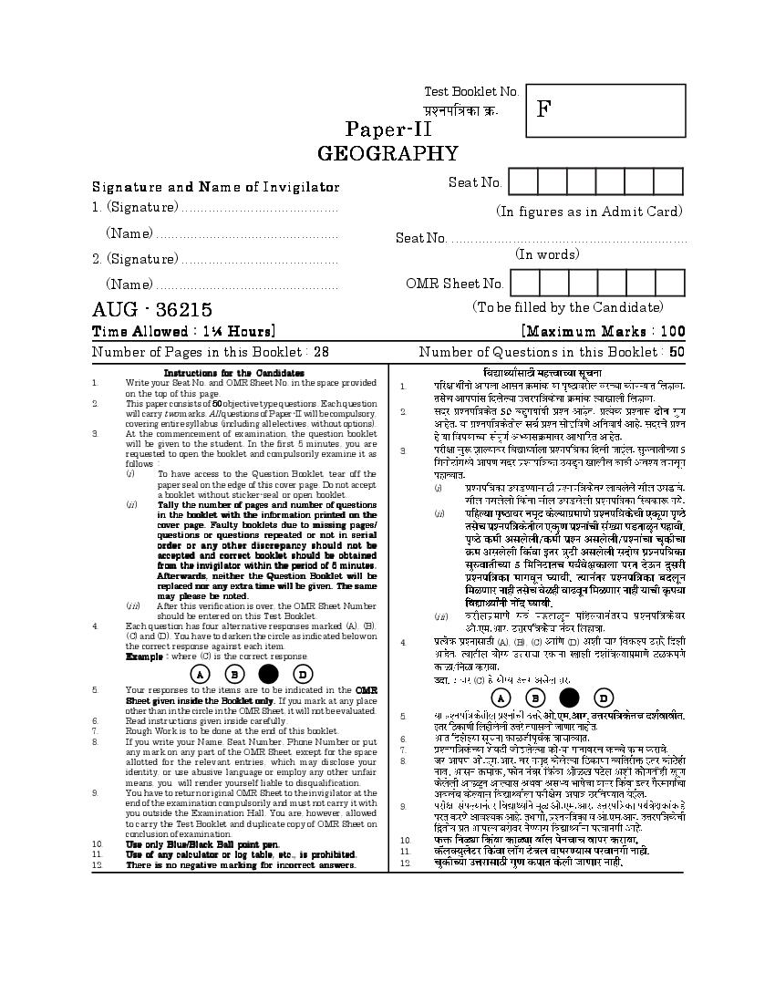
F
GEOGRAPHY
Signature and Name of Invigilator Seat No.
1. (Signature) ......................................... (In figures as in Admit Card)
(Name) ................................................ Seat No. ..............................................................
2. (Signature) ......................................... (In words)
(Name) ................................................ OMR Sheet No.
AUG - 36215 (To be filled by the Candidate)
Time Allowed : 1¼ Hours] [Maximum Marks : 100
Number of Pages in this Booklet : 28 Number of Questions in this Booklet : 50
Instructions for the Candidates
1. Write your Seat No. and OMR Sheet No. in the space provided 1.
on the top of this page.
2. This paper consists of 50 objective type questions. Each question
will carry two marks. All questions of Paper-II will be compulsory, 2.
covering entire syllabus (including all electives, without options).
3. At the commencement of examination, the question booklet
will be given to the student. In the first 5 minutes, you are
requested to open the booklet and compulsorily examine it as 3.
follows :
(i) To have access to the Question Booklet, tear off the
paper seal on the edge of this cover page. Do not accept (i)
a booklet without sticker-seal or open booklet.
(ii) Tally the number of pages and number of questions
in the booklet with the information printed on the (ii)
cover page. Faulty booklets due to missing pages/
questions or questions repeated or not in serial
o rder or any other discre pancy should not be
accepted and correct booklet should be obtained
from the invigilator within the period of 5 minutes.
Afterwards, neither the Question Booklet will be
replaced nor any extra time will be given. The same
may please be noted.
(iii) After this verification is over, the OMR Sheet Number
should be entered on this Test Booklet. (iii)
4. Each question has four alternative responses marked (A), (B),
(C) and (D). You have to darken the circle as indicated below on
the correct response against each item. 4. (A), (B), (C) (D)
Example : where (C) is the correct response.
A B D
(C)
5. Your responses to the items are to be indicated in the OMR
Sheet given inside the Booklet only. If you mark at any place A B D
other than in the circle in the OMR Sheet, it will not be evaluated.
5.
6. Read instructions given inside carefully.
7. Rough Work is to be done at the end of this booklet.
8. If you write your Name, Seat Number, Phone Number or put 6.
any mark on any part of the OMR Sheet, except for the space 7.
allotted for the relevant entries, which may disclose your 8.
identity, or use abusive language or employ any other unfair
means, you will render yourself liable to disqualification.
9. You have to return original OMR Sheet to the invigilator at the
end of the examination compulsorily and must not carry it with 9.
you outside the Examination Hall. You are, however, allowed
to carry the Test Booklet and duplicate copy of OMR Sheet on
conclusion of examination.
10. Use only Blue/Black Ball point pen. 10.
11. Use of any calculator or log table, etc., is prohibited. 11.
12. There is no negative marking for incorrect answers. 12.
Page 2
Page 3
Paper II
II
Time Allowed : 75 Minutes] [Maximum Marks : 100
Note : This paper contains 50 multiple choice questions, each carrying
Two (2) marks. Attempt All questions.
50 (2)
1. Which one of the following type of 1.
mountains is formed exclusively by
exogenetic processes ?
(A)
(A) Fold mountain
(B)
(B) Block mountain
(C)
(C) Residual mountain
(D)
(D) Volcanic mountain
2. The slope of plates sliding into 2.
asthenosphere can be inferred from
the analysis of ...................... .
(A) Palaeomagnetic conditions
(A)
(B) Depth of earthquake focii
(B)
(C) Distribution of earthquakes and
volcanoes (C)
(D) Speed of plate movement (D)
3 [P.T.O.
Page 4
the earth is estimated to be 3200
million years (myrs), the age of
ocean floor is nowhere older than
....................... myrs. (A) 2000
(A) 2000 (B) 1000
(B) 1000
(C) 500
(C) 500
(D) 200
(D) 200
4. Who among the following scholars 4.
criticized the concept of cycle of
erosion mainly with reference to
‘base level’ ?
(A)
(A) W. Penck
(B)
(B) Hettner
(C)
(C) Passarge
(D) L. C. King (D)
4
Page 5
is not possible for ........... .
(A) River (A)
(B) Sea waves (B)
(C) Glacier (C)
(D) Wind (D)
6. Commercial airliners of temperate 6.
latitudes prefer to fly in the
atmospheric layer namely ............... .
(A) Lower Troposphere (A)
(B) Upper Troposphere (B)
(C) Upper Stratosphere (C)
(D) Lower Stratosphere (D)
5 [P.T.O.
Page 6
terrestrial radiation.
(A) Ultraviolet (A)
(B) Infrared (B)
(C) Visible (C)
(D) X-ray (D)
8. When pressure gradient and Coriolis 8.
force are at balance, the resultant
winds are ...................... .
(A) Foehn winds (A)
(B)
(B) Chinook winds
(C)
(C) Geostrophic winds
(D)
(D) Monsoon winds
6
Page 7
westerlies are called .................. .
(A) Hurricanes (A)
(B) Polar Front (B)
(C) Rossby (C)
(D)
(D) Doldrums
10. Which one of the following criteria 10.
is used to identify Koppen’s ‘A’ type
of climate ?
(A) Mean monthly temperature of
the coldest month is more than (A)
freezing point
(B) High rainfall throughout the
(B)
year
(C) Mean monthly temperature in (C)
all the months is more than
18ºC
18ºC
(D)
(D) Mean monthly temperature in
all the months is below 18ºC 18ºC
7 [P.T.O.
Page 8
as ...................... .
(A) hadal zone (A)
(B) hollow zone (B)
(C) halo zone (C)
(D) hidal zone (D)
12. Arrange the following sea salts in 12.
their descending proportion of
occurrence in ocean water :
(i)
(i) Sodium
(ii)
(ii) Sulphate
(iii)
(iii) Chloride
(iv)
(iv) Magnesium
(A) (i), (iii), (iv), (ii)
(A) (i), (iii), (iv), (ii)
(B) (iii), (ii), (i), (iv)
(B) (iii), (ii), (i), (iv)
(C) (iii), (i), (ii), (iv) (C) (iii), (i), (ii), (iv)
(D) (i), (iv), (iii), (ii) (D) (i), (iv), (iii), (ii)
8
Page 9
zoogeographical regions demarcated
by sclater, countries bordering
Mediterranean are included ?
(A)
(A) Palaearctic region
(B)
(B) Nearctic region
(C)
(C) Neotropical region
(D)
(D) Ethiopean region
14.
14. Which one of the following is most
important element of ecosystem ?
(A) Energy flow (A)
(B) Ecological succession (B)
(C) Food chain (C)
(D) Food web (D)
9 [P.T.O.
Page 10
scientifically explained by ............... .
(A) Adaptation (A)
(B) Climatic climax (B)
(C) Organic evolution (C)
(D)
(D) Plant succession
16.
16. Which one of the following pairs of
proponent and concept is not
matched correctly ?
Propone nt Concept (A)
(A) Leibnitz — Concept of world
as an organism (B) (inductive)
(B) Aristotle — Inductive reasoning
(C) Yi-Fu-Tuan — Geosophy (C)
(D) Patric Geddes — Place-Work-Folk (D)
Progression
10
Page 11
geographers was the originator of
‘dualism’ between physical and
human geography ?
(A)
(A) Fredrich Ratzel
(B)
(B) Richthofen
(C)
(C) Carl Ritter
(D)
(D) Oscar Peschel
18.
18. First geographer to initiate change
over from the dominantly liberal
to the Marxist perspective in
geography was .................... .
(A)
(A) David Smith
(B)
(B) David Harvey
(C) D. T. Herbert (C)
(D) William Bunge (D)
11 [P.T.O.
Page 12
(Proponents) with List II
(Contribution) and select the correct
answer from the codes given I II
below :
List I List II
(a) (i )
(Proponent) (Contribution)
(b) (ii )
(a ) A. J. Herbertson (i) Positivism
(b ) O.H.K. Spate (ii ) Uniformitarianism (c) (iii)
(c) Auguste Comte (iii) Scheme of natural
(d ) (iv)
regions
(d) Hutton (iv) Probabilism
Codes : (a) (b) (c) (d)
(a) (b) (c) (d) (A) (iii) (iv) (i ) (ii )
(A) (iii) (iv) (i) (ii)
(B) (ii ) (iii) (iv) (i )
(B) (ii ) (iii) (iv) (i)
(C) (ii ) (iv) (iii) (i )
(C) (ii ) (iv) (iii) (i)
(D) (iii) (i ) (ii ) (iv)
(D) (iii) (i ) (ii) (iv)
12
Page 13
believed that all History must be
treated geographically and also that
all geography must be studied
historically ? (A)
(A) Anaximander
(B)
(B) Hecataeus
(C)
(C) Herodotus
(D)
(D) Thales
21. Which one of the following is 21.
mismatched ?
Concept Meaning
(A)
(A) Ecumenopolis — Ultimate city with
larger area with
most of its
population (B)
(B) Megalopolis — Integration of large
urban agglomera-
tion into highly
urbanised country
(C)
(C) Metropolis — Capital city with
metro services
(D)
(D) Acropolis — The highest part of
the city usually
with fortification
13 [P.T.O.
Page 14
would be the population size of the
third ranking city Nagpur in
Maharashtra when the first ranking
city Mumbai in Maharashtra has
120 lakh population ? (A)
(A) 60 lakh
(B)
(B) 90 lakh
(C)
(C) 80 lakh
(D)
(D) 40 lakh
23.
23. The extensive built-up area formed
by the coalescence of once-separate
and mainly urban settlements is
termed as .................... .
(A) Conurbation (A)
(B) Fringe (B)
(C) Metropolis (C)
(D) Rurban (D)
14
Page 15
characteristics of primate city ?
(a) exceptionally expressive of (a)
national capacity and feeling
(b) usually disproportionately (b)
larger than any other in the
system (c)
(c) may arise due to historical and
contemporary effects on size and
distance (d)
(d) U.S.A., Russia, China and India
demonstrate some good
examples of primate city
(A) (a) and (b) only (A) (a) (b)
(B) (a) and (c) only (B) ( a) (c)
(C) (c) and (d) only (C) (c) (d)
(D) (b) and (d) only (D) (b) (d)
15 [P.T.O.
Page 16
and identify the correct statements
from the codes given below :
(a) The agricultural density refers
(a)
to agricultural population to
total cultivated area
(b) The economic density refers to
the ratio between the
(b)
requirements of a population
and the resources made
available to it by production of
the areas it occupies
(c) The arithmetic density is a
(c)
simple ratio between the total
population and residential
area
Codes :
(A) ( a) (c)
(A) (a) and (c) only
(B) ( a) (b)
(B) (a) and (b) only
(C) ( b) (c)
(C) (b) and (c) only
(D) (b) only (D) (b)
16
Page 17
generally has linear location ?
(A) Tourism (A)
(B) Iron and steel (B)
(C) Cotton textile (C)
(D) Chemical industry (D)
27. The concept of ‘comparative 27.
advantage’ provides an
understanding of ................... .
(A)
(A) Regional specialisation
(B) Locating plants near raw (B)
material sources
(C) Lower wage rates in a
(C)
developed country
(D)
(D) High market demand for
products
17 [P.T.O.
Page 18
production plus transport costs
equals the value of the commodity
at the market, the farmer is
at ..................... .
(A)
(A) Economic margin of cultivation
(B)
(B) Economic rent
(C)
(C) Locational rent
(D)
(D) Spatial margin of profitability
29.
29. Which of the following tertiary
activities is the world’s largest
industry in terms of jobs and total
value generated ?
(A)
(A) Retail
(B)
(B) Information Technology
(C) Stock Market (C)
(D) Tourism (D)
18
Page 19
of shifting cultivation ?
(A) Milpa (A)
(B) Chitemene (B)
(C) Ladang (C)
(D) Maquiladorus (D)
31. According to Mackinder’s Heartland 31.
Theory the ‘Pivot area’ is termed
as .................... .
(A)
(A) Inner crescent
(B)
(B) Outer crescent
(C)
(C) Insular crescent
(D)
(D) Middle crescent
32. Toponym means ..................... . 32. (toponym)
(A) Region (A)
(B) Area (B)
(C) Space (C)
(D) Place
(D)
19 [P.T.O.
Page 20
place .................. .
(A) when acceptance of information
(A)
about an information spreads
through society
(B)
(B) geographical transfer of culture
traits by movements of people
across space
(C) when expansion of culture (C)
affects uniformly in areas
outward from source region
(D) cultural development in
(D)
different places
34.
34. A good indicator of social status
is ................... .
(A) commuting to CBD (A) CBD
(B) ethnic composition (B)
(C) number of automobile users (C)
(D) number of persons per room per (D)
housing unit
20
Page 21
cultures is known as ................... .
(A) Interaction (A)
(B) Assimilation (B)
(C) Aculturation (C)
(D) Amalgamation (D)
36. Activities in the region which 36.
produce goods and services for
export are called as .................... .
(A) Non-basic activities (A)
(B) Basic activities (B)
(C) Local administration (C)
(D) Bakery (D)
37. Which one of the following is not the 37.
part of Dudley Stamp’s scheme of
macro-level regionalization of
India ?
(A)
(A) The mountain rim
(B)
(B) The Gangetic plain
(C)
(C) The peninsula
(D) The coastal plains (D)
21 [P.T.O.
Page 22
acceptance of clearly defined system
of objectives to frame the overall
policies is called .................... .
(A)
(A) Political economy
(B)
(B) Development
(C)
(C) Planning
(D)
(D) Regionalization
39. Production of ..................... is included 39.
in new agricultural policy of 2000,
described as ‘Rainbow Revolution’.
(A) Fruits and Vegetables (A)
(B) Food grains (B)
(C) Commercial crops (C)
(D) Fisheries (D)
22
Page 23
people by the local government by
developing the local resources is
termed as .................. .
(A)
(A) Rural development
(B)
(B) Remote area development
(C)
(C) Eco-development
(D)
(D) Regional development
41. Which one of the following pairs of 41.
Valley National Park and State is
not correctly matched ?
(A) Pin Valley — Himachal
(A)
Pradesh
(B) Neora Valley — Arunachal
(B)
Pradesh
(C) Valley of — Uttarakhand
(C)
Flowers
(D) Wayanad — Kerala (D)
23 [P.T.O.
Page 24
42.
of state shows correct descending
order of density of population
(per sq. km.) as per 2011 census ?
(A) Kerala, West Bengal, Uttar
Pradesh and Bihar
(B) West Bengal, Kerala, Bihar and (A)
Uttar Pradesh
(B)
(C) Bihar, Kerala, Uttar Pradesh
and West Bengal
(C)
(D) Bihar, West Bengal, Kerala and
Uttar Pradesh (D)
43. Which of the following two districts
43.
from Maharashtra appear in the list
of top 10 in India recording negative
growth rate of population as per
2011 census ?
(A) Mumbai Suburban and
(A)
Ratnagiri
(B)
(B) Mumbai City and Sindhudurg
(C)
(C) Mumbai City and Ratnagiri
(D) Sindhudurg and Ratnagiri (D)
24
Page 25
recorded second lowest literacy rate
in India as per 2011 census ?
(A) Andhra Pradesh (A)
(B) Arunachal Pradesh (B)
(C)
(C) Rajasthan
(D)
(D) Bihar
45. Arrange the following hills from 45.
South to North in locational
sequence : (a)
(a) Nallamalai Hills
(b)
(b) Dafla Hills
(c)
(c) Javadi Hills
(d)
(d) Ramgarh Hills
Codes : Choose the correct option
(A) (c), (a), (d), (b)
(A) (c), (a), (d), (b)
(B) (a), (d), (b), (c)
(B) (a), (d), (b), (c)
(C) (c), (d), (a), (b)
(C) (c), (d), (a), (b)
(D) (d), (b), (c), (a) (D) (d), (b), (c), (a)
25 [P.T.O.
Page 26
will use to calculate co-efficient of
variation ?
(A) s / n
(A) s / n
(B) /x
(B) /x
x
x (C)
(C) n
n
(x x )2
(x x )2 (D)
(D) n
n
47. In GIS Topology describes ............. . 47.
(A) how objects are connected with
reference to their co-ordinates (A)
(B) how objects are connected to one
another independent of their
(B)
coordinates
(C) how grid cells are set up
adjacent to one another (C)
(D) how grid cells are contained
within a larger raster data (D)
model
26
Page 27
would likely to be shown as .............. .
(A) Points (A)
(B) Polygon (B)
(C) Individual lines (C)
(D) Grid cells (D)
49. If the data are skewed which of the 49.
following measure of central
tendency you will recommend ?
(A) Mean (A)
(B) Median (B)
(C) Average (C)
(D) Mode (D)
50. The information (data) related to sea 50.
surface elevation will be available
from .................... Indian satellite.
(A) SARAL (A) SARAL
(B) GSAT-7 (B) GSAT-7
(C) IRNSS-1A (C) IRNSS-1A
(D) RISAT-1 (D) RISAT-1
27 [P.T.O.
Page 28
28
Document Details
| Board / Org | Maharashtra Exams |
| Exam | MAHA SET |
| Type | Question Paper |
| Pages | 28 |
| Updated | 30 Apr 2026 |