CBSE Class 12 Question Paper 2025 Solution Geospatial Technology
Finished viewing? Save it for later —
Download CBSE Class 12 Question Paper 2025 Solution Geospatial Technology (PDF · 9 pages)About CBSE Class 12 Question Paper 2025 Solution Geospatial Technology
CBSE Class 12 Question Paper 2025 Solution Geospatial Technology is available here for free download. Published by CBSE for Class 12, this solution can be viewed online or downloaded as a PDF (9 pages). Candidates preparing for Class 12 can use CBSE Class 12 Question Paper 2025 Solution Geospatial Technology to understand the exam pattern, the type of questions asked, and the overall difficulty level.
Frequently Asked Questions
How can I download CBSE Class 12 Question Paper 2025 Solution Geospatial Technology?
Open this page and click the Download button to save CBSE Class 12 Question Paper 2025 Solution Geospatial Technology as a PDF. It is completely free on AglaSem Docs.
Is CBSE Class 12 Question Paper 2025 Solution Geospatial Technology free to download?
Yes. CBSE Class 12 Question Paper 2025 Solution Geospatial Technology can be viewed online and downloaded as a PDF free of cost on AglaSem Docs.
How many pages does CBSE Class 12 Question Paper 2025 Solution Geospatial Technology have?
CBSE Class 12 Question Paper 2025 Solution Geospatial Technology contains 9 pages, which you can read online or download together as a single PDF.
Where can I find more Class 12 study material?
You can find more Class 12 question papers, sample papers, syllabus, and answer keys on AglaSem Docs.
CBSE Class 12 Question Paper 2025 Solution Geospatial Technology – Text
Read the full text of this solution below — useful to quickly search, copy and reference the content online without downloading the PDF.
📄 View text version (9 pages)
Page 1
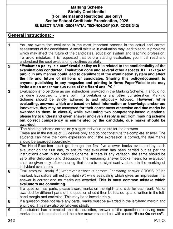
Strictly Confidential
(For Internal and Restricted use only)
Senior School Certificate Examination, 2025
SUBJECT NAME: GEOSPATIAL TECHNOLOGY (Q.P. CODE 342)
General Instructions: -
1 You are aware that evaluation is the most important process in the actual and correct
assessment of the candidates. A small mistake in evaluation may lead to serious problems
which may affect the future of the candidates, education system and teaching profession.
To avoid mistakes, it is requested that before starting evaluation, you must read and
understand the spot evaluation guidelines carefully.
2 “Evaluation policy is a confidential policy as it is related to the confidentiality of the
examinations conducted, Evaluation done and several other aspects. Its’ leakage to
public in any manner could lead to derailment of the examination system and affect
the life and future of millions of candidates. Sharing this policy/document to
anyone, publishing in any magazine and printing in News Paper/Website etc may
invite action under various rules of the Board and IPC.”
3 Evaluation is to be done as per instructions provided in the Marking Scheme. It should not
be done according to one’s own interpretation or any other consideration. Marking
Scheme should be strictly adhered to and religiously followed. However, while
evaluating, answers which are based on latest information or knowledge and/or are
innovative, they may be assessed for their correctness otherwise and due marks be
awarded to them. In class-X, while evaluating two competency-based questions,
please try to understand given answer and even if reply is not from marking scheme
but correct competency is enumerated by the candidate, due marks should be
awarded.
4 The Marking scheme carries only suggested value points for the answers
These are in the nature of Guidelines only and do not constitute the complete answer. The
students can have their own expression and if the expression is correct, the due marks
should be awarded accordingly.
5 The Head-Examiner must go through the first five answer books evaluated by each
evaluator on the first day, to ensure that evaluation has been carried out as per the
instructions given in the Marking Scheme. If there is any variation, the same should be
zero after delibration and discussion. The remaining answer books meant for evaluation
shall be given only after ensuring that there is no significant variation in the marking of
individual evaluators.
6 Evaluators will mark( √ ) wherever answer is correct. For wrong answer CROSS ‘X” be
marked. Evaluators will not put right (✓)while evaluating which gives an impression that
answer is correct and no marks are awarded. This is most common mistake which
evaluators are committing.
7 If a question has parts, please award marks on the right-hand side for each part. Marks
awarded for different parts of the question should then be totaled up and written in the left-
hand margin and encircled. This may be followed strictly.
8 If a question does not have any parts, marks must be awarded in the left-hand margin and
encircled. This may also be followed strictly.
9 If a student has attempted an extra question, answer of the question deserving more
marks should be retained and the other answer scored out with a note “Extra Question”.
342 1 P.T.O.
Page 2
once.
11 A full scale of marks __________(example 0 to 80/70/60/50/40/30 marks as given in
Question Paper) has to be used. Please do not hesitate to award full marks if the answer
deserves it.
12 Every examiner has to necessarily do evaluation work for full working hours i.e., 8 hours
every day and evaluate 20 answer books per day in main subjects and 25 answer books
per day in other subjects (Details are given in Spot Guidelines).This is in view of the
reduced syllabus and number of questions in question paper.
13 Ensure that you do not make the following common types of errors committed by the
Examiner in the past:-
● Leaving answer or part thereof unassessed in an answer book.
● Giving more marks for an answer than assigned to it.
● Wrong totaling of marks awarded on an answer.
● Wrong transfer of marks from the inside pages of the answer book to the title page.
● Wrong question wise totaling on the title page.
● Wrong totaling of marks of the two columns on the title page.
● Wrong grand total.
● Marks in words and figures not tallying/not same.
● Wrong transfer of marks from the answer book to online award list.
● Answers marked as correct, but marks not awarded. (Ensure that the right tick mark
is correctly and clearly indicated. It should merely be a line. Same is with the X for
incorrect answer.)
● Half or a part of answer marked correct and the rest as wrong, but no marks awarded.
14 While evaluating the answer books if the answer is found to be totally incorrect, it should
be marked as cross (X) and awarded zero (0)Marks.
15 Any unassessed portion, non-carrying over of marks to the title page, or totaling error
detected by the candidate shall damage the prestige of all the personnel engaged in the
evaluation work as also of the Board. Hence, in order to uphold the prestige of all
concerned, it is again reiterated that the instructions be followed meticulously and
judiciously.
16 The Examiners should acquaint themselves with the guidelines given in the “Guidelines
for Spot Evaluation” before starting the actual evaluation.
17 Every Examiner shall also ensure that all the answers are evaluated, marks carried over to
the title page, correctly totaled and written in figures and words.
18 The candidates are entitled to obtain photocopy of the Answer Book on request on
payment of the prescribed processing fee. All Examiners/Additional Head Examiners/Head
Examiners are once again reminded that they must ensure that evaluation is carried out
strictly as per value points for each answer as given in the Marking Scheme.
342 2
Page 3
$
MARKING SCHEME
GEOSPATIAL TECHNOLOGY
SECTION A
(Objective Type Questions) (30 marks)
1. Answer any 4 out of the given 6 questions on Employability Skills. 41=4
(i) Speaking, listening, reading and writing are the part of communication. 1
(ii) Schizoid personality disorder 1
(iii) Impress, PPt slides, keynote – any two or any other relevant software.
1/2+1/2=1
(iv) Slides are like new pages which are added to separate different topics in
a presentation. 1
(v) a. It is necessary for success in every walk of life.
b. It sparks passion to complete the given task and reach out goal.
1/2+1/2=1
(vi) Compressed natural gas 1
2. Answer any 5 out of the given 7 questions. 51=5
(i) (B) 0∙4 m – 0∙7 m 1
(ii) (D) Chlorophyll 1
(iii) (A) Concrete 1
(iv) (D) limitation in the sensing instrument 1
(v) (D) Light shade of grey 1
(vi) (B) Colour 1
(vii) (D) Rubber sheeting 1
3. Answer any 6 out of the given 7 questions. 61=6
(i) (D) Displaying 1
(ii) (B) Spaghetti Data 1
342 3 P.T.O.
Page 4
(iv) (A) Unique ID 1
(v) (A) Input Spatial operation Output 1
(vi) (B) DGPS 1
(vii) (C) It gives coordinates in local datum. 1
4. Answer any 5 out of the given 6 questions. 51=5
(i) (B) A satellite system 1
(ii) (A) Stone Age 1
(iii) (D) Digital Photogrammetry 1
(iv) (A) Eureka 1
(v) (B) Mobile GIS 1
(vi) (C) Industrial resources 1
5. Answer any 5 out of the given 6 questions. 51=5
(i) Shape 1
(ii) Stereo 1
(iii) Topology 1
(iv) 19,100 1
(v) Rado age 1
(vi) The universal address system 1
6. Answer any 5 out of the given 6 questions. 51=5
(i) Watershed management 1
(ii) An Algorithm 1
(iii) A question used as a spatial analysis tool which can be simple statement
based or complex conditions based. 1
(iv) Receivers clocks are not as accurate as satellite’s atomic clocks so circles
don’t meet at a point which becomes wide and form an area. 1
(v) 200 bands 1
(vi) collection and analysis of spatial and attribute data, preparation of
hazard map of a disease, creating awareness, etc. OR any other relevant
point. 1/2+1/2=1
342 4
Page 5
(Subjective Type Questions) (30 Marks)
Answer any 3 out of the given 5 questions on Employability Skills. Answer each question
in 20 – 30 words. 32=6
7. (i) Some words need for connecting words, phrases, clauses or sentences.
(ii) They are articles, conjunctions, prepositions and interjections. 1+1=2
8. (i) A healthy and balanced diet is important for a healthy body and mind as
it provide all the essential vitamins and minerals and required nutrients
to us.
(ii) It provides the strength required to do daily work efficiently.
OR any other relevant point. 1+1=2
9. (i) It has many options to make content look neat and easy to read, change
text style, heading size, etc.
(ii) changing number formats (like currency, percentages, or dates) and
applying text styles (bold, italic, font type, color) 1+1=2
10. These are the ways to manage our day-to-day stress-
(i) Taking a walk in nature.
(ii) Doing a physical activity like running, swimming.
(iii) Practising deep breathing exercises.
(iv) Practising meditation or yoga. (Any two) 1+1=2
11. (i) Eco-tourism is intended to provide an experience to visitors to
understand the importance of conserving resources; reducing waste,
enhancing the natural environment and reducing pollution.
(ii) It helps improve public image as the visitors feel good about being in an
environment-friendly place.
Workers engaged in eco-tourism are green workers only. 1+1=2
Answer any 3 out of the given 5 questions in 20 – 30 words each. 32=6
12. (i) Image restoration
(ii) Statistical analysis
342 5 P.T.O.
Page 6
1
(iv) Image classification 4=2
2
13. (i) It refers to the spatial arrangement of visibly separate object.
(ii) An orderly repetition of similar tones and textures will produce a
distinctive and recognisable pattern.
Pattern helps us to identify and distinguish natural and man-made
objects, natural forests and orchards etc. 1+1=2
14. (i) Scanning errors include intersection lines being too close wide/thin or
broken.
(ii) Digitizing errors from tracing includes collapsed lines, misshapen lines
and extra lines. 1+1=2
15. (i) Mapping grade GPS are more accurate than recreational units; commonly
to within a meter.
(ii) Mapping grade GPS receivers are most often used by government
agencies and researchers. 1+1=2
16. (i) It is a system that integrated through an entire organisation so that a
large number of uses can manage, share and use spatial data and related
information to address a variety of problems.
(ii) More and more organisations have started adopting GIS to manage
spatial information in support of spatial decisions making and improved
the working efficiency. OR any other relevant point. 1+1=2
Answer any 2 out of the given 3 questions in 30 – 50 words each. 23=6
17. (i) Clouds haze, shadows/sun angle, snow.
(ii) Distortion due to tip and tilt, relief distortion, radial distortion.
(iii) Storage and handling can be a problem.
(iv) Limited to 0·3 – 0·9 m (Uv – NIR) 13=3
18. (i) A reference datum is a known and constant surface which can be used to
describe the location of unknown points.
(ii) The normal reference datum is sea level, there are many datum systems
are available.
342 6
Page 7
WGS 84 is a universal system which is based at the centre of Earth’s
mass. 1+1+1=3
19. (i) Radio-based navigation systems are discovered and used in
World War II. Both ships and airplanes used in ground-based radio
navigation system.
(ii) Radio navigational system uses radio signals to measures distances from
several transmitting towers, located at known points.
(iii) The first ground-based radio-navigation system was developed after
20th century.
(iv) The accurate locations are calculated by using several towers. 3
(diagram can be provided in the answer)
Answer any 3 out of the given 5 questions in 50 – 80 words each. 34=12
20. Microwave (long waves) band is used in RS to provide useful information.
Ranges from
0·1 – 30 cms sensing in microwave bands. Microwave band lies between
Infrared and Radio waves. When microwaves strike a surface, the proportion of
energy scattered back to the sensor depends on many factors.
(i) Physical factors such as the dielectric constant of the surface materials
which also depends strongly on the moisture content.
(ii) Geometric factors such as surface roughness, slopes, orientation of the
objects relative to the radar beam direction.
(iii) The types of land cover (soil, vegetation, manmade objects).
(iv) Microwave frequency polarization and incident angle. (Any three) 4
21. (i) Synoptic view and repetitive coverage.
(ii) Continuous acquisition of data.
(iii) Coverage of inaccessible areas.
(iv) Up-to-date information, accurate and reliable data.
(v) Quantifiable data; new information.
(vi) Multidisciplinary applications, time, manpower, saving. 14=4
342 7 P.T.O.
Page 8
explained with real-life examples in detail)- Any four.
22. (i) A TIN is a vector-based representation on the physical land surface. It is
used to create digital terrain models.
(ii) A TIN connects adjacent data point vertices by lines to create a network
of irregular triangles.
(iii) First, the TIN of sampled location is computed then the triangles
containing the specified unsampled location is determined from the TIN
using the predicate point inside the triangle.
(iv) The 3D distance between the data points along vertices and unsampled
location computed using trigonometry. The value of unsampled location
is the geometric means of the values of the vertices of triangle
containing. 4
(Diagram should be provided with the answer)
(Weightage should be given to the answer with diagram and real life
application of TIN)
23. (i) Geographic coordinates system is a 3D reference system that locates
points on the Earth surface.
(ii) A point at Earth has two coordinate values, latitude and longitude.
Latitude and longitude measures angles. Latitude is defined as the angle
formed by the intersection of a line perpendicular to the Earth’s surface
at a point and the plane of the equator.
(iii) Points north of the equator have positive latitude values, whereas points
towards south have negative values.
(iv) Latitudes values ranges from – 90 to + 90 degrees. Lines of latitude are
called parallels. A meridian is formed by a plane that passes through the
point and the North and South poles. 1+3=4
(Def. calculate location information by some known reference point)
(Give diagram fig. 97)
24. (i) Significant improvement in time.
(ii) Laborious task of edge matching of drawings are eliminated,
re-work for various drawing office activities are eliminated.
(iii) Enhanced output and prints.
(iv) Easy updating of various drawings.
342 8
Page 9
eliminated.
(Or any other relevant point – any four)
(All the benefits should be explained with real life examples to support
the benefits, weightage should be given to such answers.) 14=4
342 9 P.T.O.
Document Details
| Board / Org | CBSE |
| Exam | Class 12 |
| Type | Solution |
| Pages | 9 |
| Updated | 24 Sep 2026 |