MAHA SET 2018 Question Paper 3 Geography
Finished viewing? Save it for later —
Download MAHA SET 2018 Question Paper 3 Geography (PDF · 40 pages)About MAHA SET 2018 Question Paper 3 Geography
MAHA SET 2018 Question Paper 3 Geography is available here for free download. Published by Maharashtra Exams for MAHA SET, this question paper can be viewed online or downloaded as a PDF (40 pages). Candidates preparing for MAHA SET can use MAHA SET 2018 Question Paper 3 Geography to understand the exam pattern, the type of questions asked, and the overall difficulty level.
Frequently Asked Questions
How can I download MAHA SET 2018 Question Paper 3 Geography?
Open this page and click the Download button to save MAHA SET 2018 Question Paper 3 Geography as a PDF. It is completely free on AglaSem Docs.
Is MAHA SET 2018 Question Paper 3 Geography free to download?
Yes. MAHA SET 2018 Question Paper 3 Geography can be viewed online and downloaded as a PDF free of cost on AglaSem Docs.
How many pages does MAHA SET 2018 Question Paper 3 Geography have?
MAHA SET 2018 Question Paper 3 Geography contains 40 pages, which you can read online or download together as a single PDF.
Where can I find more MAHA SET study material?
You can find more MAHA SET question papers, sample papers, syllabus, and answer keys on AglaSem Docs.
MAHA SET 2018 Question Paper 3 Geography – Text
Read the full text of this question paper below — useful to quickly search, copy and reference the content online without downloading the PDF.
📄 View text version (40 pages)
Page 1
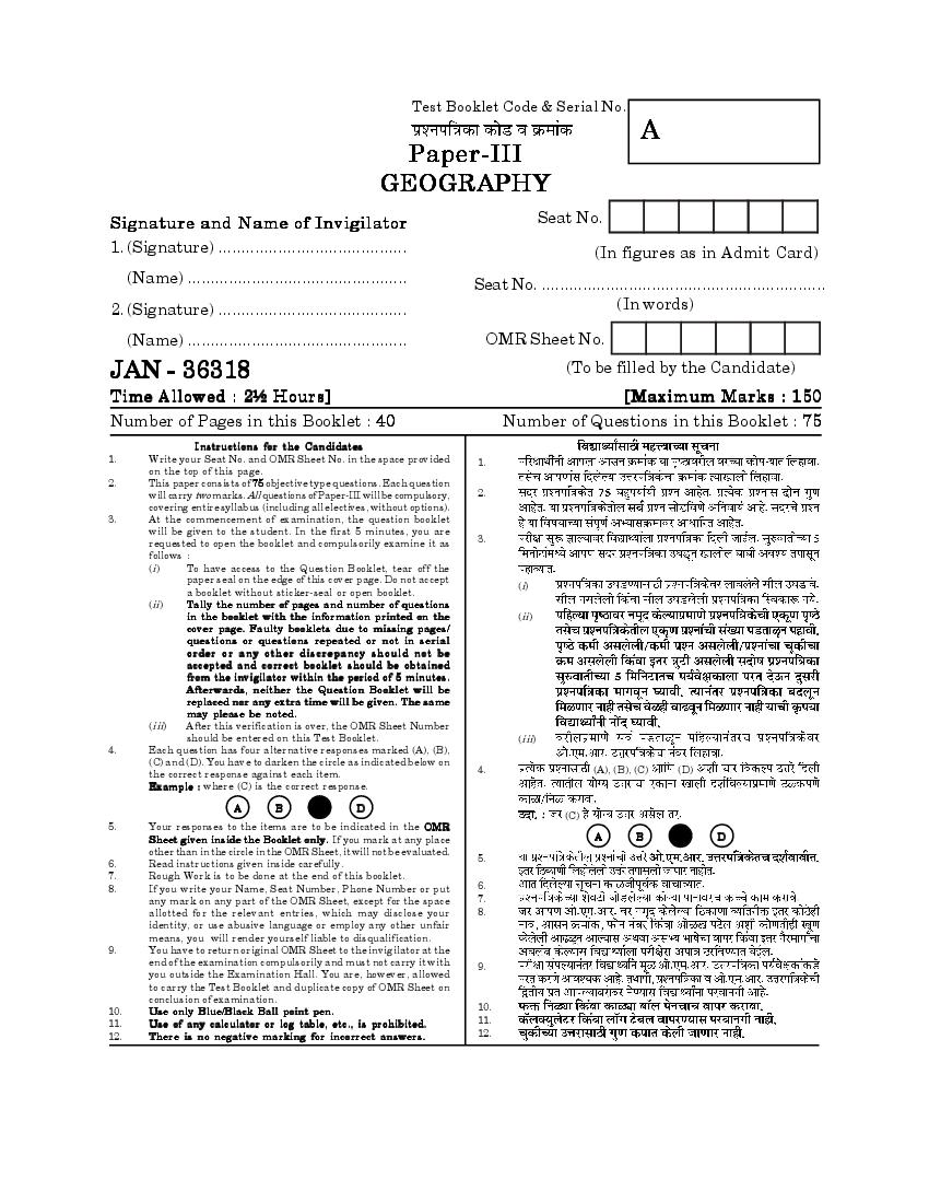
A
GEOGRAPHY
Signature and Name of Invigilator Seat No.
1. (Signature) ......................................... (In figures as in Admit Card)
(Name) ................................................ Seat No. ..............................................................
2. (Signature) ......................................... (In words)
(Name) ................................................ OMR Sheet No.
JAN - 36318 (To be filled by the Candidate)
Time Allowed : 2½ Hours] [Maximum Marks : 150
Number of Pages in this Booklet : 40 Number of Questions in this Booklet : 75
Instructions for the Candidates
1. Write your Seat No. and OMR Sheet No. in the space provided 1.
on the top of this page.
2. This paper consists of 75 objective type questions. Each question
will carry two marks. All questions of Paper-III will be compulsory, 2.
covering entire syllabus (including all electives, without options).
3. At the commencement of examination, the question booklet
will be given to the student. In the first 5 minutes, you are
requested to open the booklet and compulsorily examine it as 3.
follows :
(i) To have access to the Question Booklet, tear off the
paper seal on the edge of this cover page. Do not accept
(i)
a booklet without sticker-seal or open booklet.
(ii) Tally the number of pages and number of questions
in the booklet with the information printed on the (ii)
cover page. Faulty booklets due to missing pages/
questions or questions repeated or not in serial
o rder or any other discre pancy should not be
accepted and correct booklet should be obtained
from the invigilator within the period of 5 minutes.
Afterwards, neither the Question Booklet will be
replaced nor any extra time will be given. The same
may please be noted.
(iii) After this verification is over, the OMR Sheet Number
should be entered on this Test Booklet. (iii)
4. Each question has four alternative responses marked (A), (B),
(C) and (D). You have to darken the circle as indicated below on
the correct response against each item. 4. (A), (B), (C) (D)
Example : where (C) is the correct response.
A B D
(C)
5. Your responses to the items are to be indicated in the OMR
Sheet given inside the Booklet only. If you mark at any place A B D
other than in the circle in the OMR Sheet, it will not be evaluated.
5.
6. Read instructions given inside carefully.
7. Rough Work is to be done at the end of this booklet.
8. If you write your Name, Seat Number, Phone Number or put 6.
any mark on any part of the OMR Sheet, except for the space 7.
allotted for the relevant entries, which may disclose your 8.
identity, or use abusive language or employ any other unfair
means, you will render yourself liable to disqualification.
9. You have to return original OMR Sheet to the invigilator at the
end of the examination compulsorily and must not carry it with 9.
you outside the Examination Hall. You are, however, allowed
to carry the Test Booklet and duplicate copy of OMR Sheet on
conclusion of examination.
10. Use only Blue/Black Ball point pen. 10.
11. Use of any calculator or log table, etc., is prohibited. 11.
12. There is no negative marking for incorrect answers. 12.
Page 2
Page 3
Paper III
III
Time Allowed : 2½ Hours] [Maximum Marks : 150
Note : This paper contains Seventy Five (75) multiple choice questions. Each
question carrying Two (2) marks. Attempt All questions.
(75) (2)
1. In which rock type areas, petroleum 1.
reserves are found ?
(A) Sedimentary (A)
(B) Metamorphic (B)
(C) Igneous (C)
(D)
(D) Volcanic
2. “ ................ is the interaction of kinetic 2.
energy by the moving material to
the surface along which it moves.”
(A) Weathering (A)
(B) Mass movement (B)
(C) Transport (C)
(D) Erosion (D)
3 [P.T.O.
Page 4
stream erosion.
(A) Relatively flat flood plains (A)
(B) Stream flow (B)
(C) Natural leeves (C)
(D) Steep gradients (D)
4. Karst topography is developed due 4.
to ................... erosion.
(A) Glacial (A)
(B) Groundwater (B)
(C) Stream (C)
(D) Wave (D)
5. ................. is not associated with 5.
stream landscapes in arid areas.
(A) Alluvial fans (A)
(B) Arroyos (B)
(C) Ox bow lakes (C)
(D) Wadies (D)
4
Page 5
following :
Scientists
(a)
(a) W. M. Davis
(b)
(b) Karl Gilbert
(c)
(c) L. C. King
(d)
(d) W. Penck
Areas
(1)
(1) Alps Mountain
(2)
(2) New England
(3)
(3) Henry Mountains
(4)
(4) South Africa
Which one of the following is the
correct sequence of the pairs ?
(a) (b) (c) (d) (a) (b) (c) (d)
(A) (1) (2) (3) (4) (A) (1) (2) (3) (4)
(B) (2) (3) (4) (1) (B) (2) (3) (4) (1)
(C) (3) (2) (1) (4) (C) (3) (2) (1) (4)
(D) (4) (3) (2) (1) (D) (4) (3) (2) (1)
5 [P.T.O.
Page 6
formed and separated before
Pangea ?
(A)
(A) Zero
(B)
(B) One
(C)
(C) Three
(D)
(D) More than three
8. As glaciers retreat, they leave 8.
behind large hills of debris known
as .................. .
(A) Glacial till (A)
(B) Outwash deposit (B)
(C) Drumlins (C)
(D) Moraine (D)
6
Page 7
temperature reaches dew point.
0º
When the dew point is below 0ºC,
it is referred to as ................ .
(A)
(A) Supercooled point temperature
(B)
(B) Frost point temperature
(C)
(C) Ice temperature
(D)
(D) Cooler temperature
10. The uneven distribution of insolation 10.
on the earth surface is maintained
by ................... .
(A)
(A) Spherical shape of the earth
(B)
(B) Distribution of land and water
(C)
(C) Direction of winds
(D) Pressure belts on the earth (D)
7 [P.T.O.
Page 8
energy between two bodies, without
the necessary aid of an intervening
material is termed as ................. .
(A) Radiation (A)
(B) Convection (B)
(C) Conduction (C)
(D) Current (D)
12. The summer monsoon normally sets 12.
in over the extreme south of Indian
Peninsula on ................... .
(A)
(A) First of June
(B)
(B) Fifteenth of May
(C) Twentieth of May (C)
(D) Fifth of June (D)
8
Page 9
and their characteristics (List II) are II
given.
Match the List-I and List-II and
select the correct answer from the
I
codes given below :
(a)
List I
(b)
(a) Snow
(c)
(b) Hail
(c) Dew (d)
(d) Rime II
List II (1)
(1) Condensation droplets on the
ground surface or grass (2)
(2) Clear crystalline or granular ice (3)
(3) Ice crystals falling in branched
clusters as snow flakes
(4)
(4) Hard pellets, balls or irregular
lumps of ice
Codes :
(a) (b) (c) (d)
(a) (b) (c) (d)
(A) (3) (2) (1) (4)
(A) (3) (2) (1) (4)
(B) (2) (1) (4) (3)
(B) (2) (1) (4) (3)
(C) (3) (4) (1) (2)
(C) (3) (4) (1) (2)
(D) (4) (3) (2) (1) (D) (4) (3) (2) (1)
9 [P.T.O.
Page 10
The height of the tropopause at any
point is correlated with sea-level
temperature and pressure.
Reason (R) :
(R)
Sea level temperature and pressure
are related to factors of latitude,
season and daily changes in surface
pressure.
Select the correct answer from the
codes given below.
Codes : (A) (A) (R)
(R) (A)
(A) Both (A) and (R) are true and
(R) is correct explanation of (A) (B) (A) (R) (R)
(B) Both (A) and (R) are true but (A)
(R) is not correct explanation (C) (A) (R)
of (A)
(C) (A) is true and (R) is false (D) (A) (R)
(D) (A) is false but (R) is true
10
Page 11
deviced by .................. .
(A) Koeppen (A)
(B) Strahler (B)
(C) Trewartha (C)
(D) Thornthwait (D)
16. Fall in sea level is caused 16.
by .................... .
(A) Loss of ocean water through
(A)
evaporation
(B)
(B) Isostatic rebound
(C)
(C) Melting of ice sheets
(D) Hydroisostasy (D)
11 [P.T.O.
Page 12
Phytoplanktons are also considered
as grazing grounds for zoo-
planktons.
(R)
Reason (R) :
Zooplanktons are not grazers.
Select the correct alternative using
the codes below :
Codes : (A) (A) (R)
(A) Both (A) and (R) are true and (R) (A)
(R) is the correct explanation
(B) (A) (R) (R)
of (A)
(A)
(B) Both (A) and (R) are true but
(R) is not correct explanation (C) (A) (R)
of (A)
(C) (A) is true but (R) is false (D) (A) (R)
(D) (A) is false but (R) is true
18. ............... is not observed in equatorial 18.
rainforest.
(A) Ebony (A)
(B) Mahogany (B)
(C) Bamboo (C)
(D) Rosewood (D)
12
Page 13
is responsible for variations in the
flora and fauna in different parts of
the earth.
(A)
(A) Changes in physical
environment (B)
(B) Changes in social and cultural
environment
(C)
(C) Changes in technology
(D) (B) (C)
(D) Both (B) and (C)
20. Ocean gyres are mainly the result 20.
of ................... .
(A) Prevailing winds and Coriolis
(A)
effect
(B)
(B) Ocean current diversion
(C)
(C) Conveyor belt
(D) Salinity of the ocean (D)
13 [P.T.O.
Page 14
reef.
(A) Abyssal reef (A)
(B) Fringing reef (B)
(C) Atoll (C)
(D) Barrier reef (D)
22. Which of the following is not an 22.
island arc ?
(A)
(A) Aleutian
(B)
(B) Hawaiian
(C)
(C) Philippine
(D)
(D) Japanese
23. ................... are vascular plants. 23.
(A) Algae (A)
(B) Fungi (B)
(C) Pteridophyta (C)
(D) Lichens (D)
14
Page 15
greatly influenced by mythological
literature ?
(A)
(A) Determinism
(B)
(B) Possibilism
(C)
(C) Catastrophism
(D) Environmentalism (D)
25. “The senile man talked about the 25.
senile landscape.” This criticism
was levelled against W. M. Davis
by .................... .
(A)
(A) R. J. Choreley
(B)
(B) L. C. King
(C)
(C) Penk
(D)
(D) Wouldridge
26. Which of the following is incorrect 26.
pair ?
(A) Ellsworth Huntington : (A)
Determinism
(B) Richard Hartshone : Areal (B)
differentiation
(C)
(C) Yi-Fu Tuan : Humanistic
Geography
(D)
(D) Richard Peet : Possibilism
15 [P.T.O.
Page 16
is incorrect about contribution of
Arab Geographers ?
(A)
(A) Al Battam measured the circum-
ference of the earth
(B) Al Masudi described Indian (B)
monsoon
(C) Sun was considered as the (C)
centre of the universe
(D) Tides are caused due to the
(D)
gravitational pull of the sun and
the moon
28. The concept of ‘deep ecology’ is 28.
associated with whom of the
following ?
(A)
(A) James Lovelock
(B)
(B) Arne Naess
(C)
(C) D. Hughes
(D) J. Emel (D)
16
Page 17
29.
is not correct ?
(A)
(A) Quantitative revolution leads to
quantification
(B) Quantitative revolution has
(B)
changed the language of
expression
(C) Quantitative revolution
(C)
discarded the descriptive
method
(D) Quantitative revolution does (D)
not have much scope for
mathematical applications
30. Who among the following was 30.
influenced by Charles Darwin in
model proposed by him ?
(A)
(A) L. C. King
(B)
(B) W. M. Davis
(C) Walter Penk (C)
(D) James Dana (D)
17 [P.T.O.
Page 18
approach in population geography ?
(A) Behavioural (A)
(B) System (B)
(C) Histo-genetic (C)
(D) Systematic (D)
32. Who used the concept of “Outlying 32.
Business District” in Urban Landuse
Theory ?
(A)
(A) E. Burges
(B)
(B) Harris and Ullman
(C)
(C) Homer Hoyt
(D) E. Burges and Homer Hoyt (D)
33. Dry point rural settlement are 33.
commonly found in .................. region.
(A) Desert (A)
(B) Plateau (B)
(C) Mountainous (C)
(D) Riverine (D)
18
Page 19
correct answer from the codes given
below :
I
List-I
(a)
(a) Transhumance
(b)
(b) Emigration
(c)
(c) Commuting
(d) Immigration (d)
List-II II
(1) Daily movement to urban areas (1)
(2) Seasonal movement with (2)
animals
(3)
(3) Movement from a country
(4)
(4) Movement into a country
Codes :
(a) (b) (c) (d)
(a) (b) (c) (d)
(A) (3) (2) (1) (4)
(A) (3) (2) (1) (4)
(B) (1) (2) (3) (4)
(B) (1) (2) (3) (4)
(C) (2) (3) (1) (4) (C) (2) (3) (1) (4)
(D) (4) (3) (2) (1) (D) (4) (3) (2) (1)
19 [P.T.O.
Page 20
deteriorating areas of cities by influx
of high class and professional groups
is called as .................. .
(A)
(A) Counter urbanisation
(B)
(B) Gentrification
(C)
(C) Necropolis
(D)
(D) Corbunation
36. According to Christaller’s theory, In 36.
marketing principle, if the 18,000
population of the region is 18,000,
what will be the population served
by the central place and the
complementary region ?
(A) 6,000 12,000
(A) 6,000 and 12,000
(B) 4,000 14,000
(B) 4,000 and 14,000
(C) 3,000 15,000
(C) 3,000 and 15,000
(D) 8,000 and 8,000 (D) 8,000 8,000
20
Page 21
(A) Urban continuum (A)
(B) Peri-urban (B)
(C) City-region (C)
(D) Central business district (D)
38. Considering the Crude Birth rate is 38. 15/1000
15/1000 and the crude death rate is 12/1000
12/1000, then the country is in the
.................. stage of demographic
transition.
(A) I
(A) I
(B) II (a)
(B) II (a)
(C) II (b)
(C) II (b)
(D) III
(D) III
21 [P.T.O.
Page 22
industrial location in the book
entitled .................... .
(A) The theory of industrial
location (A)
(B) The location and theory of (B)
industries
(C)
(C) Least-cost location theory
(D)
(D) Industrial location
40. Which of the following mode of 40.
transport has higher fixed costs ?
(A) Bus (A)
(B) Truck (B)
(C) Railway (C)
(D) Ship (D)
22
Page 23
variable cost of railway transport
system ?
(A)
(A) Depreciation and interest
(B)
(B) Labour cost
(C)
(C) Servicing and maintenance
(D)
(D) Fuel cost
42. Nomadic herding is practised by the 42.
................... in East Africa.
(A) Fulani (A)
(B) Bantu (B)
(C) Nuba (C)
(D) Masais (D)
43. Ladang is a type of agriculture 43.
practised in ................... .
(A) Brazil (A)
(B) Mexico and Central America (B)
(C) Indonesia and Malaysia (C)
(D) North-Eastern States of India (D)
23 [P.T.O.
Page 24
statements is incorrect ?
(A)
(A) Plantation crops require heavy
outlay
(B) Economy of livestock ranchers (B)
is commercial
(C) Shifting cultivation is
(C)
characterised by field rotation
rather than by crop rotation
(D) In intensive subsistence
(D)
agriculture animal farming is
more developed
45. The concept of ‘Spread’ and 45.
‘Backwash’ effect was introduced
by :
(A)
(A) Gunnar Myrdal
(B)
(B) A. O. Hirschman
(C)
(C) Gunder Frank
(D) Sameer Amin (D)
24
Page 25
been studied first by which
geographer ?
(A)
(A) Meinig
(B)
(B) Kniffen
(C)
(C) Jackson
(D)
(D) Simon
47. Which is not a variable of cultural 47.
needs ?
(A) Security (A)
(B) Shelter (B)
(C) Recreation (C)
(D) Education (D)
25 [P.T.O.
Page 26
the focus of which sub-branch of
human geography ?
(A) Radical geography (A)
(B) Humanistic geography (B)
(C) Welfare geography (C)
(D) Theoretical geography (D)
49. The United Kingdom includes : 49.
(A) English
(A)
(B) English and Scottish
(B)
(C) English, Scottish and Welsh
(C)
(D) English, Scottish, Welsh and
Ulster (D)
50. Mestizo is a .................. found in Latin 50.
America.
(A) Language (A)
(B) Religion (B)
(C) Group of People (C)
(D) Script (D)
26
Page 27
geopolitics’ ?
(A)
(A) Agnew
(B)
(B) Kjellen
(C)
(C) Natter
(D) Sharp (D)
52. Which among the following is not 52.
a force of cohesion for a nation ?
(A) Common language (A)
(B) Sense of ethnic kinship (B)
(C) Demographic homogeneity (C)
(D) Fear of a common enemy (D)
53. The Tharus are inhabitants 53.
of ............... .
(A) Coastal region (A)
(B) Thar desert (B)
(C) Deccan plateau (C)
(D) Tarai region (D)
27 [P.T.O.
Page 28
54.
actual delineation of functional
regions are :
(A) Ranking coefficient method
(A)
analysis
(B)
(B) Flow and gravitational analysis
(C) Composite index method (C)
analysis
(D)
(D) Simple correlation analysis
55. Which is not a social indicator of 55.
Human Development ?
(A) Employment (A)
(B) Education (B)
(C) Economic growth (C)
(D) Infrastructure (D)
28
Page 29
of economic planning ?
(A) Integrated watershed
development (A)
(B) Multi-purpose river valley (B)
project
(C)
(C) Management of scarce resources
(D)
(D) Town planning
57. Arrange the level in a bottom-up 57.
hierarchy of planning region :
(1) Mesolevel (1)
(2) Macro level (2)
(3) Micro-minor level (3)
(4) Minor level (4)
(A) (1) (2) (4) (3) (A) (1) (2) (4) (3)
(B) (1) (2) (3) (4) (B) (1) (2) (3) (4)
(C) (2) (1) (4) (3) (C) (2) (1) (4) (3)
(D) (3) (4) (1) (2) (D) (3) (4) (1) (2)
29 [P.T.O.
Page 30
58. (A)
Regional modelling helps achieving
a scientific understanding of cities
and regions.
Reason (R) : (R)
Model building can provide solution
to a variety of both urban and
regional problems.
Read the statements given above
and choose the correct option from
the following :
(A) (A) (R)
(A) Both (A) and (R) are true and
(R) is proper explanation of (A) (R) (A)
(B) Both (A) and (R) are true (B) (A) (R)
but (R) is not the correct
(R) (A)
explanation of (A)
(C) (A) (R)
(C) (A) is true but (R) is false
(D) (A) is false but (R) is true (D) (A) (R)
30
Page 31
of the regional system whole is called
the principle of ................... .
(A) Ecological equilibrium (A)
(B) Comprehensive development (B)
(C) Horizontal spatial unity (C)
(D) Vertical unity of phenomena (D)
60. Which of the following five year 60.
plans aimed at the removal of
poverty and attainment of self-
reliance ?
(A)
(A) Second
(B)
(B) Third
(C)
(C) Fourth
(D) Fifth (D)
31 [P.T.O.
Page 32
regional space are fully integrated
with each other is called principle
of .................. .
(A)
(A) Vertical unity
(B)
(B) Horizontal spatial unity
(C)
(C) Space-time continuum
(D) Ecological equilibrium (D)
62. Between which of the two following 62.
ranges Kashmir valley is located ?
(A) Pir Panjal and Greater
(A)
Himalaya
(B)
(B) Pir Panjal and Zanskar
(C)
(C) Zanskar and Ladakh
(D) Pir Panjal and Karakoram (D)
32
Page 33
63.
two of the mountain peaks that are
also syntaxes ?
(A) Nanga Parbat and K2 (A) K2
(B) K2 and Namcha Barwa
(B) K2
(C) Nanga Parbat and
Kanchenjunga (C)
(D) Namcha Barwa and Nanga
(D)
Parbat
64. Which of the following states has 64.
highest number of major dams ?
(A) Punjab (A)
(B) Maharashtra (B)
(C) Karnataka (C)
(D) Uttar Pradesh (D)
33 [P.T.O.
Page 34
select the correct answer from the
codes given below :
List I I
(a) Black soil (a)
(b) Red soil (b)
(c) Alluvial soil (c)
(d) Mountain soil (d)
List II II
(1) Rice (1)
(2) Cotton (2)
(3) Fruits (3)
(4) Coffee (4)
Codes :
(a) (b) (c) (d) (a) (b) (c) (d)
(A) (2) (4) (3) (1) (A) (2) (4) (3) (1)
(B) (2) (3) (1) (4) (B) (2) (3) (1) (4)
(C) (2) (4) (1) (3) (C) (2) (4) (1) (3)
(D) (1) (2) (3) (4) (D) (1) (2) (3) (4)
34
Page 35
the largest basin area ?
(A) Narmada (A)
(B) Tapi (B)
(C) Pannar (C)
(D) Kaveri (D)
67. Which tributary of Godavari system 67.
flows in East to West direction ?
(A) Wainganga (A)
(B) Pranahita (B)
(C) Indravati (C)
(D) Manjara (D)
68. Tropical thorney vegetation is 68.
observed in ................. .
(1) Rajasthan (1)
(2) Gujrat (2)
(3) Karnataka (3)
(4) Telangana (4)
(A) Only in (1) and (2) (A) (1) 2)
(B) Only in (3) and (4) (B) (3) (4)
(C) Only in (2) and (4) (C) (2) (4)
(D) In all the above states (D)
35 [P.T.O.
Page 36
assumed to be in raster format is
generally represented on .............. .
(A) a choropleth map (A)
(B) a chorochromatic map (B)
(C) an isopleth map (C)
(D) a choroschematic map (D)
70. The image co-ordinate system starts 70.
at .................. .
(A) Bottom left corner (A)
(B) Bottom right corner (B)
(C) Top left corner (C)
(D) Top right corner (D)
36
Page 37
(A) Assigning spatial data to the (A)
mapped units
(B) Assigning geographical
(B)
co-ordinates to the mapped
units
(C)
(C) Assigning attribute data to the
mapped units
(D)
(D) Assigning real time data to the
mapped units
72. A mean of the squares of deviation 72.
scores means ................... .
(A)
(A) Arithmetic mean
(B)
(B) Standard deviation
(C)
(C) Mode
(D) Variance (D)
37 [P.T.O.
Page 38
1* ? 73. na a2 * a3 * ....... an
1* ?
(A) Arithmetic mean (A)
(B) Absolute mean (B)
(C) Geometric mean (C)
(D) Harmonic mean (D)
74. Which one of the following would be 74.
shown on the map with pictorial
form ?
(A)
(A) Rainfall distribution
(B)
(B) Population distribution
(C)
(C) Monuments
(D)
(D) Elevation
75. ..................... is called tuple or record 75.
in database.
(A) Column (A)
(B) Row (B)
(C) Table (C)
(D) Attribute (D)
38
Page 39
39 [P.T.O.
Page 40
40
Document Details
| Board / Org | Maharashtra Exams |
| Exam | MAHA SET |
| Type | Question Paper |
| Pages | 40 |
| Updated | 30 Apr 2026 |