Rajasthan Board Class 12 Question Paper 2020 Geography
Finished viewing? Save it for later —
Download Rajasthan Board Class 12 Question Paper 2020 Geography (PDF · 12 pages)About Rajasthan Board Class 12 Question Paper 2020 Geography
Rajasthan Board Class 12 Question Paper 2020 Geography is available here for free download. Published by Rajasthan Board for Class 12, this question paper can be viewed online or downloaded as a PDF (12 pages). Candidates preparing for Class 12 can use Rajasthan Board Class 12 Question Paper 2020 Geography to understand the exam pattern, the type of questions asked, and the overall difficulty level.
Frequently Asked Questions
How can I download Rajasthan Board Class 12 Question Paper 2020 Geography?
Open this page and click the Download button to save Rajasthan Board Class 12 Question Paper 2020 Geography as a PDF. It is completely free on AglaSem Docs.
Is Rajasthan Board Class 12 Question Paper 2020 Geography free to download?
Yes. Rajasthan Board Class 12 Question Paper 2020 Geography can be viewed online and downloaded as a PDF free of cost on AglaSem Docs.
How many pages does Rajasthan Board Class 12 Question Paper 2020 Geography have?
Rajasthan Board Class 12 Question Paper 2020 Geography contains 12 pages, which you can read online or download together as a single PDF.
Where can I find more Class 12 study material?
You can find more Class 12 question papers, sample papers, syllabus, and answer keys on AglaSem Docs.
Rajasthan Board Class 12 Question Paper 2020 Geography – Text
Read the full text of this question paper below — useful to quickly search, copy and reference the content online without downloading the PDF.
📄 View text version (12 pages)
Page 1
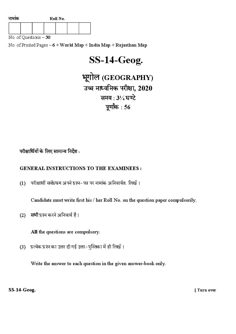
No. of Questions – 30
No. of Printed Pages – 6 + World Map + India Map + Rajasthan Map
(GEOGRAPHY)
, 2020
3¼
56
GENERAL INSTRUCTIONS TO THE EXAMINEES :
(1) -
Candidate must write first his / her Roll No. on the question paper compulsorily.
(2)
All the questions are compulsory.
(3) -
Write the answer to each question in the given answer-book only.
SS-14-Geog. [ Turn over
Page 2
(4) ,
For questions having more than one part, the answers to those parts are to be written
together in continuity.
(5) -
//
If there is any error / difference / contradiction in Hindi & English versions of the
question paper, the question of Hindi version should be treated valid.
(6)
1-13 1 20
14-21 2 60
25-27 3 100
28-30 4 250
Section Q. Nos. Marks per question Words limit of
answer
A 1-13 1 20 words
B 14-21 2 60 words
C 25-27 3 100 words
D 28-30 4 250 words
(7) 22 24 2
Question Nos. 22 to 24 are related to map-work carrying 2 marks each.
(8) , -
Attach given outline maps of World, India and Rajasthan with the answer-book.
(9) 29 30
There are internal choices in Question No. 29 and 30.
Page 3
-
SECTION – A
1.
Write the name of any two American Geographer. ½+½=1
2. ?
What is Cross ? 1
3. ?
What do you understand by Immigration ? 1
4. ?
What is Sex-Ratio ? 1
5. ?
What is Megapolis ? 1
6. ?
What is Settlement ? 1
7. ?
What is Animal based industry ? 1
8.
Write the name of any two Conventional Energy Resources. ½+½=1
9. () ?
What is the main source (ore) of Aluminium ? 1
10.
Give two examples of non-metallic minerals. 1
SS-14-Geog. [ Turn over
Page 4
11. - ?
Which two cities connects by East-West corridor ? ½+½=1
12. ?
In which year National Development Council was formed in India ? 1
13. ?
What do you understand by Mukhya Mantri Jal Swawalamban Abhiyaan ? 1
-
SECTION – B
14.
Describe the habitat of Gond Tribe. 2
15.
Draw the diagram of Circular and Linear Pattern. 1+1=2
16. ?
What do you understand by Tertiary occupation ? 2
17.
Name any four major pipe lines of the world. ½+½+½+½=2
18.
Describe any two advantages of International Trade. 1+1=2
Page 5
19.
Write any four suggestions to control water pollution. ½+½+½+½=2
20.
Write any four factors affecting literacy in India. ½+½½+½=2
21. -
Write a short note on Resource Conservation. 2
22. -
(i) (ii)
(iii) (iv)
Mark the location of the following Iron-Steel producing areas in the given outline map of
the world : 2
(i) Buffalo (ii) Saintos
(iii) Saar (iv) Osaka
23.
(i) (ii)
(iii) (iv)
Mark the location of the following Cotton Textile Industries in the given outline map of
India : 2
(i) Rajkot (ii) Madurai
(iii) Wardha (iv) Hugli
24.
(i) (ii)
(iii) (iv)
Mark the location of the following districts in the given outline map of Rajasthan : 2
(i) Bikaner (ii) Banswara
(iii) Karauli (iv) Nagaur
SS-14-Geog. [ Turn over
Page 6
-
SECTION – C
25.
Discuss critically the livestock rearing. 3
26.
Suggest any three measures to control population growth in India. 1+1+1=3
27. ()
Write a note on Mahatma Gandhi National Rural Employment Guarantee Act
(MGNREGA). 3
-
SECTION – D
28.
Describe the economic factors that affect the population density in the world. 1 + 1 + 1 + 1 = 4
29. ( )
Distinguish between organic and chemical farming. (any four) 1+1+1+1=4
OR
Describe the Geographical conditions for wheat production.
30.
Analyse the population growth in Rajasthan. 4
OR
Analyse the social life of Meena tribe.
____________
Page 7
SS-14-Geog. [ Turn over
Page 8
Page 9
SS-14-Geog. [ Turn over
Page 10
Page 11
SS-14-Geog. [ Turn over
Page 12
Document Details
| Board / Org | Rajasthan Board |
| Exam | Class 12 |
| Type | Question Paper |
| Pages | 12 |
| Updated | 22 Jul 2026 |