Finished viewing? Save it for later —
Download CBSE Class 12 Question Paper 2024 Solution Geography (PDF · 18 pages)About CBSE Class 12 Question Paper 2024 Solution Geography
CBSE Class 12 Question Paper 2024 Solution Geography is available here for free download. Published by CBSE for Class 12, this solution can be viewed online or downloaded as a PDF (18 pages). Candidates preparing for Class 12 can use CBSE Class 12 Question Paper 2024 Solution Geography to understand the exam pattern, the type of questions asked, and the overall difficulty level.
Frequently Asked Questions
How can I download CBSE Class 12 Question Paper 2024 Solution Geography?
Open this page and click the Download button to save CBSE Class 12 Question Paper 2024 Solution Geography as a PDF. It is completely free on AglaSem Docs.
Is CBSE Class 12 Question Paper 2024 Solution Geography free to download?
Yes. CBSE Class 12 Question Paper 2024 Solution Geography can be viewed online and downloaded as a PDF free of cost on AglaSem Docs.
How many pages does CBSE Class 12 Question Paper 2024 Solution Geography have?
CBSE Class 12 Question Paper 2024 Solution Geography contains 18 pages, which you can read online or download together as a single PDF.
Where can I find more Class 12 study material?
You can find more Class 12 question papers, sample papers, syllabus, and answer keys on AglaSem Docs.
CBSE Class 12 Question Paper 2024 Solution Geography – Text
Read the full text of this solution below — useful to quickly search, copy and reference the content online without downloading the PDF.
📄 View text version (18 pages)
Page 1
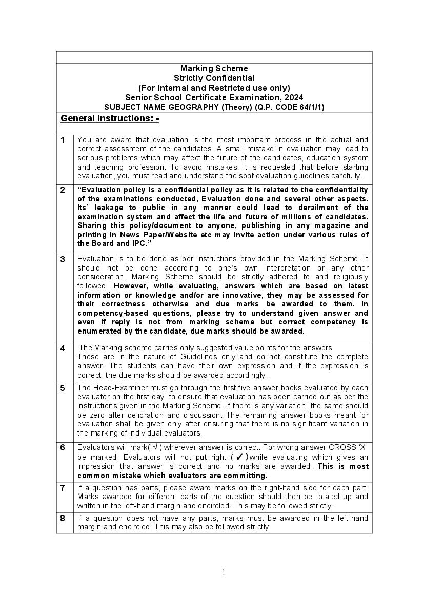
Strictly Confidential
(For Internal and Restricted use only)
Senior School Certificate Examination, 2024
SUBJECT NAME GEOGRAPHY (Theory) (Q.P. CODE 64/1/1)
General Instructions: -
1 You are aware that evaluation is the most important process in the actual and
correct assessment of the candidates. A small mistake in evaluation may lead to
serious problems which may affect the future of the candidates, education system
and teaching profession. To avoid mistakes, it is requested that before starting
evaluation, you must read and understand the spot evaluation guidelines carefully.
2 “Evaluation policy is a confidential policy as it is related to the confidentiality
of the examinations conducted, Evaluation done and several other aspects.
Its’ leakage to public in any manner could lead to derailment of the
examination system and affect the life and future of millions of candidates.
Sharing this policy/document to anyone, publishing in any magazine and
printing in News Paper/Website etc may invite action under various rules of
the Board and IPC.”
3 Evaluation is to be done as per instructions provided in the Marking Scheme. It
should not be done according to one’s own interpretation or any other
consideration. Marking Scheme should be strictly adhered to and religiously
followed. However, while evaluating, answers which are based on latest
information or knowledge and/or are innovative, they may be assessed for
their correctness otherwise and due marks be awarded to them. In
competency-based questions, please try to understand given answer and
even if reply is not from marking scheme but correct competency is
enumerated by the candidate, due marks should be awarded.
4 The Marking scheme carries only suggested value points for the answers
These are in the nature of Guidelines only and do not constitute the complete
answer. The students can have their own expression and if the expression is
correct, the due marks should be awarded accordingly.
5 The Head-Examiner must go through the first five answer books evaluated by each
evaluator on the first day, to ensure that evaluation has been carried out as per the
instructions given in the Marking Scheme. If there is any variation, the same should
be zero after delibration and discussion. The remaining answer books meant for
evaluation shall be given only after ensuring that there is no significant variation in
the marking of individual evaluators.
6 Evaluators will mark( √ ) wherever answer is correct. For wrong answer CROSS ‘X”
be marked. Evaluators will not put right ( ✓ )while evaluating which gives an
impression that answer is correct and no marks are awarded. This is most
common mistake which evaluators are committing.
7 If a question has parts, please award marks on the right-hand side for each part.
Marks awarded for different parts of the question should then be totaled up and
written in the left-hand margin and encircled. This may be followed strictly.
8 If a question does not have any parts, marks must be awarded in the left-hand
margin and encircled. This may also be followed strictly.
1
Page 2
more marks should be retained and the other answer scored out with a note “Extra
Question”.
10 No marks to be deducted for the cumulative effect of an error. It should be
penalized only once.
11 A full scale of marks __70 (example 0 to 80/70/60/50/40/30 marks as given in
Question Paper) has to be used. Please do not hesitate to award full marks if the
answer deserves it.
12 Every examiner has to necessarily do evaluation work for full working hours i.e., 8
hours every day and evaluate 20 answer books per day in main subjects and 25
answer books per day in other subjects (Details are given in Spot Guidelines).This
is in view of the reduced syllabus and number of questions in question paper.
13 Ensure that you do not make the following common types of errors committed by
the Examiner in the past:-
● Leaving answer or part thereof unassessed in an answer book.
● Giving more marks for an answer than assigned to it.
● Wrong totaling of marks awarded on an answer.
● Wrong transfer of marks from the inside pages of the answer book to the title
page.
● Wrong question wise totaling on the title page.
● Wrong totaling of marks of the two columns on the title page.
● Wrong grand total.
● Marks in words and figures not tallying/not same.
● Wrong transfer of marks from the answer book to online award list.
● Answers marked as correct, but marks not awarded. (Ensure that the right tick
mark is correctly and clearly indicated. It should merely be a line. Same is with
the X for incorrect answer.)
● Half or a part of answer marked correct and the rest as wrong, but no marks
awarded.
14 While evaluating the answer books if the answer is found to be totally incorrect, it
should be marked as cross (X) and awarded zero (0)Marks.
15 Any unassessed portion, non-carrying over of marks to the title page, or totaling
error detected by the candidate shall damage the prestige of all the personnel
engaged in the evaluation work as also of the Board. Hence, in order to uphold the
prestige of all concerned, it is again reiterated that the instructions be followed
meticulously and judiciously.
16 The Examiners should acquaint themselves with the guidelines given in the
“Guidelines for Spot Evaluation” before starting the actual evaluation.
17 Every Examiner shall also ensure that all the answers are evaluated, marks carried
over to the title page, correctly totaled and written in figures and words.
18 The candidates are entitled to obtain photocopy of the Answer Book on request on
payment of the prescribed processing fee. All Examiners/Additional Head
Examiners/Head Examiners are once again reminded that they must ensure that
evaluation is carried out strictly as per value points for each answer as given in the
Marking Scheme.
2
Page 3
Main Examination, 2024
SUBJECT- GEOGRAPHY (029)
PAPER CODE-Set 64/1/1
SET-1
MM-70
Q EXPECTED ANSWERS/VALUE POINTS Page Distributi
No no in on of
TB marks
SECTION -A 17x1=17
Question no. 1-17 are Multiple Choice Questions.
(A) Sanskrit, Bodo and Manipuri Pg 9
1. TB II 1
(D) Chain Stores Pg 48 1
2
TB I
(B) Chemical-based industry
3 Pg 41 1
TB I
(C) Indira Gandhi Canal Command area -
4 Ganganagar, Hanumangarh Pg 72 1
TB II
(B) Only II, III and IV are Correct
5 Pg 8 1
TB II
(C) Barani
6 Pg 25 1
TB II
(D) To divert the flow of the river from the cities
7 Pg 97 1
TB II
(A) Allahabad / Prayagraj - Haldia
8 Pg 81 1
TB II
(C) Both statements I and II are correct and
9 statement II is the correct example of statement I. Pg 18 1
TB II
(C) For maximum utilization of available water
10 resources. Pg 16 1
TB II
(A) Indian Railways
11 Pg 79 1
TB II
(B) Ankaleshwar, Singrauli and Digboi Pg 19
12 TB II 1
3
Page 4
13 Pg 96 1
TB II
(B) World Trade Organisation
14 Pg 74 1
TB I
15
1
Which among the following stage/stages has/have
high growth of population?
(B) Only the second stage
Choose the most appropriate option from the
16 following regarding components of population
change:
(A) Births, deaths and migration
1
Which of the following stage/stages has/have a slow
17 growth of population?
(D) Only first and last stages 1
SECTION B 2x3=6
Question number 18 and 19 are Source-based
Questions.
4
Page 5
(18.1) Mention any one example of common and 1
widespread services.
Grocery shops or Laundry are examples of
common and widespread services.
(anyone)
(18.2) Who supervises and controls the marketing
of services?
State and Union legislation have 1
established corporation to supervise and
control the marketing of services.
(18.3) “Services occur at many different levels.”
Support the statement. 1
Some are geared to industry, some to people
and some to both industry and people./High
order services and low order services.
5
Page 6
(19.1) In 2014-15, which category of land use has
undergone the highest net increase in
1
comparison to 1950-51?
Forest
(19.2) In 2014-15, which category of land use has
undergone the highest net decline in comparison
to 1950-51? 1
Barren and unculturable waste land
(19.3) Mention any two reasons for the decline in land
under culturable wasteland.
Reasons for decline in land under culturable
wasteland are :-
(i) Pressure from agricultural sector. 1
(ii) Pressure from non agricultural sector/activities.
1/2+1/2=1
Any other relevant point.
Note : For Visually Impaired Candidates Only in lieu of
Q. No. 19
“Land use in a region, to a large extent, is influenced
by the nature of economic activities carried out in that
region.” Support the statement in three points.
(i) The size of the economy 1
(ii) The composition of the economy 1
6
Page 7
activities reduces over time, the
pressure on land for agriculture Pg 22 3x1=3
activities does not declined. TB II 1
(iv) Any other relevant point
(Any three points to be explained.)
SECTION-C
Question number 20 to 23 are Short Answer 4x3=12
Type Questions.
20 (a) Explain the criticisms faced by the World Trade
Organization.
Criticisms faced by the World Trade Organization
are:-
(i) It has been opposed by those who are worried
about the effects of free trade and economic
globalisation.
(ii) Free trade does not make ordinary people’s
lives more prosperous.
(iii) It widens the gulf between rich and poor by
making rich countries more rich.
(iv) The influential nations in the WTO focus on
their own commercial interests.
(v) Many developed countries have not fully
opened their markets to the products from
developing countries.
Pg 74
TB I 3x1=3
(vi) Issues of health, worker’s rights, child labour
and environment are ignored.
(vii) Any other relevant point.
(Any Three Points to be explained.)
OR
(b) What is ‘Balance of Trade’? Explain the
characteristics of ‘Balance of Trade’.
7
Page 8
goods and services imported as well as
exported by a country to other countries.
1
Characteristics of Balance of Trade :-
(i) If the value of imports is more than the
value of a country’s exports, the country
has negative or unfavourable balance of Pg 73 1+2=3
trade. TB I
(ii) If the value of exports is more than the
value of imports, then the country has a
positive or favourable balance of trade.
(iii) Any other relevant point
2x1=1
(Any Two Points to be explained.)
21 Explain any three characteristics of ‘Phase II’ of
growth of population in India.
Characteristics of ‘Phase II’ of growth of
population in India are:-
(i) The decades 1921-1951 are referred to as the
period of steady population growth.
(ii) An overall improvement in health and
sanitation throughout the country brought
down the mortality rate.
(iii) Better transport and communication system
improved distribution system.
(iv) The crude birth rate remained high in this
period leading to higher growth rate.
(v) Any other relevant point. Pg 7
3x1=3
(Any three points to be explained.) TB II
8
Page 9
environmental determinism.
Environmental determinism:-
(i) The interaction between primitive human
society and strong forces of nature is known
as environmental determinism.
(ii) Human being listened to nature.
(iii) Human being was afraid of its fury
(iv) Human being worshipped nature.
Examples:-
Direct relationship of a house hold belonging to
an economically primitive society with nature.
Nature is the powerful force, worshipped,
revered and conserved.
Pg 2,3
3x1=3
There is a direct dependence of human being on TB I
a nature for resources which sustained them.
(v) Any other relevant Point.
(Any three points to be explained. )
OR
(b) “The dichotomy between physical and human is
not a very valid one.” Explain the statement with
example.
The dichotomy between physical and human is not
a very valid one because-
(i) Nature and human are inseparable elements.
(ii) It should be seen holistically.
(iii) Both physical and human phenomena are
describes in metaphors using symbols from
the human anatomy.
Examples are:-
‘Mouth’ of the river, ‘neck’ of isthmus, ‘Profile’
of the soil, ‘face’ of the earth, ‘eye’ of the storm
9
Page 10
Networks of road, railways and waterways
have been described as ‘arteries of circulation’.
Pg 1,2
3x1=3
TB I
Regions, villages, towns have been described as
‘organisms’.
(iv) Any other relevant point.
(Any three points to be explained.)
23 Explain any three problems of slums in India.
Problems of slums in India:-
(i) They are residential area of the least choice,
dilapidated houses, poor hygienic conditions.
(ii) Lack of ventilation, basic amenities like
drinking water, light and toilet facilities etc.
(iii) Open defecation, unregulated drainage
system.
(iv) Over crowded narrow street patterns.
(v) Prone to different types of diseases and
illness.
(vi) Prone to social problems like drug abuse,
alcoholism, crime etc.
(vii) Any other relevant point.
Pg 103
TB II
(Any three points to be explained.) 3x1=3
SECTION -D
Questions number 24 to 28 are Long Answer 5x5=25
Type Questions.
10
Page 11
24 Explain key areas of human development.
Measures of Human Development Index:
Human development index (HDI) ranks the
countries based on their performance in the key
areas of health, education and access to
resources. These ranking are based on a score
between 0 to 1. The closer score is to one the
greater is the level of human development. 2
Key Areas:-
(i) Health:- The indicator chosen to assess health is
the life expectancy at birth.
(ii) Access to knowledge: The adult literacy rate
and the gross enrollment ratio represent
access to knowledge.
(iii) Access to resources: It is measured in terms of
purchasing power (US $).
2+3=5
(iv) Any other relevant point. Pg 17
3x1=1 TB I
( Any three points to be explained.)
25 (a) Name the canal connecting the Atlantic Ocean
and the Pacific Ocean. Explain its main features.
Panama canal connects the Atlantic Ocean and the
Pacific Ocean. 1
Features of Panama Canal are:-
(i) It has been constructed across the Panama
Isthmus between Panama city and Colon by
the US government.
(ii) It is about 72 kms long.
(iii) It has a six lock system.
(iv) It shorten the distance between Newyork
and San Francisco.
(v) The distance between western Europe and
the West coast of U.S.A; and north -Eastern
and Central U.S.A and East and South east
11
Page 12
Pg
(vi) It is vital to the economies of Latin America. 63,64 1+4=5
(vii) Any other relevant point. 4x1=4 TB 1
(Any four points to be explained.)
OR
(b) Explain the main features of the Rhine
Waterways.
Features of the Rhine Waterways:
(i) It flows through Germany and Netherland.
(ii) It is navigable from Rotterdam in the
Netherland to Bassel in Switzerland.
(iii) The Ruhr river joins the Rhine from the East.
(iv) This waterways is the world’s most heavily
used.
(v) Each year more than 20,000 ocean going
ships and 2,00,000 inland vessels exchange
their cargo.
(vi) It connects the industrial areas of
Switzerland, Germany, France, Belgium and
the Netherlands with the North Atlantic sea
route.
Pg 65 5x1=5
(vii) Any other relevant point.
TB I
(Any five points to be explained.
26 (a) Analyse the main features of Plantation
Agriculture in the world.
Main features of Plantation Agriculture in the
world are:-
(i) It was Introduced by Europeans in colonies
situated in the tropics.
(ii) Important Crops are Tea, coffee, cocoa,
rubber, cotton, oil palm, sugarcane, bananas
and pineapples.
(iii) Large estates or plantations.
(iv) Large capital investment.
(v) Managerial and technical support
12
Page 13
(vii) Cheap labour.
(viii) Single crop specialisation.
Pg 28,
(ix) A good system of transportation which links TB I 5x1=5
the estates to the factories and markets for
the export of the products.
(x) Any other relevant point.
(Any five points to be analysed.)
OR
(b) Analyse the main features of extensive
commercial grain cultivation in the world.
Features of Extensive commercial Grain
Cultivation are:-
(i) Practised in the interior parts of semi-
arid lands of the mid-latitudes.
(ii) Wheat is the principal crop, though other
crops like barley, oats and rye are also
grown.
(iii) The size of the farm is very large.
(iv) Entire operations are mechanised.
(v) There is low yield per acre but high
yield per person.
(vi) Best developed in Eurasian Steppes, the
Canadian and American Prairies, the
Pampas of Argentina, the Velds of South Pg
Africa, the Australian Downs and the 28,29
Canterbury plains of New Zealand. TB I
5x1=5
(vii) Any other relevant point
(Any five points to be analysed.)
27 Explain the Indian sea ports as gateways of
international trade.
Indian sea ports as gateways of international
trade:-
(i) India is surrounded by sea from three sides
13
Page 14
(ii) India has a long tradition of sea faring.
(iii) Indian west coast has more ports than its east
ports.
(iv) Variations in the size and quality of ports.
(v) The ports act as suction points of the
resources from their hinterlands.
(vi) Extension of railways linked the ports of the
local markets to regional markets to national
markets.
(vii) Indian ports are handling large volume of
domestic as well as over seas trade.
(viii) At present, India has 12 major ports and 200
minor or intermediate ports. Pg 89,
5x1=5
90 TB II
(ix) Any other relevant point.
(Any five points to be explained.)
28 (a) Analyze the relationship between the
conservation of mineral resources and sustainable
development in India.
Relationship between conservation of mineral
Resources and sustainable development:-
(i) The challenge of sustainable development
requires integration of quest for economic
development with environmental concerns.
(ii) Traditional methods of resource use result
into generating enormous quantity of waste
as well as create other environmental
problems.
(iii) Sustainable development calls for the
protection of resources for the future
generations. There is an urgent need to
conserve the resources.
(iv) The alternative energy sources like solar
power, wind, wave, geothermal energy are
inexhaustible resource and these should be
14
Page 15
resources.
(v) In case of metallic minerals, use of scrap
metals will enable recycling of metals.
(vi) Use of scrap is specially significant in metals
like copper, lead and zinc.
(vii) Use of substitutes for scarce metal may also
reduce their consumption. Pg 64 5x1=5
TB II
(viii) Export of strategic and scarce minerals must
be reduced.
(ix) Any other relevant point.
(Any five points to be analysed.)
OR
(b) Analyze the advantages of non-conventional
energy sources by giving the example of solar
energy in India.
Advantages of non-conventional energy sources
are:-
(i) Inexhaustible resources which are
abundantly available.
(ii) More equitably distributed.
(iii) Environment-friendly.
(iv) They are renewable energy sources like
solar, wind, hydro-geothermal, biomass
etc.
(v) More sustained, eco-friendly.
(vi) Cheaper energy sources.
(vii) It has full potential to replace conventional
sources of energy.
Solar energy :
Cost competitive.
Environment friendly.
Easy to construct.
15
Page 16
crop dryers, coolers, etc.
Pg 61 5x1=5
The Western part of India like Gujarat TB II
and Rajasthan has greater potential.
(viii) Any other relevant point.
(Any five points to be analysed.)
SECTION E
Questions number 29 and 30 are Map-based 2x5=10
Questions.
Please See Attached Map:- 5x1=5
29.
Note: For Visually Impaired Candidates only in lieu of Q.No. 29
Attempt any five. 5x1=5
(29.1) Velds of South Africa.
(29.2) Suez Canal
(29.3) Perth
(29.4) Tokyo / Osaka
16
Page 17
(29.6) Tropical Africa
(29.7) St. Lawrence
Please See Attached Map.. 5x1=5
30.
17
Page 18
Attempt any five. 5x1=5
(30.1) Tamil Nadu
(30.2) Rajasthan
(30.3) Amritsar
(30.4) West Bengal
(30.5) Bihar
(30.6) Mathura
(30.7) Jharkhand
18
Document Details
| Board / Org | CBSE |
| Exam | Class 12 |
| Type | Solution |
| Pages | 18 |
| Updated | 30 Apr 2026 |